

KA-20240907a#
ec_under ec_track in_cloud insitu_aerosolCrew#
Tim Carlsen, Sorin Ghemulet, Alex VladEarthCARE target scenarios
Cumulus and marine aerosol: Marine low clouds.
Mixed aerosol types: Marine and Saharan dust.
Complex multi-layer scenes: Multiple low-level cloud decks and potential cirrus.
Flight summary
During the research flight on 7th September 2024, we targeted EarthCARE (orbit #1582E) and sampled in multi-layered, warm liquid clouds (16-20°C). We performed porpoising to envelope the cloud decks between 1.0 and 1.8 km altitude.
Track#
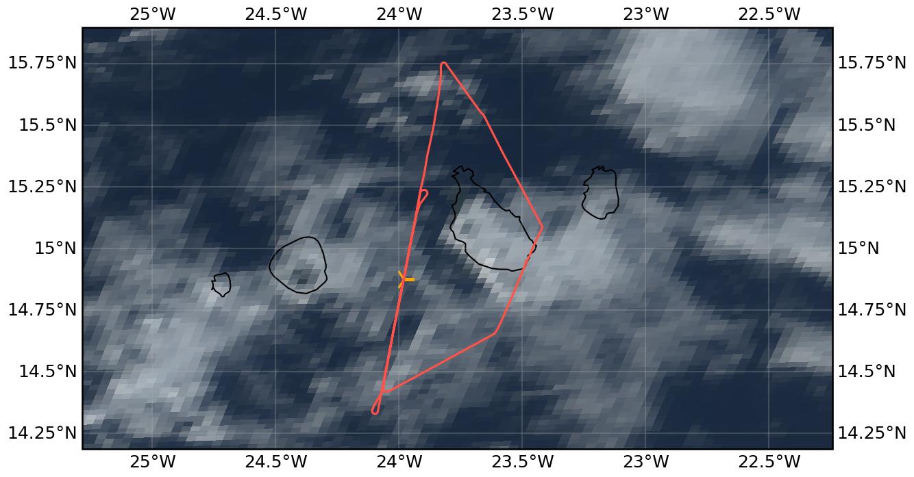
Flight path superimposed on the natural color image from NOAA’s Geostationary Operational Environmental Satellites (GOES) 16 satellite on 7th September 2024 at 15:40 UTC. The location of the aircraft at the time of the EarthCARE overpass is shown by the orange cross.
Conditions#
Thicker low cloud deck over Praia and almost all Santiago, but north and west of Santiago thinner clouds. Around WP1 it was actually cloud free, as dry air from the north moved in. Very interesting cloud conditions from north of WP2 to about 5min north of WP1. Along the EC track, we experienced multi-layer clouds, with a thin, more continuous cloud deck at around FL040, and more scattered low clouds at around FL030. However, also the cloud tops of the uppermost layer changed often. As far as visible to the naked eye, no high clouds above.
Flight video#
This video shows the forward and sideward view from the King Air aircraft together with live data (basic navigation data, aerosol/cloud in-situ data) during the EC leg.
Events#
Time (UTC) |
Comment |
|---|---|
14:39 |
Takeoff Praia |
15:44 |
EarthCARE overpass (orbit #1582E) |
16:28 |
Landing Praia |
Execution#
14:39 UTC (13:39 LT): takeoff
15:01 UTC: skip hold, go towards WP2 already
We took off on time, heading towards WP1. We adapted our plans a bit when reaching WP1, as the cloud situation around WP1 was not good - we had mostly clear sky, with some low cloud band slightly N/E, but according to latest sat image this was just a very narrow band. So we decided to skip the hold at WP1 and turn south on the EC track early towards WP2 to assess the cloud situation. There were good clouds to measure in starting slightly north of WP2 and reaching until about 5 min north of WP3. We were in and out of cloud, and the pilots performed “cloud top hunting” along the track as they tried to account for changing cloud top altitude. This worked quite well, so we were in cloud very often. As we had enough time, we decided to turn north again shortly before WP3 to meet EC within good cloud conditions. North of WP2, we reached the cloud boundary again, so turned back south (10min after EC overpass) again to sample clouds again shortly after EC overpass. 25min after EC overpass, we left the track and turned back home.
Impressions#
14:41 UTC: in-cloud on way up
14:42 UTC: small particles at cloud top (FCDP)
15:00 UTC: arrival WP1, clouds to the E and NE, but look similar on the satellite image as clouds farther south
15:02 UTC: descent to FL040 to be at right altitude for clouds
15:04 UTC: just some broken clouds below us, not much yet
15:06 UTC: Tamb 17°C, TAS 65m/s, FL048
15:08 UTC: FL040 alt capture
15:09 UTC: start to enter thin clouds, signal on FCDP, CAS and some in CIP
15:12 UTC: going up to get in cloud again
15:14 UTC: in cloud, FL058
15:15 UTC: 2 layers, very thin at top (where we are right now), descent again into lower layer
15:16 UTC: FL040 in cloud, big droplets, continue descent a bit more to FL035
15:19 UTC: droplets in CIP when we reached cloud top of lower layer, ‘cloud hunting in altitude’ a bit, Tamb = 17°C
15:21 UTC: FL037 ft, in cloud
15:22 UTC: cloud top (see blue shining through)
15:27 UTC: in and out of cloud but long stretches in
15:32 UTC: cloud leg N was good, 5min before WP3 turn N again to go back to WP2 for the satellite overpass
15:34 UTC: still 2 layers, thin deck at top, lower clouds scattered
15:35 UTC: climb to FL050 to get to top
15:36 UTC: FL055
15:37 UTC: FL053: reached cloud top
15:38 UTC: descent towards FL020 for full profile
15:40 UTC: enter lower-layer cloud deck, out of lower cloud, go higher again
15:43 UTC: in cloud again, FL040, TAS165kt
15:44 UTC: EC overpass in cloud, a bit in and out
15:46 UTC: nice thin deck, Tamb 18°C, TAS70m/s, FL040, we are at cloud top
15:48 UTC: out of cloud, climb to get in again, CIP also sees particles
15:50 UTC: hunting cloud top along track
15:52 UTC: no more clouds again in front, turn back south
15:55 UTC: back on track (North of WP2)
15:56 UTC: in cloud again
15:57 UTC: climb up again
15:59 UTC: FL040 in lower cloud deck
16:00 UTC: CAS data error? “instrument data checksum was not validated”, but still measuring, likely too many particles and not quick enough in writing to disk
16:03 UTC: go down to get below clouds
16:05 UTC: FL035, some cloud again, FL030 alt capture, up again to FL040
16:07 UTC: FL040
16:11 UTC: end track, go home
16:13 UTC: stop recording and start data transfer
16:17 UTC: CAPS measuring again for landing profile
16:28 UTC: Landing, CAS stop.
Campaign is a wrap!
Instrument status & quicklooks#
Instrument |
Operational |
Comment |
|---|---|---|
CAS-DPOL |
✅ |
None |
CIP |
✅ |
None |
LWC Hotwire |
❌ |
None |
FCDP |
✅ |
None |
2D-S |
✅ |
None |
CPI |
✅ |
None |
Gopros |
✅ |
None |
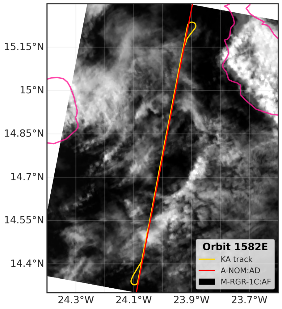
EarthCARE MSI image (RGR-1C:AF) with EarthCARE ground track (red) and King Air flight track (yellow).
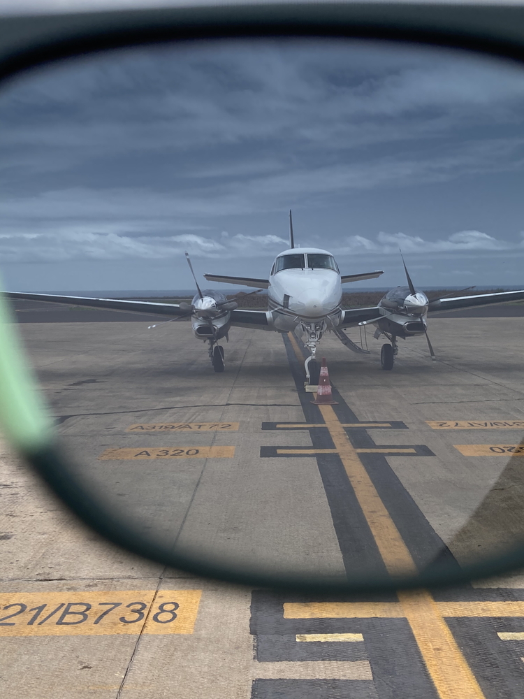
Kelvin-Helmholtz wave action behind King Air right before takeoff.
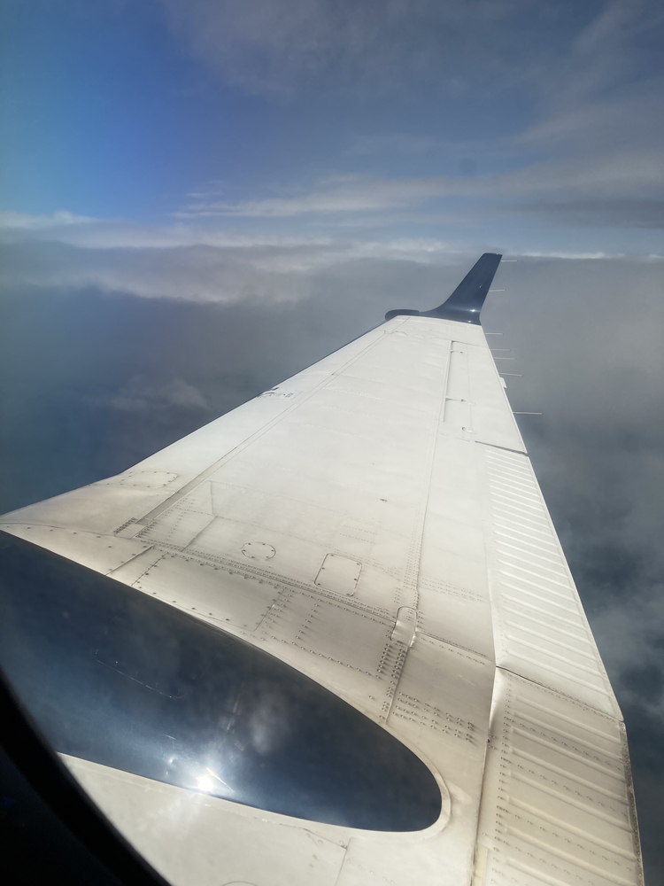
Sideward view during EC overpass at around 15:44 UTC.