

KA-20240905a#
ec_under ec_track in_cloud insitu_aerosol spiral_mindeloCrew#
Robert Oscar David, Sorin Ghemulet, Marius CorbuEarthCARE target scenarios
Cumulus and marine aerosol: Marine mid-level clouds (supercooled).
Mixed aerosol types: Marine and Saharan dust.
Complex multi-layer scenes: Multiple low and mid-level cloud decks and potential cirrus.
Flight summary
During the research flight on 5th September 2024, we targeted EarthCARE (orbit #1551E) and sampled in multi-layered, supercooled liquid clouds. We performed porpoising to envelope the cloud decks between 5.7 and 6.2 km altitude. After the EC leg, we flew a spiral over the Mindelo ground site (low cloud deck, aerosol layer above).
Track#
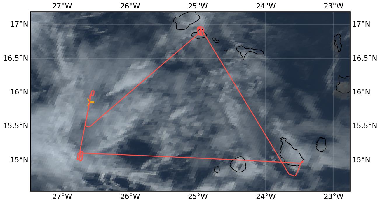
Flight path superimposed on the natural color image from NOAA’s Geostationary Operational Environmental Satellites (GOES) 16 satellite on 5th September 2024 at 16:00 UTC. The location of the aircraft at the time of the EarthCARE overpass is shown by the orange cross.
Conditions#
During the EC leg we sampled within a complex multi-layer scene with us flying through supercooled liquid clouds (Tamb -4 to -7 °C). Over Mindelo, we spiraled above very low clouds.
Flight video#
This video shows the forward and sideward view from the King Air aircraft together with live data (basic navigation data, aerosol/cloud in-situ data) during the EC leg…
… and during the Mindelo spiral.
Events#
Time (UTC) |
Comment |
|---|---|
14:18 |
Takeoff Praia |
15:55 |
EarthCARE overpass (orbit #1551E) |
16:44-17:18 |
Spiral over Mindelo ground site |
18:08 |
Landing Praia |
Execution#
14:18 UTC (13:18 LT): takeoff, all probes working
15:22 UTC: at WP1, in cloud but not a lot around us, will hold in the cloud and get statistics
15:55 UTC: at WP2
16:09 UTC: heading to Mindelo
16:44 UTC: start spiral over Mindelo
17:18 UTC: spiral done
17:24 UTC: HAWKEYE stop for data download
17:50 UTC: descending, transect home
18:08 UTC: landing
Impressions#
14:20 UTC: in cloud
14:22 UTC: through cloud layer, FL050
14:26 UTC: Tamb 12°C TAS74m/s
14:30 UTC: FL140, aerosol almost gone
14:35 UTC: at FL180 some ice falling from above, in and out of cloud, thin cirrus, CIP not working well
14:41 UTC: FL180, in liquid cloud @Tamb -6°C
14:43 UTC: climbing to get into cloud
15:27 UTC: blue screen on CAPS
15:31 UTC: CAPS back on but let’s see
15:40 UTC: FL180, Tamb -1°C, but Tamb -5°C at FL177, starting leg in cloud
15:56 UTC: one ice crystal
15:58 UTC: left cloud and we headed back to WP2 to be more in cloud
16:01 UTC: the cloud is clearing, going toward lower deck
16:35 UTC: catching a cloud layer on approach to Mindelo
16:40 UTC: right at cloud top approaching Mindelo
16:42 UTC: approaching
16:44 UTC: spiral started above cloud
16:48 UTC: some ice on probes
17:03 UTC: start climb, we were just above the cloud layer
17:05 UTC: FL054: clear, FL070: getting dirty again
17:13 UTC: FL140, Tamb 4°C, getting clean again
17:15 UTC: ice crystals, lots of columns, lots of ice, Tamb -3°C
17:18 UTC: spiral done, lots of ice, Tamb -5°C, top of cloud is at FL210 likely estimate (T -7°C)
17:19 UTC: mainly liquid now and a bit of ice, Tamb -6°C, mainly columns
17:50 UTC: descending, transect home we were just below cloud, in and out sometimes
Instrument status & quicklooks#
Instrument |
Operational |
Comment |
|---|---|---|
CAS-DPOL |
✅ |
None |
CIP |
✅ |
Check, some issues |
LWC Hotwire |
❌ |
None |
FCDP |
✅ |
None |
2D-S |
✅ |
None |
CPI |
✅ |
None |
Gopros |
✅ |
None |
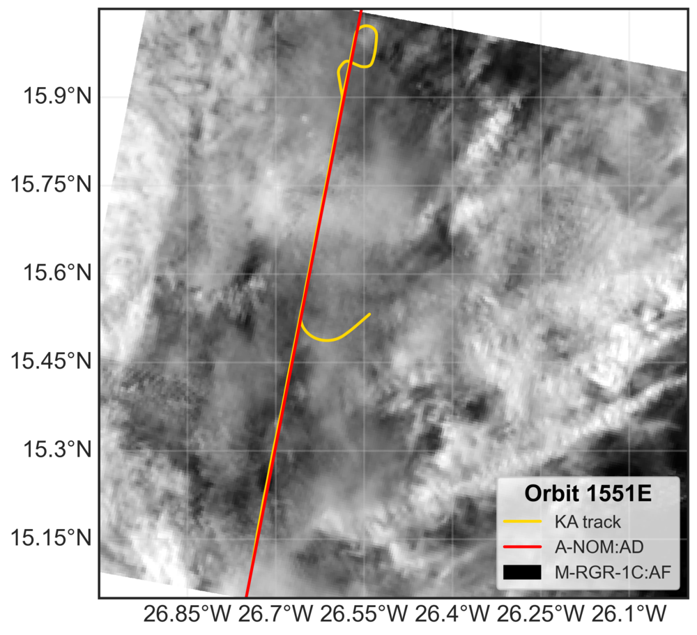
EarthCARE MSI image (RGR-1C:AF) with EarthCARE ground track (red) and King Air flight track (yellow).