

KA-20240831a#
ec_under ec_track in_cloud insitu_aerosolCrew#
Robert Oscar David, Sorin Ghemulet, Marius CorbuEarthCARE target scenarios
Cumulus and marine aerosol: Marine low clouds.
Mixed aerosol types: Marine and Saharan dust.
Complex multi-layer scenes: Multiple low cloud decks and potential cirrus.
Flight summary
During the research flight on 31st August 2024, we targeted a complex multi-layer scene, which consisted of multiple low cloud decks between 1.0 and 1.2 km altitude with potentially overlying cirrus underneath EarthCARE (orbit #1473E). During the northbound EC leg we were flying in-cloud below the ATR (remote sensing mode). Afterwards, the ORCESTRA performed 'formation flying' on the southbound leg: after the EarthCARE overpass, the King Air flew to the right of the ATR (now also lower in-cloud) within the range of ATR's rightward-looking remote sensing instrumentation, while HALO (going northward) passed over the ATR.
Track#
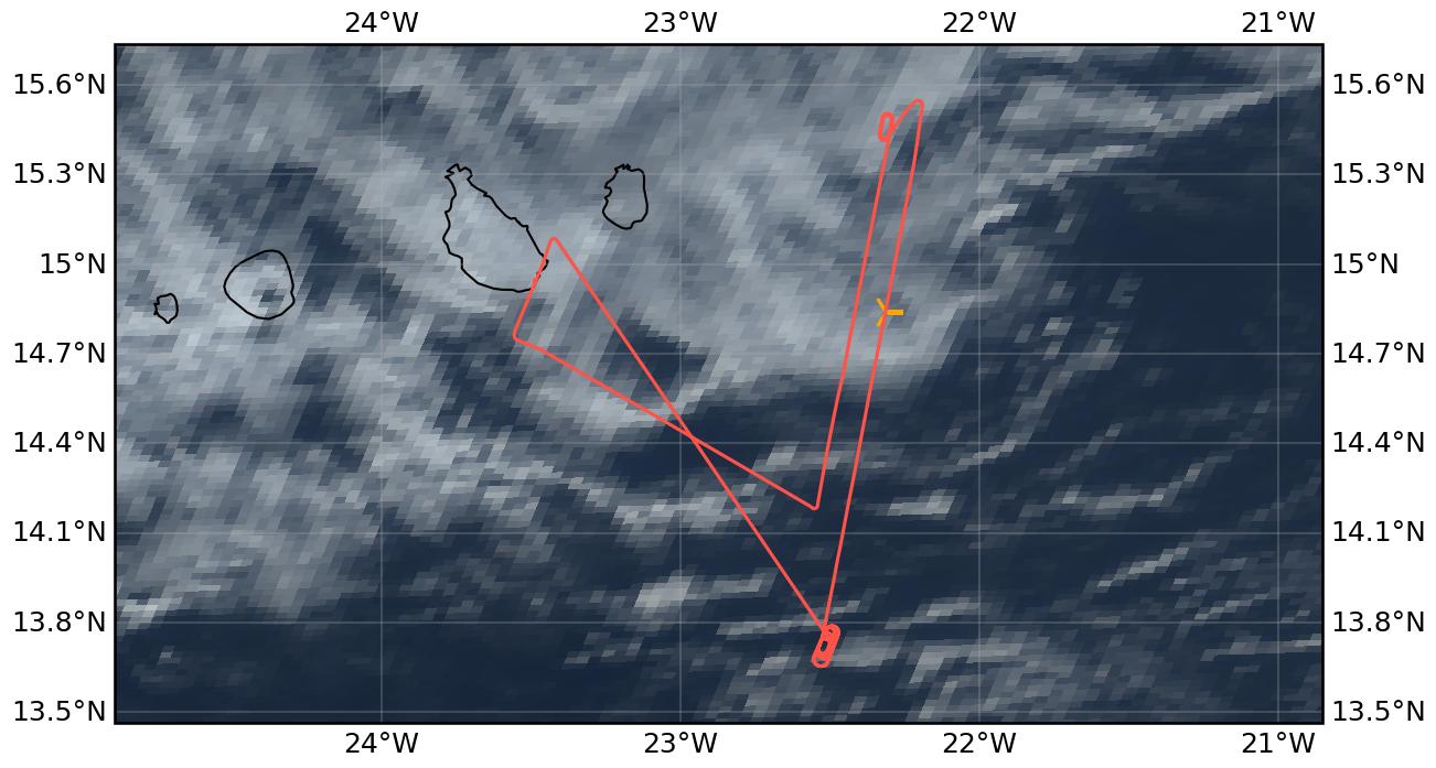
Flight path superimposed on the natural color image from NOAA’s Geostationary Operational Environmental Satellites (GOES) 16 satellite on 31st August 2024 at 15:40 UTC. The location of the aircraft at the time of the EarthCARE overpass is shown by the orange cross.
Conditions#
The EC leg was characterized by multiple low cloud decks of different characteristics (scattered cumuliform clouds as well as more stratiform layers) with occassionally overlying cirrus clouds. Some of the clouds we measured in were drizzling.
Flight video#
This video shows the forward and sideward view from the King Air aircraft together with live data (basic navigation data, aerosol/cloud in-situ data) during the EC leg (ATR above) and the southbound leg (right of the ATR in cloud, HALO northward above) formation flying.
Events#
Time (UTC) |
Comment |
|---|---|
14:08 |
Takeoff Praia |
15:37 |
EarthCARE overpass (orbit #1473E), ATR above in remote sensing mode |
16:10 |
Coordinated leg to the right of ATR in-cloud, HALO above ATR |
17:30 |
Landing Praia |
Execution#
14:08 UTC (13:08 LT): takeoff, all instruments are nominal except LWC, drizzle during taxi
14:46 UTC: at waypoint KA_South
14:51 UTC: descending to FL065
15:13 UTC: heading toward EC2 together with ATR
15:50 UTC: passed EC1
15:51 UTC: heading to EC1 had to wait for ATR to come down
15:56 UTC: hold begin
16:08 UTC: almost on coordinated leg
16:31 UTC: leg over, heading home
good flight maybe some issue with CIP
Impressions#
14:09 UTC: in cloud
14:10 UTC: in and out of cloud, cloud top FL060
14:18 UTC: aerosol layer top at around FL120
14:55 UTC: aerosol FL110
15:04 UTC: in cloud
15:17 UTC: in and out of cloud
15:25 UTC: FL030 @EC2, in and out of cloud, perfect coordination
15:31 UTC: in cloud
15:32 UTC: in cloud
15:34 UTC: ending this cloud, lots of drops, some drizzle
15:41 UTC: below cloud layers a bit, nice bimodal distribution
15:49 UTC: basically clearing up to the North, but also at EC1, we are just above cloud top, and just a little bit off track the last minute or so but not much to the right anyway
16:11 UTC: in line with them not in cloud yet
16:14 UTC: lots of cloud and rain
16:17 UTC: not in cloud but drizzle a bit before
16:19 UTC: in cloud-ish again
16:23 UTC: out of cloud, but lots of big drops before
on approach only CAPS data because Hawkeye download started
CAPS data in different folder
Instrument status & quicklooks#
Instrument |
Operational |
Comment |
|---|---|---|
CAS-DPOL |
✅ |
None |
CIP |
✅ |
Check, maybe some issues |
LWC Hotwire |
❌ |
None |
FCDP |
✅ |
None |
2D-S |
✅ |
None |
CPI |
✅ |
None |
Gopros |
✅ |
None |
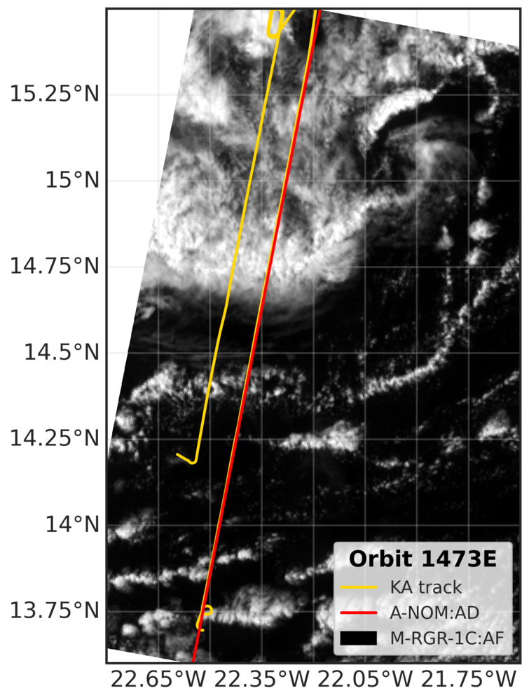
EarthCARE MSI image (RGR-1C:AF) with EarthCARE ground track (red) and King Air flight track (yellow).
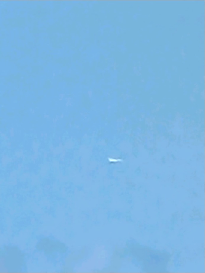
The ATR as seen from the King Air during common leg (KA to the right of ATR)
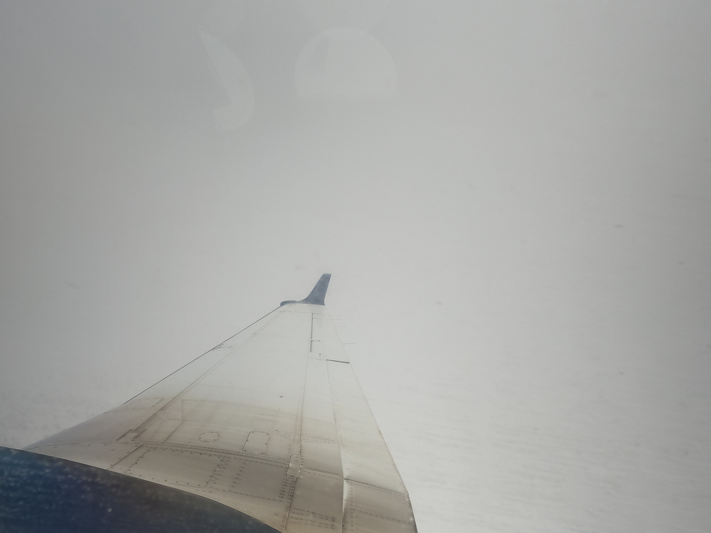
Sideward view during EarthCARE overpass around 15:37 UTC.