

KA-20240829a#
ec_under ec_track in_cloud spiral_mindelo insitu_aerosolCrew#
Tim Carlsen, Sorin Ghemulet, Alex VladEarthCARE target scenarios
Cumulus and marine aerosol: Marine low clouds.
Mixed aerosol types: Marine and Saharan dust.
Flight summary
During the research flight on 29th August 2024, we targeted low-level, marine liquid clouds below EarthCARE. After a full aerosol profile at the beginning of the EC leg, we collocated with the ATR on our way North and sampled in-cloud underneath EarthCARE (orbit #1442E). Unfortunately, EarthCARE experienced a CPR anomaly on that day with no CPR measurements available. We concluded the flight with a double spiral (descending and ascending) over the Mindelo ground site, sampling a distinct aerosol layer.
Track#
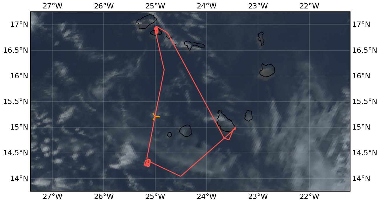
Flight path superimposed on the natural color image from NOAA’s Geostationary Operational Environmental Satellites (GOES) 16 satellite on 29th August 2024 at 16:00 UTC. The location of the aircraft at the time of the EarthCARE overpass is shown by the orange cross.
Conditions#
During the EC leg, we experienced scattered low-level liquid clouds with thin higher clouds above. A distinct aerosol layer was visible during the descent before WP1 and over the Mindelo ground site.
Flight video#
This video shows the forward and sideward view from the King Air aircraft together with live data (basic navigation data, aerosol/cloud in-situ data) during the EC leg and ATR overpass.
Events#
Time (UTC) |
Comment |
|---|---|
14:20 |
Takeoff Praia |
15:29-15:48 |
Collocation with ATR |
15:48 |
EarthCARE overpass (orbit #1442E) |
16:25-17:00 |
Spiral descent and ascent over Mindelo ground site |
18:00 |
Landing Praia |
Execution#
14:20 UTC (13:20 LT): takeoff, CAS works, TAS/Tamb OK
14:29 UTC: FCDP failed to connect to probe, restart, now works
14:34 UTC: CAPS display frozen
14:41 UTC: CAPS back
15:00 UTC: WP1, start hold, instruments work, request FL180 to go above aerosol layer
15:04 UTC: start climb to FL180
15:08 UTC: reached FL180, start descent 1000 ft/min
15:14 UTC: start descent for full profile
15:29 UTC: start @WP1 going down into cloud FL030
15:48 UTC: WP2 EC_meet right on time
16:09 UTC: arrive WP3, head towards WP4, start climb to FL180
17:01 UTC: go home towards RAI
18:00 UTC: landing Praia
Impressions#
15:04 UTC: Cirrus seems too high to reach, there seem to be low clouds at beginning of EC track, CAS/FCDP almost at 0 (above aerosol layer)
15:34 UTC: FL021, TAS87m/s, in and out of thin clouds
15:39 UTC: FL020
15:40 UTC: cruising at ‘cloud level’, have to get lucky, TAS91m/s
15:43 UTC: FCDP/2DS see some droplets from time to time
15:47 UTC: also some signal in CIP, in and out of cloud
15:49 UTC: number concentration 300-1500 cm-3
15:53 UTC: stay at FL020, lands us at in-and-out-of-cloud level, TAS150kt, Tamb 20°C
15:58 UTC: TAS155kt
16:05 UTC: less clouds now, but we stay at FL020 until WP3, TAS157kt, Tamb 23°C, ATR 20 miles behind us
16:23 UTC: over the island, FL165, CAS shows 4 cm-3
16:25 UTC: start descent from FL175 for racetrack descent over Mindelo supersite, 1000 ft/min, right turn, hazy outside, 2D-S sees particles
16:30 UTC: some low clouds in vicinity, but clear sky above ground-based lidar
16:37 UTC: FL055
16:41 UTC: FL040 full overflight Mindelo direct hit
16:42 UTC: start ascent again, same racetrack pattern, 1000 ft/min, right turn, CAS 0.1 cm-3
16:48 UTC: TAS190kt, Tamb 16°C
16:53 UTC: CAS 23 cm-3, FL140, Tamb 5°C, TAS200kt
17:00 UTC: CAS 1 cm-3, FCDP 0 cm-3, TAS215kt, Tamb -6°C, direct overpass over Mindelo, end of ascent
Instrument status & quicklooks#
Instrument |
Operational |
Comment |
|---|---|---|
CAS-DPOL |
✅ |
None |
CIP |
✅ |
None |
LWC Hotwire |
❌ |
None |
FCDP |
✅ |
None |
2D-S |
✅ |
None |
CPI |
✅ |
None |
Gopros |
✅ |
None |
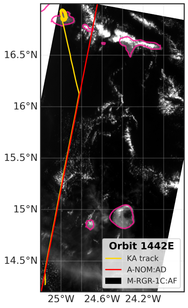
EarthCARE MSI image (RGR-1C:AF) with EarthCARE ground track (red) and King Air flight track (yellow).
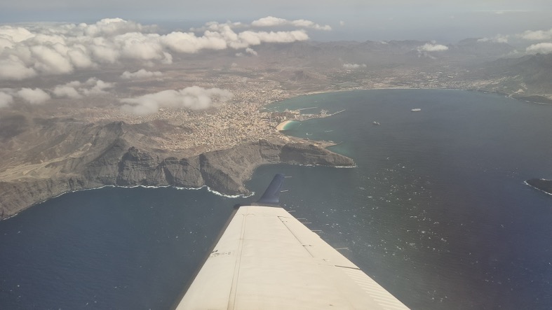
Sideward view to Mindelo ground site during spiral.
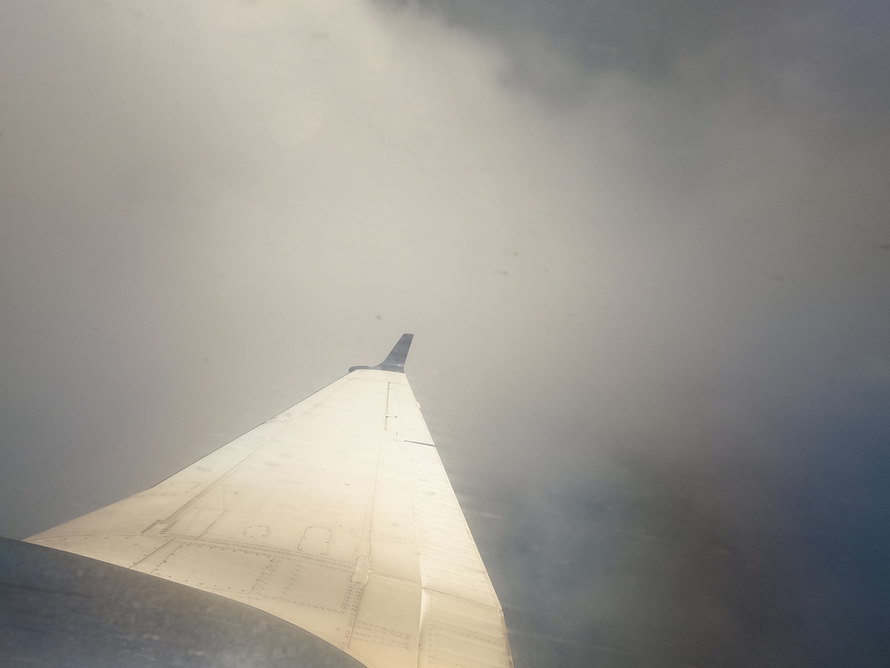
Sideward view during the EarthCARE overpass at around 15:48 UTC.