HALO-20240928a#
ec_under ec_track pace_under c_mid radarCrew#
Julia Windmiller, Silke Groß, Georgios Dekoutsidis, Allison Wing, Patrizia Schoch, Tobias Zinner, Daniel Klocke, Luca Schmidt, Sebastian OrtegaTrack#
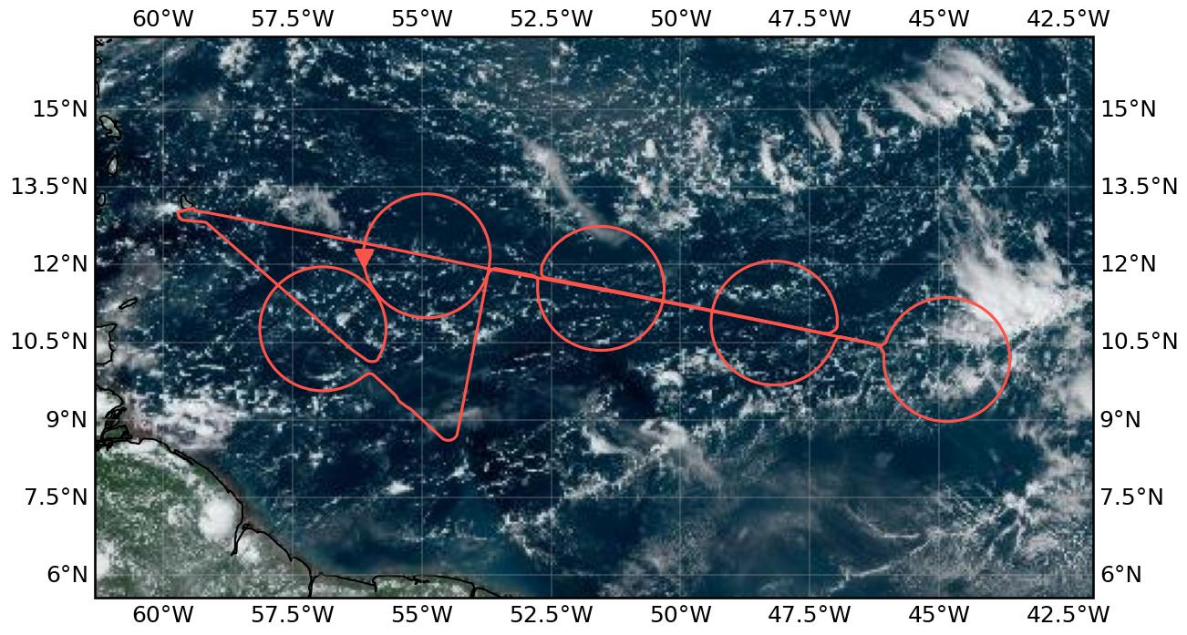
Flight path superimposed on the natural color image from NOAA’s Geostationary Operational Environmental Satellites (GOES) 16 satellite on 28th September 2024 at 17:40 UTC. The location of the aircraft at the time of the image is shown by the red arrow.
Conditions#
During the flight, the west Atlantic was dominated by the influence of Tropical Storm Joyce to the north. The flight track intersected the boundary between the northward inflow region and the southward outflow region, with the ITCZ situated in between. Convergence lines were observed north and south of the track, with a shallow third line in the middle. Deep convection was limited to these convergence lines and the tropical wave to the east. The doldrums were observed in the region between the ITCZ and the convergence lines. On a larger scale, the MJO was active, enhancing convection over the Atlantic, while La Niña-related anomalies were beginning to emerge in the Pacific.
Execution#
10:47 UTC take off (slightly delayed due to problems with BAHAMAS)
12:34 UTC Entered circle west
13:40 UTC Entered cirle mid east
14:48 UTC - 15:16 UTC Dropped five additional sondes in / close to the doldrums
15:54 UTC Entered circle mid west
16:32 UTC Entered circle west
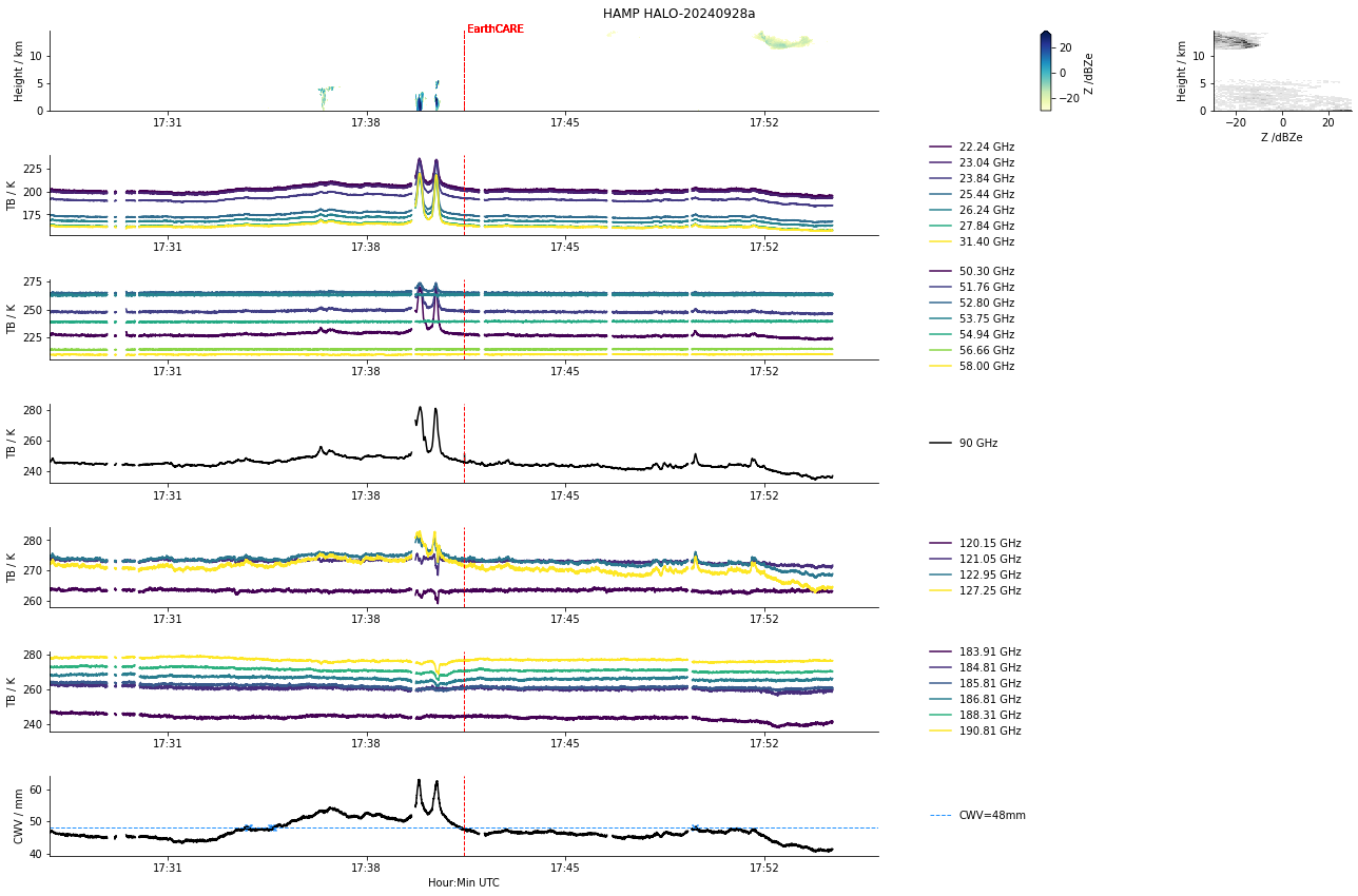
17:31 UTC Entered EarthCARE track
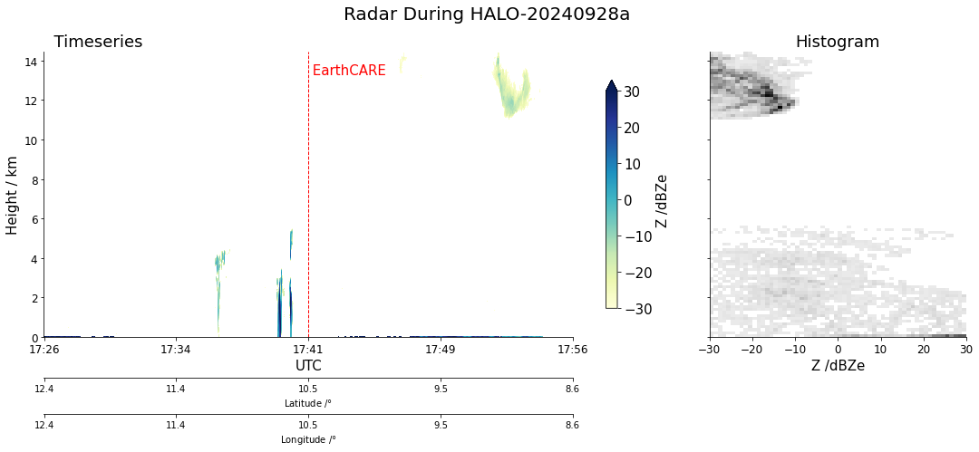
17:41 UTC EarthCARE underpass
17:54 UTC Left EarthCARE track
18:05 UTC Radar callibration wiggle
18:13 UTC Entered last circle
19:41 UTC Radar callibration dive
Note
PACE: We were in the PACE swath shortly after the overflight.
Impressions#
11:06 UTC Since take off: shallow clouds, sometimes organised along some lines; intersperesed by some stratiform layers; cirrus clouds above us
11:15 UTC Increasing number of the shallow clouds have hats
11:20 UTC Numerous cirrus layers around us (sometimes in it)
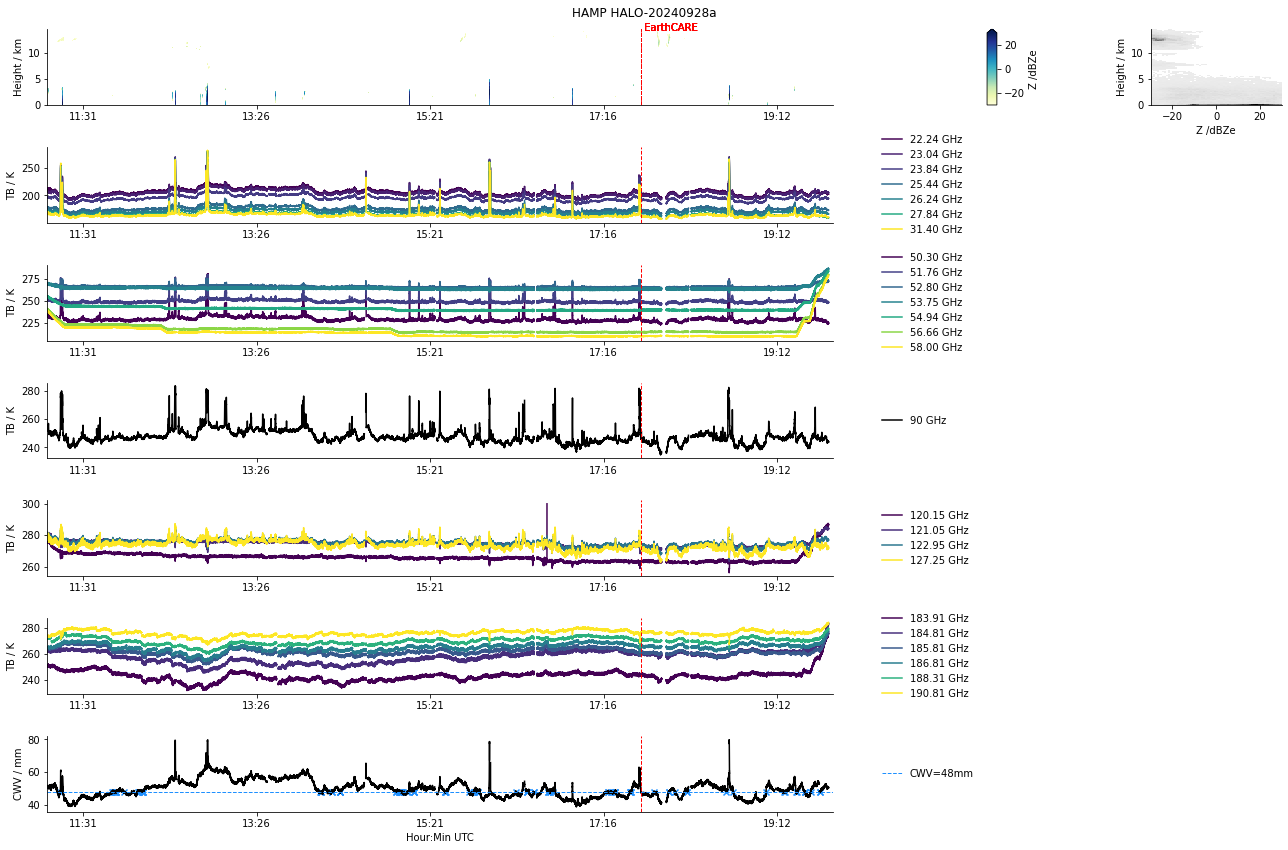
11:00 - 11:20 UTC passed through a region of increased CWV (40 mm to 50 mm to 40 mm)
11:33 UTC Deeper convection with tilted anvils to the north of us
11:43 UTC Some cloud reflections (and so likely low wind speeds) below us
11:44 UTC The deep convective clouds towards the north of us appear to be partly isolated and partly clumped into a bigger system
11:55 UTC Deep convection about 100 nm away; mirror like ocean below us
12:00 UTC CWV has been rising slowly since 11:25 UTC
12:00 UTC Some deeper convection appearing towards the south of us
12:05 UTC Very low wind speeds below us; very narrow regiono of specular reflectance visible on specMACs
12:10 UTC Sudden increase in upper level humidity (around 10 km)
12:15 UTC Weak clear air turbulence
12:20 UTC Wind speeds have increased (based on specMACS)
12:26 UTC Only very small clouds below us; aerosols and humdity hint at subsiding motion in lower levels
12:33 UTC turning onto first circle
12:35 UTC CWV values of around 60mm (maximum so far)
12:38 UTC Multiple layers of cirrus clouds around us
12:43 UTC Some midlevel clouds at 8 km
12:46 UTC Can see some anvils of the deeper system towards to east of us
12:50 UTC Seeing an overshooting top peaking out of the anvil
12:53 UTC Flying along the edge of a cloud system
13:06 UTC Weak clear air turbulence
13:09 UTC Flying in cirrus
13:10 UTC Increase in aerosol load
13:15 UTC Reached southern tip of the circle, very small clouds below us and nothing to see toward the south; inside cirrus cloud
13:39 UTC Shallow clouds organised along circles
13:59 UTC Some deeper convection as we cross the southern convergence line
14:14 UTC Very low wind speeds below us with some deep convection forming along the middle converge line (Silke’s picture!)
14:22 UTC Higher wind speeds compared to south of the convergence line
15:14 UTC Deep convection towards the north of us; shallow convection bellow us; many strongly sheared clouds are visible
15:24 UTC Cold pool structures visible to the south of us (sometimes with a remaining cloud hat in the center)
15:30 UTC Heading straight towards the deep convective cloud system; mostly shallow clouds to the south; anvil is whirled around
15:41 UTC Flying through the outermost part of the anvil
15:53 UTC Crossing the central convergence line; looks like cold pools with convection only triggered on one side
16:18 UTC Crossing the central convergence line again
16:56 UTC Fields of shallow clouds below us; inside cirrus cloud
17:07 UTC Shallow cumuli
17:25 UTC Deep convection with swi White dragon to the left
17:43 UTC Cloud streets (shallow clouds below)
17:51 UTC Large cirrus shield
18:34 UTC Deep convection towards the south of us, some shallow cumuli cloud streets below us
Instrument status & quicklooks#
Instrument |
Operational |
Comment |
|---|---|---|
BACARDI |
✅ |
None |
BAHAMAS |
✅ |
None |
Dropsondes |
✅ |
None |
HAMP |
✅ |
None |
PI-Camera |
✅ |
None |
Smart |
✅ |
None |
SpecMACS |
✅ |
Little icing on leftward looking side camera. Probably no dark current measurments of SWIR camera. |
VELOX |
✅ |
None |
WALES |
✅ |
None |

BACARDI
HAMP
HAMP during EarthCARE underpass
Radar during EarthCARE underpass
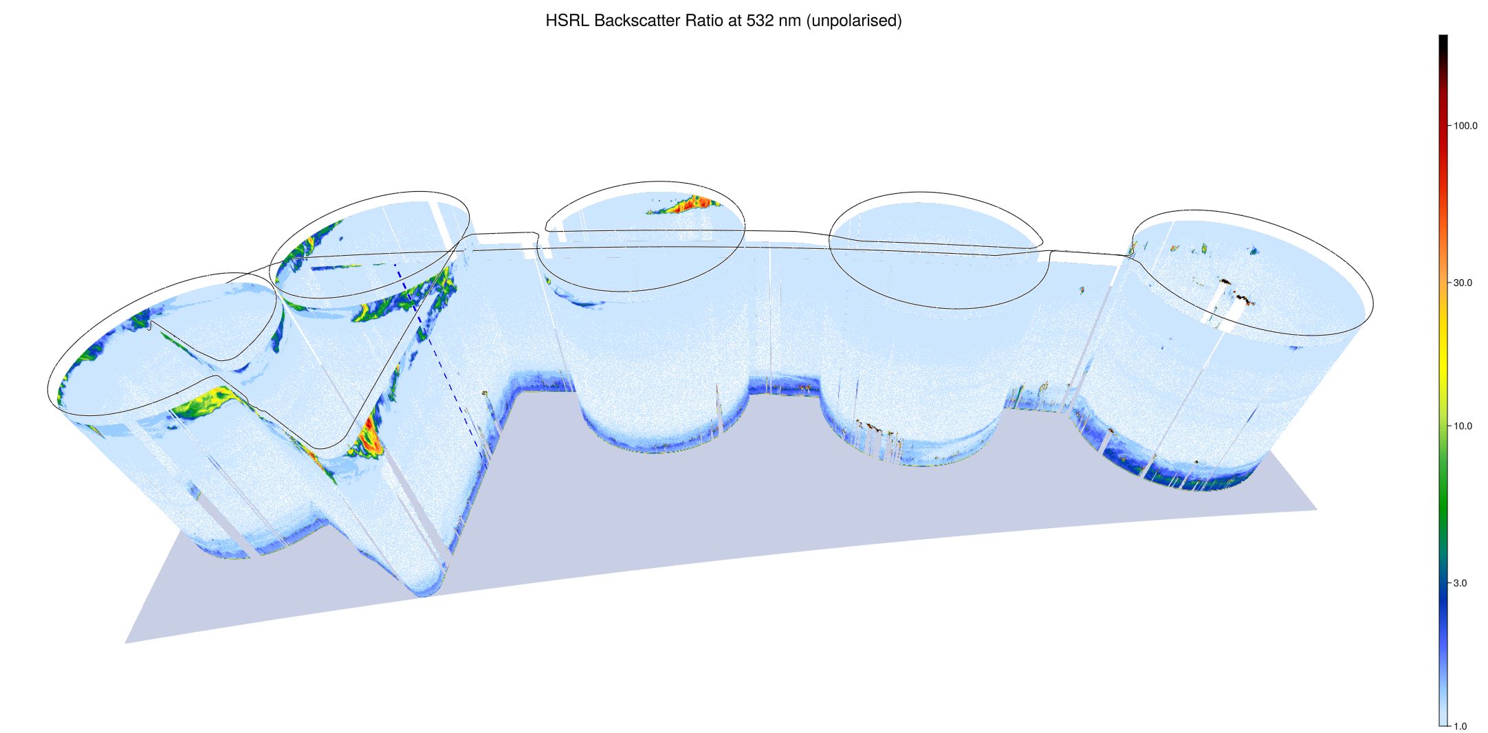
WALES (3D backscatter)
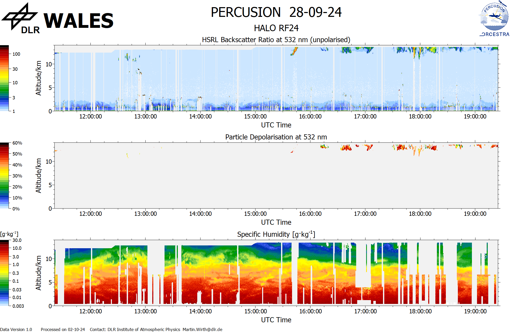
WALES (cross section)
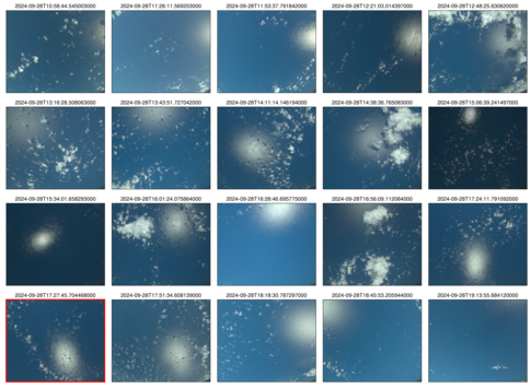 specMACS RGB snapshots from polb (lower right) with EarthCARE underpass marked in red. Find further quicklooks here.