HALO-20240916a#
ec_under ec_track c_north c_mid c_south pace_under meteor curtainCrew#
Konstantin Krüger, Dimitra Kouklaki, Georgios Dekoutsidis, Nina Dobbins, Michael Schäfer, Anja Stallmach, Manfred Wendisch, Raphaela VogelTrack#
Synoptical setting on the flight day#
The forecast indicated an ITCZ very far to the north, which was divided into two band (zonal along 7.5°N and 16°N, repsectively), particularly in the area between 40-55°W. The convective activity in this area was very localized. To the west of this zone between 50-60°W was a pronounced zone of weak wind (Doldrum). It is expected that the Doldrum air mass, upstream of Tropical Storm GORDON, may significantly influence its further development. The far northern position of the ITCZ also allows the air mass south of the ITCZ to be sampled, which could differ greatly in terms of aerosol, cloud and water vapor composition. Remarkable was the high forecast uncertainty regarding the water vapor distribution in the last 5 days before the research flight. It is also interesting that the southern branch of the ITCZ was predicted very accurately in terms of its position during the same forecast period.
Flight strategy#
The fundamental strategy of this research flight was to coordinate HALO-based observations with EarthCARE, PACE, METEOR in the above mentioned areas with the associated meteorological features: This day provided a favorable opportunity for a coordination of EarthCARE and PACE measurements, whose tracks/swaths of their overpasses were only about 1 hour apart, and whose track covered similar air masses. The PACE/EarthCARE tracks should also be connected with circles (dropsonde measurements). The southern part of the EarthCARE/PACE tracks should also provide a good opportunity (low clouds) for aerosol profile measurements. Another highlight was an additional coordination with METEOR, which was to be flown over twice on the EarthCARE track. On the return flight to c_north, dropsonde measurements were planned as a curtain along the entire doldrum from east to west in order to cover the associated inflow air mass of the southern part of TS “GORDON” with measurements.
Execution#
Early Take-off (20 min ahead schedule)
First circle (c_mid, CCW) conducted as scheduled, HALO overpassed METEOR
Second circle (c_south, CCW), dropsonde clearance stopped after 20min. After deep discussions with every single instrument operator, and pilots it was decided to interrupt the circle. Thus, return to circle entry point, completion of the second semicircle (CW) again under clearance. Flight into circle to have maximum PACE track.
180° turn, PACE-track, PACE track as planned, but waiting pattern (10 min) due to waiting for clearance for entry into Brazilian airspace
Flight to ec_south, Mission PI decided to drop a dropsonde as clearance was still active (and dropsonde operator had an incredibly great launch detect success rate the circles before)
EarthCARE track performed as scheduled, METEOR was overpassed at ec_under
Fly to c_north, but again no clearance until the northern part. Mission PI decided to fly a 540° circle (1.5 circle) to accomplish dropsonde observations. Exit on most northern point of c_north.
Return flight along a more northerly track than planned. However, it turned out that this was even better for capturing the Doldrums. Dropsonde curtain along this track (5min frequency). Mission PI decided to climb to FL470 to obtain higher number of data in the troposphere.
Summary: Every single research target could be covered by observations! Instrument performance great, 57/60 successfull dropsondes
Impressions#
11:47 FL220, HALO ascending, some Cb in the vicinity, but mostly Cu hum, hazy between clouds.
11:50 A lot of clouds with different depth. Spectacular cloud fields near Barbados with moistly low-level clouds, some convective towers, but still no Cirrus above, some cloud-free areas beneath
12:06 fluffy low-level Cu hum, reaching targeted FL410
12:25 clouds fluffy, low level, cu hum, with some cloudless spots in between. no cirrus at all, some Cb far away with some outflow
12:45 mid-level altostratus beneath of us, still no cirrus
12:47 a bit bumpy
12:49 mid-level clouds, some Cu penetrates through the As layer
12:56 patches of mid-level altostratus, 2 min later closed As deck
Circle entered: during the circle all dropsondes worked properly, one dropsonde in the vicinity of Meteor
13:55 Convective system ahead of us, we hopefully stay above it. It becomes bumpy. Cirrus cloud top height about 13840 m, cloud just below HALO (too high for WALES)
14:10 Cirrus clouds get thinner
14:19 exit c_mid
track to c_south: no cirrus, fluffy low-level clouds, sometimes cloud-free sections
enter circle c_south:
14:49 we have to stop dropping sondes because of traffic coming through our areas, stop cicle and go northward
15:20 back on circle, now: go clockwise the right half of the circle, drop sondes each 30 degrees heading
15:46 finish the half circle
15:50 fly north to adjust the time for the PACE underpass (goal: maximum PACE track), climb to FL430
Enter PACE track, climb to FL450
16:12 underpass, waiting circle just before brazilian airspace
16:30 just patchy cloud below us. Great water vapor curtain in the WALES quicklook
16:56 reached EarthCARE track, dropsonde released
cloud streets (someone described it “like in the Arctic”)
17:15 ec_underpass, dropsonde on METEOR
17:33 two cloud layers
Meridional aeorosol gradients weaker than hoped (as estimated from the WALES QL)
Enter c_north: No clearance for the sonde dropping from ATC at the beginning of the circle
18:14 Clearance, drop of first sonde, just patchy clouds, no cirrus
18:24 cirrus ahead of flight track
18:30 HALO above cirrus
18:49 cold pool to the right of us
18:55 circle end reached
18:57 approaching massive meso-scale convective system (MCS), impressive Cirrus anvil
19:09 Reaching the edge of this system, impressive Cirrus anvil, climb to FL470, above Cirrus
Cirrus way beyond FL500 (estimated by eye) in the vicinity
19:11 end of circle, heading to Barbados at FL470
19:27 Cloud mix with cloudless patches, Cbs, cirrus
19:31 More and more convection, patchy Cbs, cirrus, mid and low-level stuff
19:38 More cloud-free areas
19:43 Patchy cirrus, larger cloud-free areas, but also heavy convection
19:47 Convection takes over/dominates
19:49 Leftover cirrus from a previous Cb, shadow below can clearly be seen, cold pool development maybe tomorrow
19:59 Huge CB with anvil left of the flight track
20:09 Very extended cirrus outflow
20:12 Multiple cloud layers
20:20 Last drop sonde has been released
20:21 We start descending
20:29 Cbs along the way, partly below the cirrus, photos
20:57 landing BGI
Note
Summary: Quadruple rendesvouz successfull. Co-located data of HALO instruments with METEOR, PACE and EarthCARE. Additional Doldrum Dropsonde Curtain! Every single research target could be covered by observations! Instrument performance great + 57/60 successfull dropsondes.
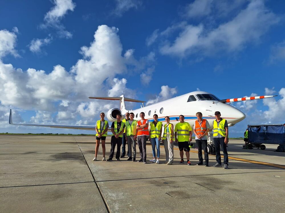
Flight crew
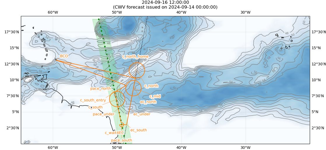
Flight plan
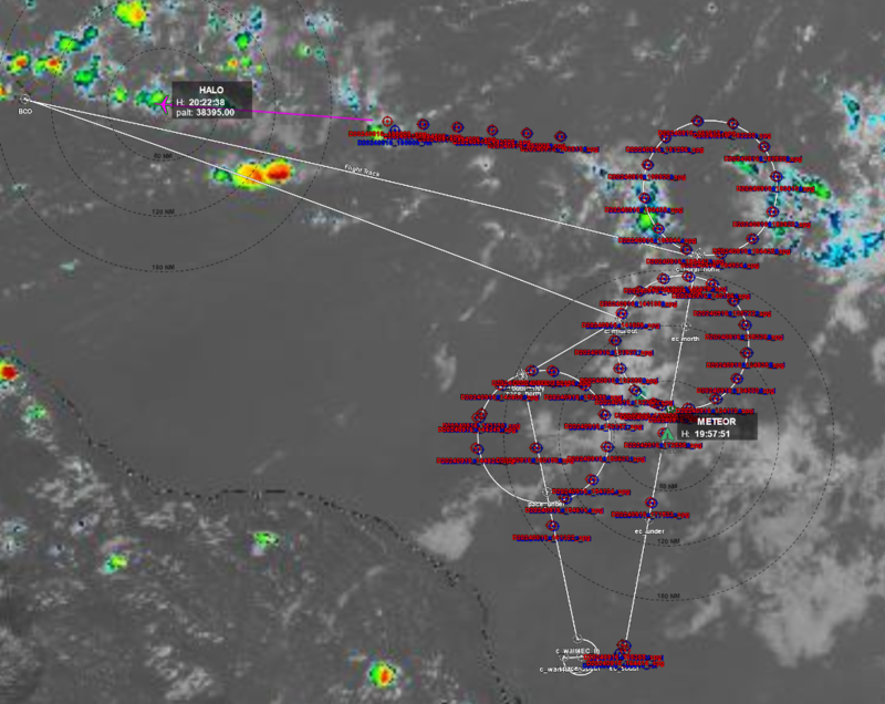
Executed flight pattern + Sondes + Sat.-image
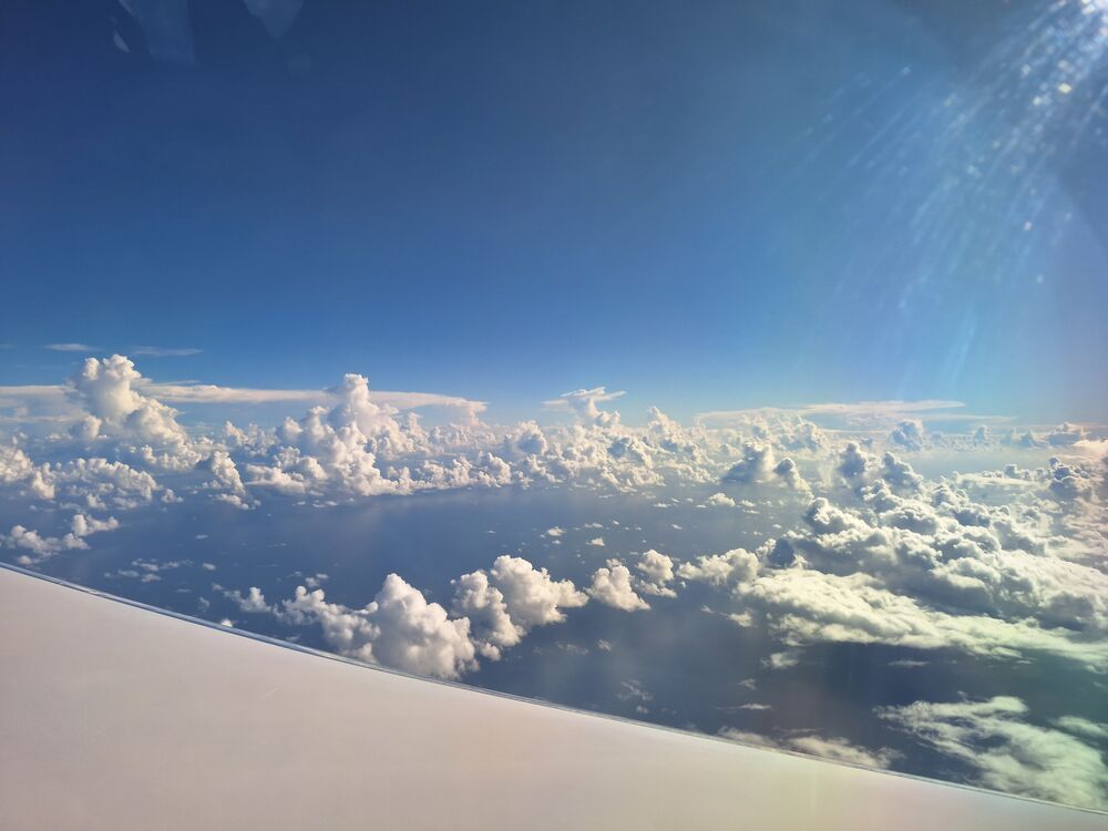
Cloud patches shortly after take off (K. Krueger, 1144 UTC)
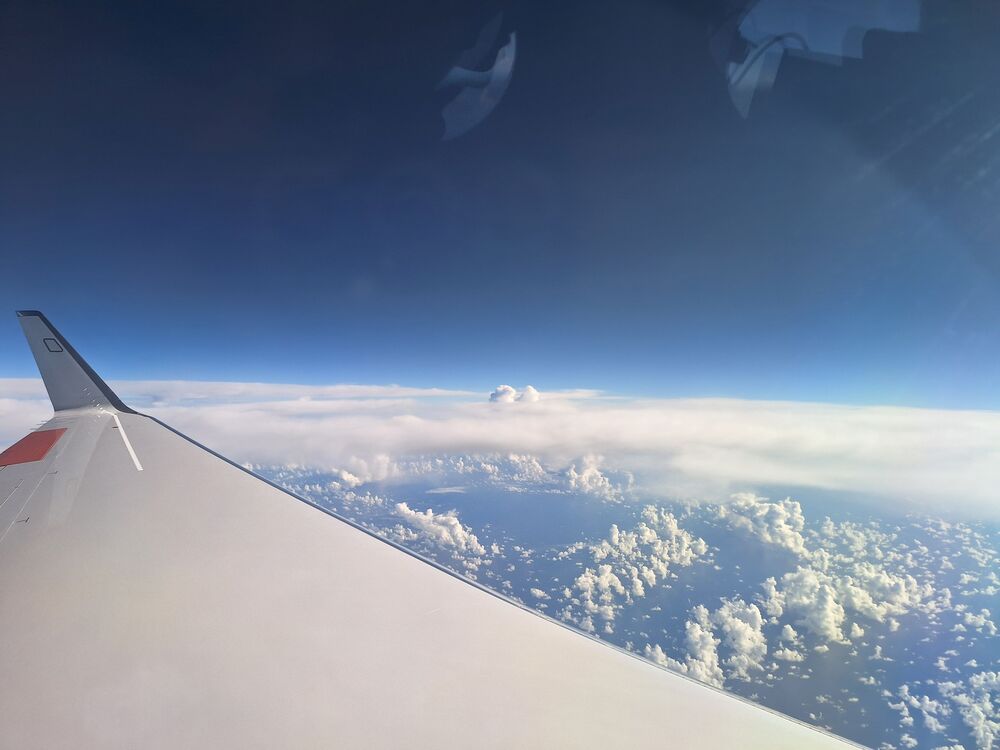
Cloud streets (K. Krueger, 1922 UTC)
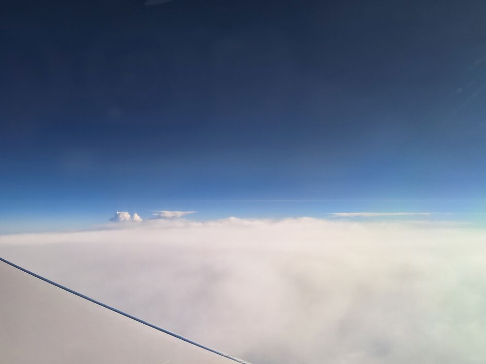
FL470, high altitude thin Cirrus clouds near horizon (K. Krueger, 1954 UTC)
FL470, thin Cirrus clouds near horizon. Definetely above FL500 (K. Krueger, 2004 UTC)
Landing Barbados (K. Krueger, 2054 UTC)
Instrument status & quicklooks#
Instrument |
Operational |
Comment |
|---|---|---|
BACARDI |
✅ |
None |
BAHAMAS |
✅ |
None |
Dropsondes |
✅ |
no entry |
HAMP |
✅ |
no entry |
PI-Camera |
✅ |
no entry |
Smart |
✅ |
no entry |
SpecMACS |
✅ |
Unexpected restart of the boilerroom part. Missing measurements for about 20 min. |
VELOX |
✅ |
no entry |
WALES |
✅ |
no entry |
Dropsondes
WALES flight sections
WALES EarthCARE section
SpecMACS_Quicklook 1
SpecMACS_Quicklook 2
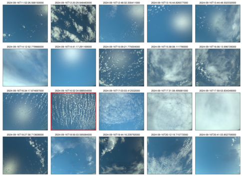 specMACS RGB snapshots from polb (lower right) with EarthCARE underpass marked in red. Find further quicklooks here.