HALO-20240914a#
ec_under ec_track c_north c_mid c_southCrew#
Helene Glöckner, Sabrina Zechlau, Clara Bayley, Theresa Mieslinger, André Ehrlich, Anna Weber, Lukas Kluft, Wei-Ting HsiaoTrack#
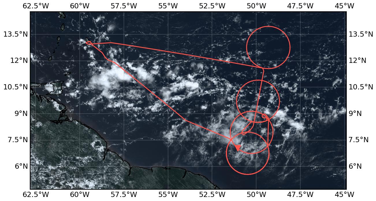
Flight path superimposed on the natural color image from NOAA’s Geostationary Operational Environmental Satellites (GOES) 16 satellite on September 14, 2024 at 15:20 UTC. The location of the aircraft at the time of the satellite image is highlighted.
Conditions#
Basically any kind of clouds could be observed during this flight. It started with shallow convection and midlevel clouds. Later on convective towers among shallow convection and small sugary cloud spots could be seen on the way towards the first circle. The southern most circle was marked by lowlevel cumulus and midlevel clouds in the south and a full mid-level cloud deck in the north.
In the second circle, a very thick cirrus (~7km) was seen, that was later replaced by a thick layer of mid-level clouds with very few clear-spots. Towards the end we crossed a deep convective cloud.
In the center circle many cloud conditions could be observed: starting with shallow convection and small towers with thin midlevel clouds, condition changed to thin cirrus, towers and sugary clouds in the distance. Later on small low-level clouds could be seen that the radar did not see and again many towers. Towards the end we entered a coldpool region.
The underpass started in deep clouds and fully white sky. Two minutes before meeting Earthcare those cleared up and gave way to nice lidar conditions with only few shallow clouds.
The Northern circle was marked by clear-sky and some singular shallow convection and thin cirrus. Windspeeds were very low, especially in the North-Western part of the circle.
The way back started with convective towers again and a cirrus layer later on.
Execution#
flew southern most circle twice because of problems with the dropsonde system.
problems could not be solved; so no sounding data in the southern most circle.
skipped small waiting circle as a result
entered second southern circle from the north-east to by some time for the dropsonde team
third circle directly after second (both with okay soundings)
some holding pattern to by some time before Earthcare, because we were early
perfectly timed underpass
fourth circle as planned
back home
Impressions#
11:36 take-off, shallow clouds and small towers
11:37 deep convection ahead; going over
11:44 deep convective tower to the left
11:47 second deep convective tower directly behind the first
12:02 many cirrus
12:04 complete whiteness
12:06 thin cirrus, shallow clouds, ocean visible
12:11 mid and high level clouds, cirrus until 12km
12:20 many very small clouds (sugar?)
12:25 shallow cumulus low clouds, towers in the distance, less sugar
12:37 all white (thin cirrus)
12:40 thick cirrus (all white in any direction)
12:53 thick mid-level layer, thin cirrus above
12:58 holes in mid-level allow view on shallow cumulus
13:19 singular mid-level clouds, very small low-level clouds
13:57 mid-level deck, high thin cirrus
14:02 sugar again, mid-level deck in the distance
14:19 mid-level clouds, some towers
14:53 high cirrus, small towers below, mixed with cumulus
15:00 mid-level deck (thin) , no shallow cumulus
15:23 ~7km thick cirrus
15:37 low clouds, very small; thin high clouds, high cirrus above plane
15:52 right: clear-sky and some small shallow clouds, left mid-layer cloud deck
16:08 high thin cirrus, shallow cumulus and towers
16:12 everything completely white
16:13 mid-level cumulus, some sugar in the distance, breakup of high level
16:15 perfect anvil, next to us
16:17 towers in the distance looking like dancers
16:29 small bubble clouds - low level? (cannot be seen by radar), coldpools
16:35 cloud towers and very thin mid-level clouds in between
16:37 singular towers everywhere
16:45 entering deeper convective clouds, still some mid-level as well
16:48 very deep convective cloud right below us, high cirrus above
16:55 back to mid level pop up
17:08 clear-sky, left mid/high level clouds
17:18 back in deep clouds, cirrus above
17:23 tower family to the left and clear-sky
17:28 towers become smaller
17:33 coldpool region
17:52 thin cirrus
17:57 clear-sky
18:12 (few) shallow/ mid level clouds
18:35 more towers
19:27 tower pair to the right
19:37 thin cirrus and small mid-level clouds
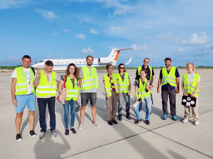
Exhausted crew upon arrival (20:32 UTC)
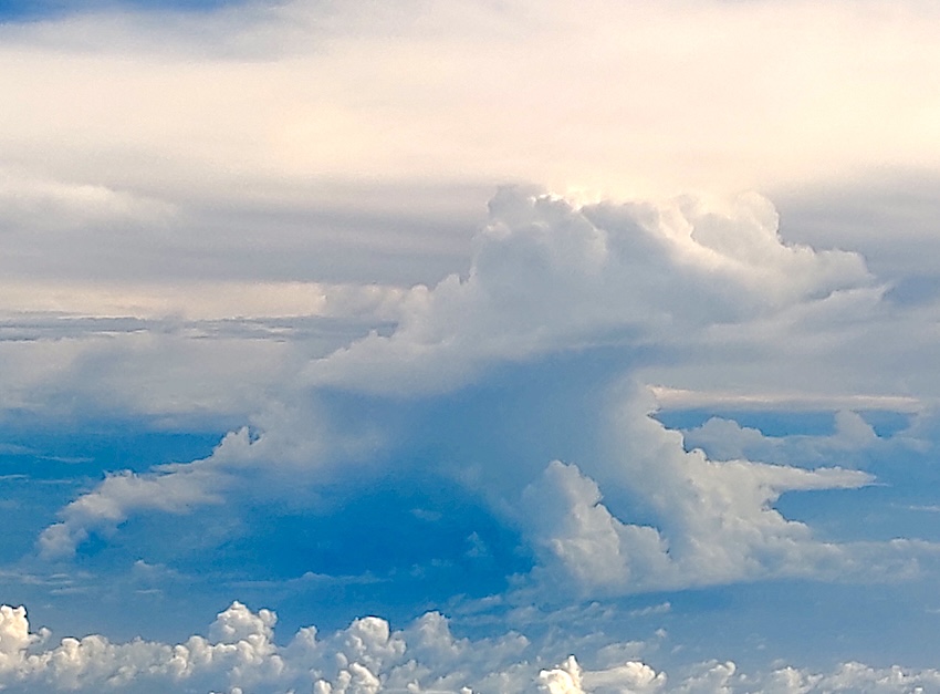
Greetings from a frog (19:41 UTC)
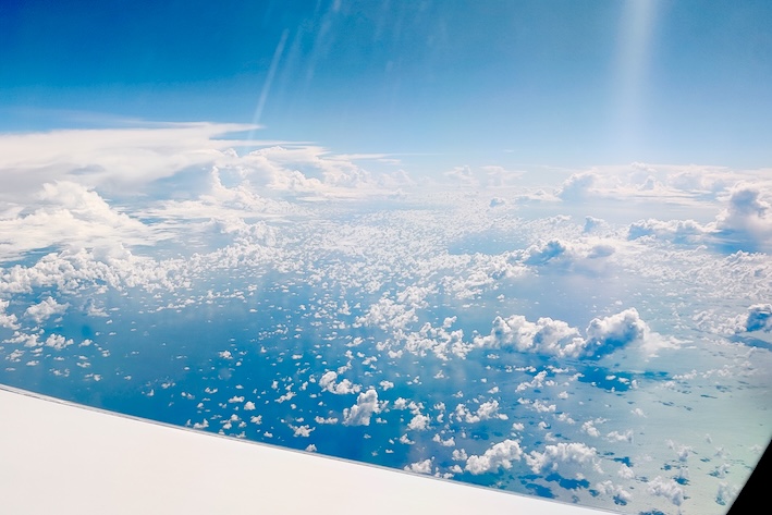
sea of sugar and cumulus (12:23 UTC)
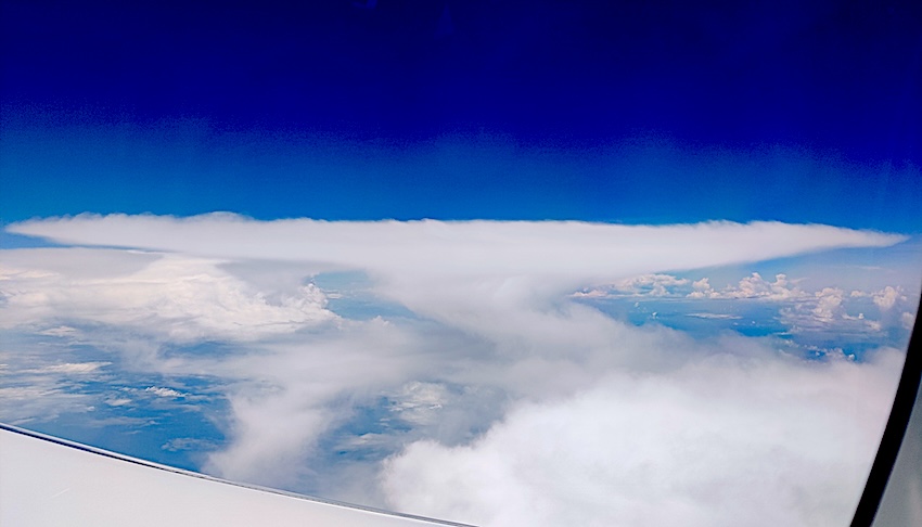
How I imagined anvil clouds as a kid (16:15 UTC)
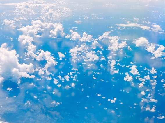
Ocean mirror (17:38 UTC)
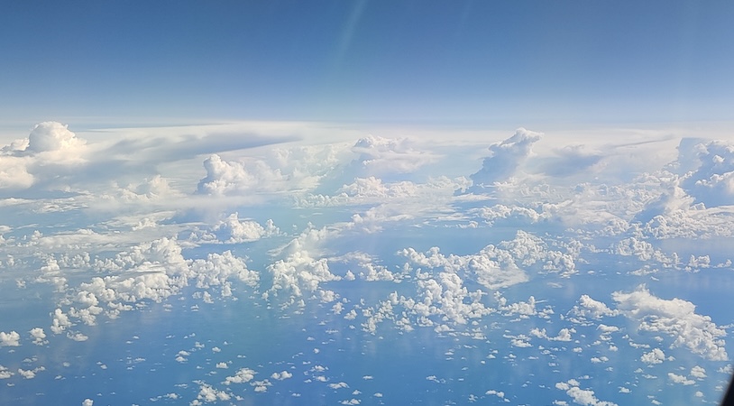
Cloud tower family (18:36 UTC)
Instrument status & quicklooks#
Instrument |
Operational |
Comment |
|---|---|---|
BACARDI |
✅ |
None |
BAHAMAS |
✅ |
None |
Dropsondes |
✅ |
cable change in first circle, no data in first circle |
HAMP |
✅ |
no entry |
PI-Camera |
✅ |
no entry |
Smart |
✅ |
Generally ok. Issues with Fdn (SWIR) (SWIR2) spectromter. Upper inlet fixed. |
SpecMACS |
✅ |
Some icing on sideward looking cameras after flying through a cirrus cloud. |
VELOX |
✅ |
Fully functional. |
WALES |
✅ |
no entry |
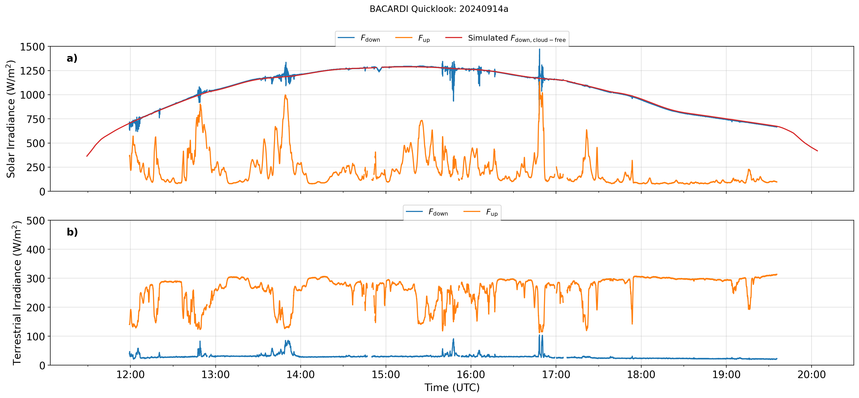
BACARDI
Dropsondes
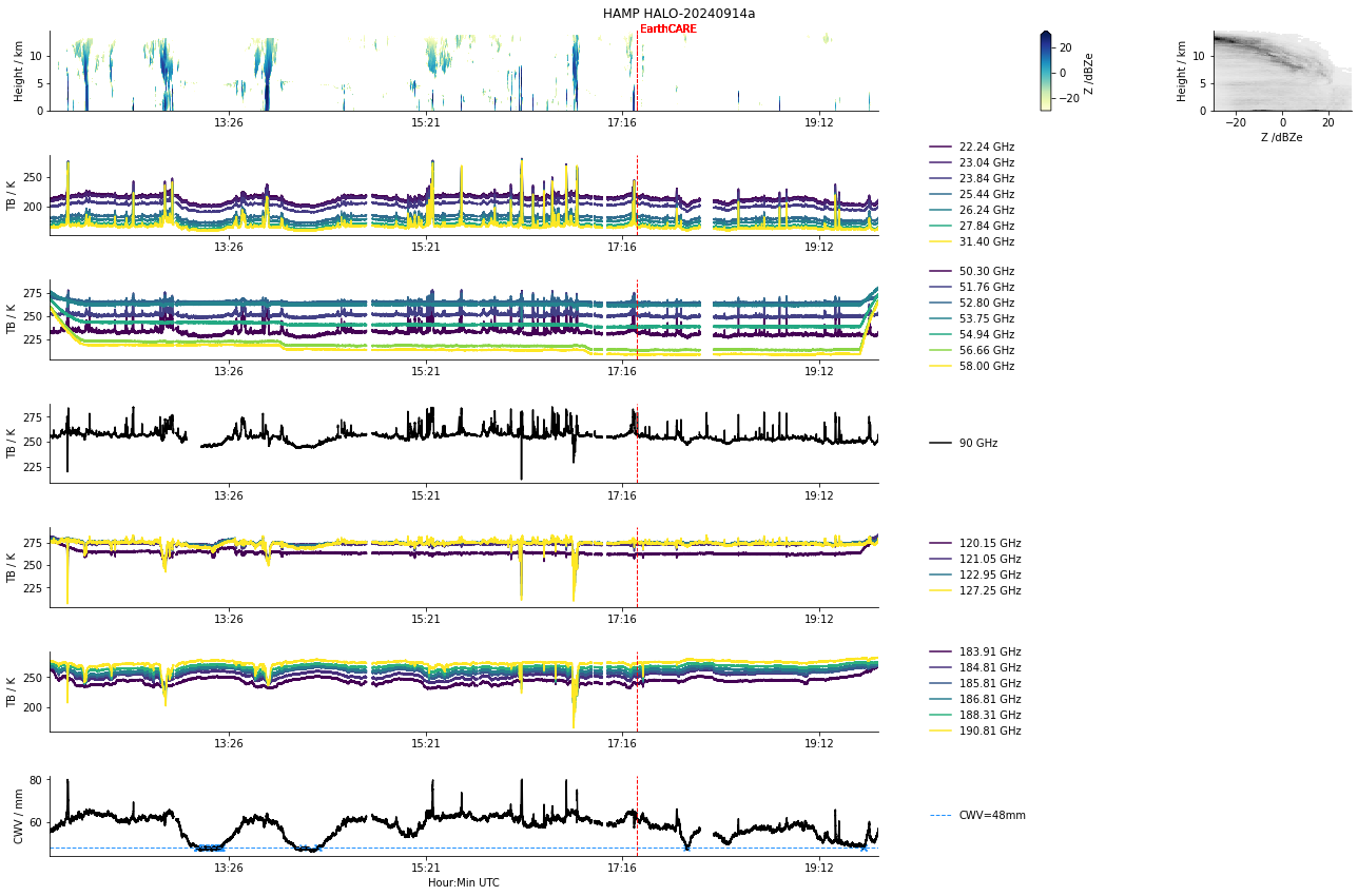
HAMP
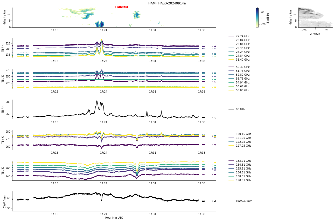
HAMP during EarthCARE underpass
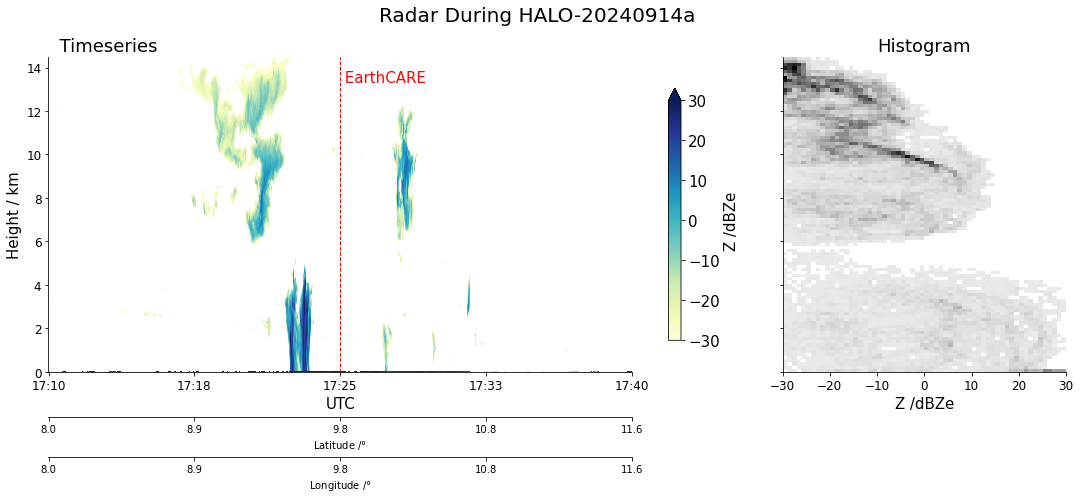
Radar during EarthCARE underpass
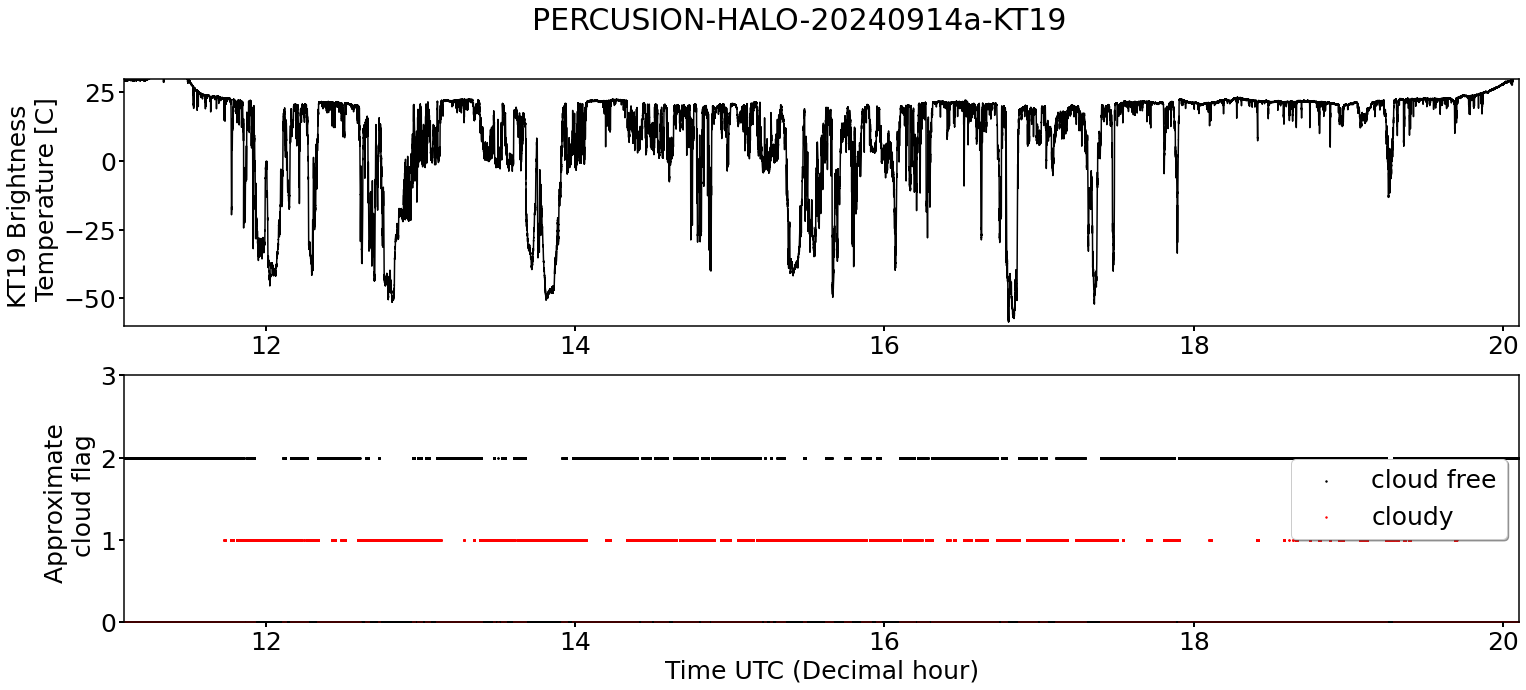
KT19 Timeseries of brigthness temperature.
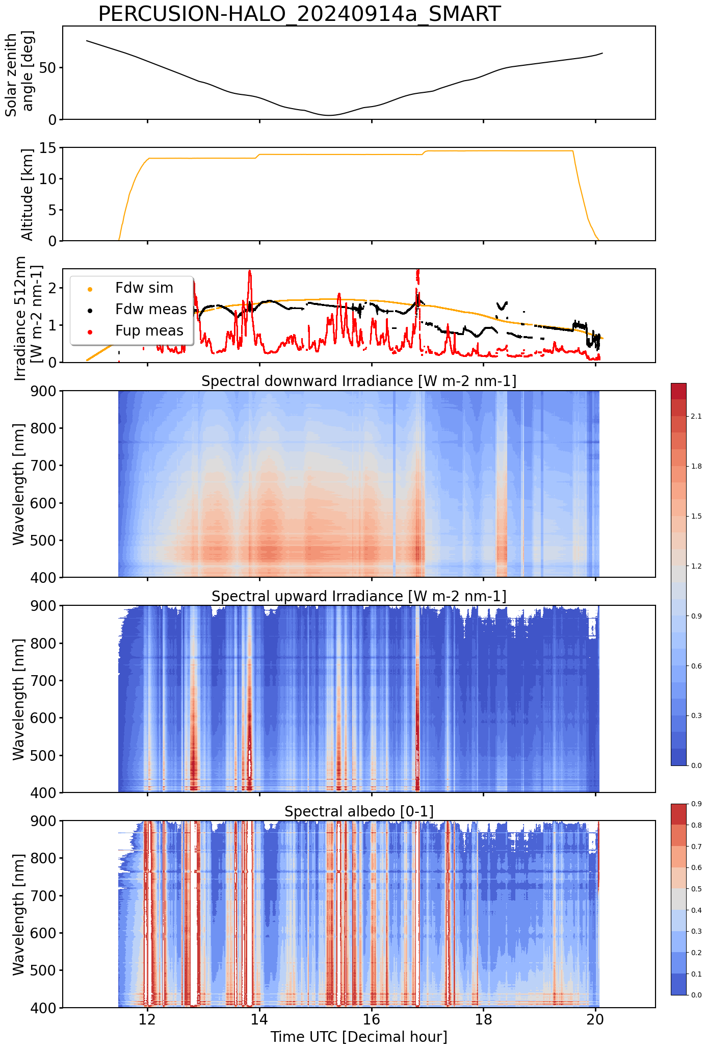
SMART Time series of upward and downward spectral irradiadiance, and albedo.
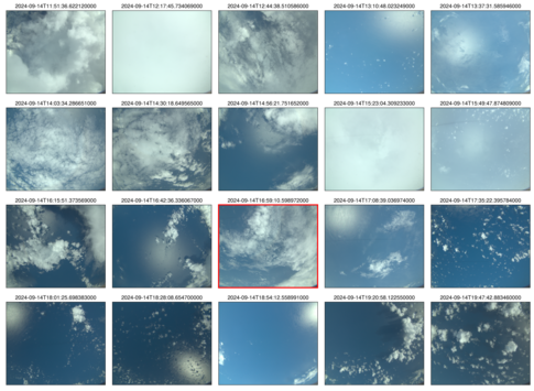 specMACS RGB snapshots from polb (lower right) with EarthCARE underpass marked in red. Find further quicklooks here.
VELOX broadband channel with EC underpass
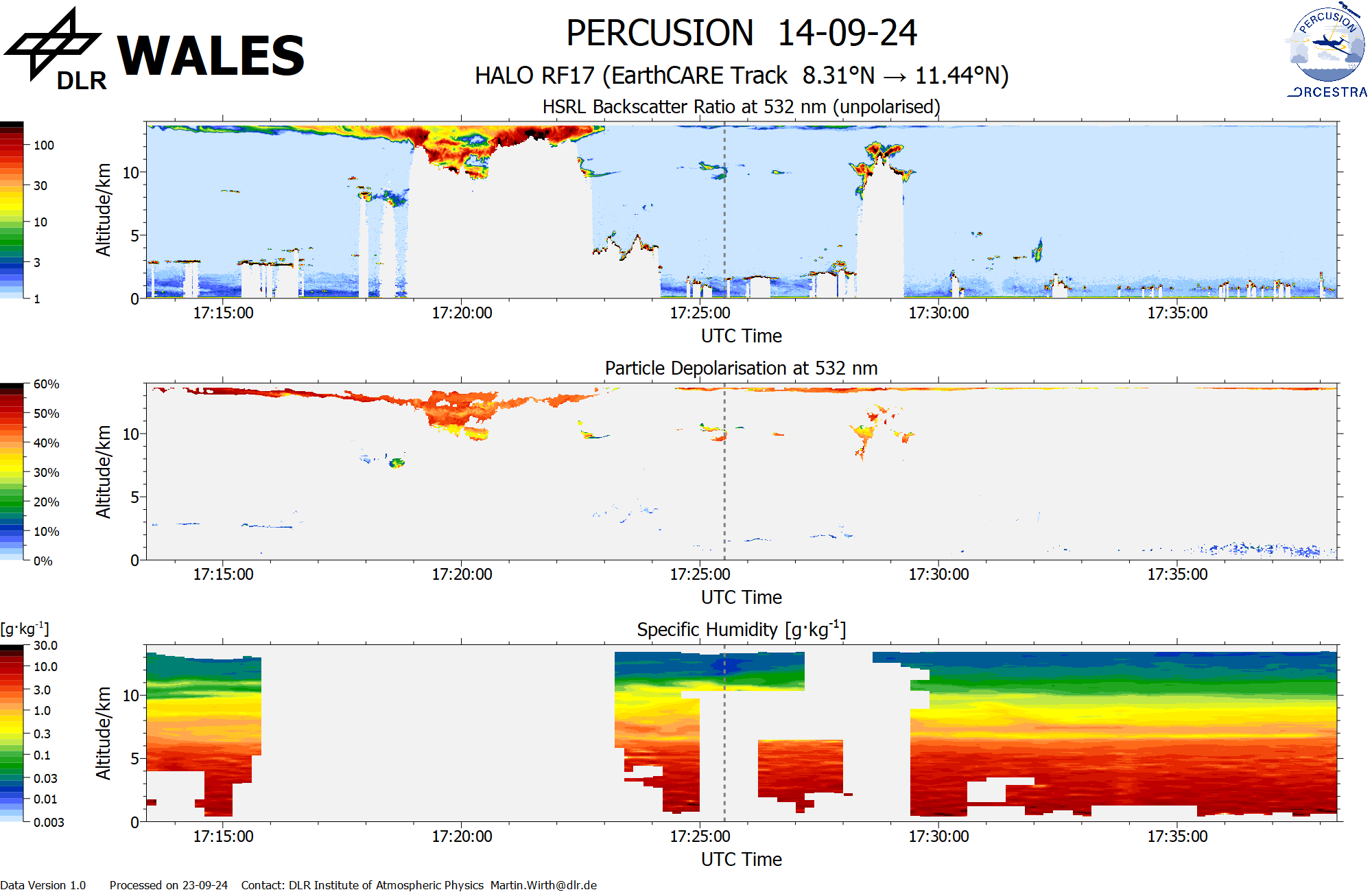
WALES (backscatter, polarization and humidity) at EC overpass
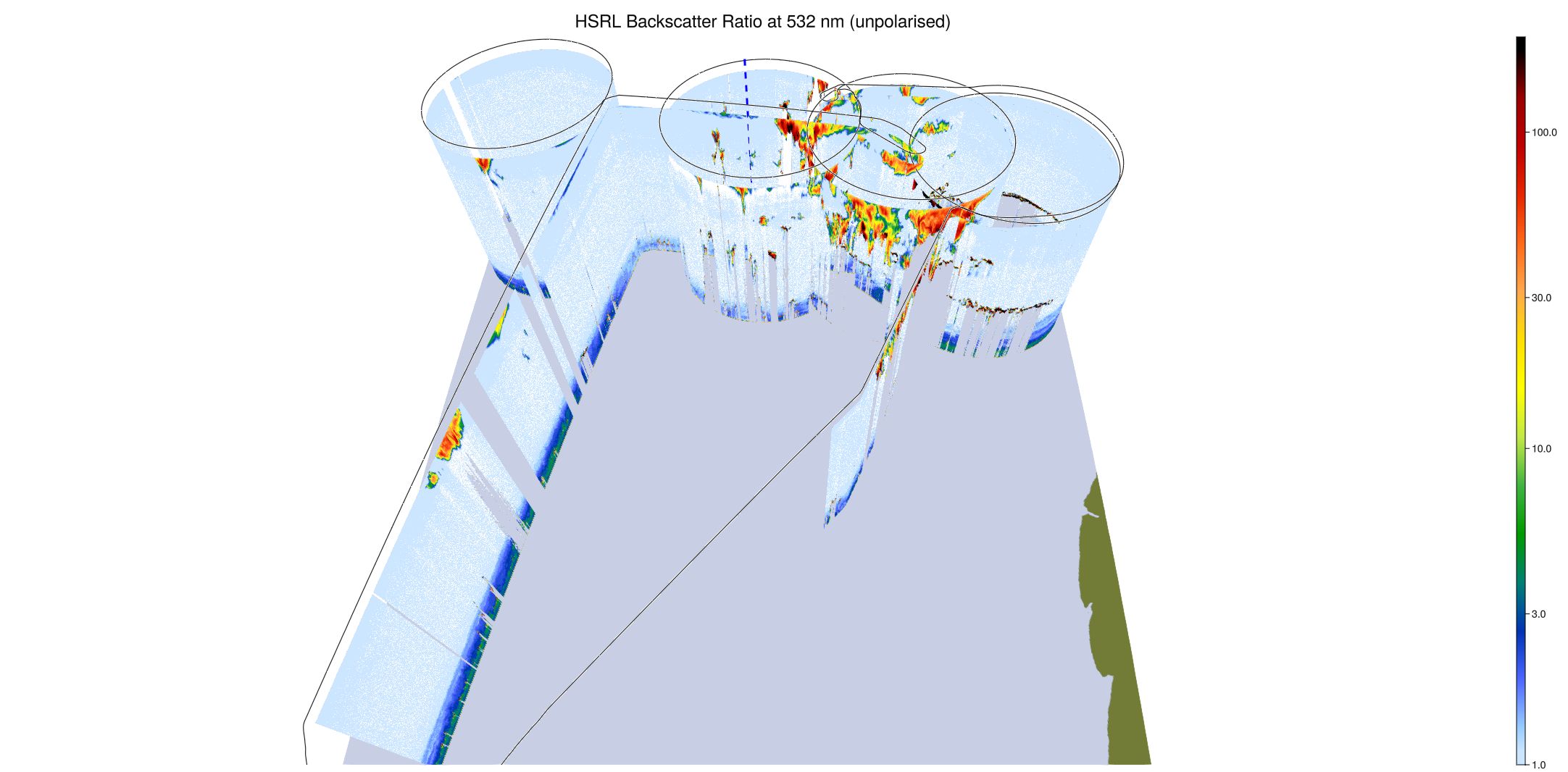
WALES (3D backscatter)
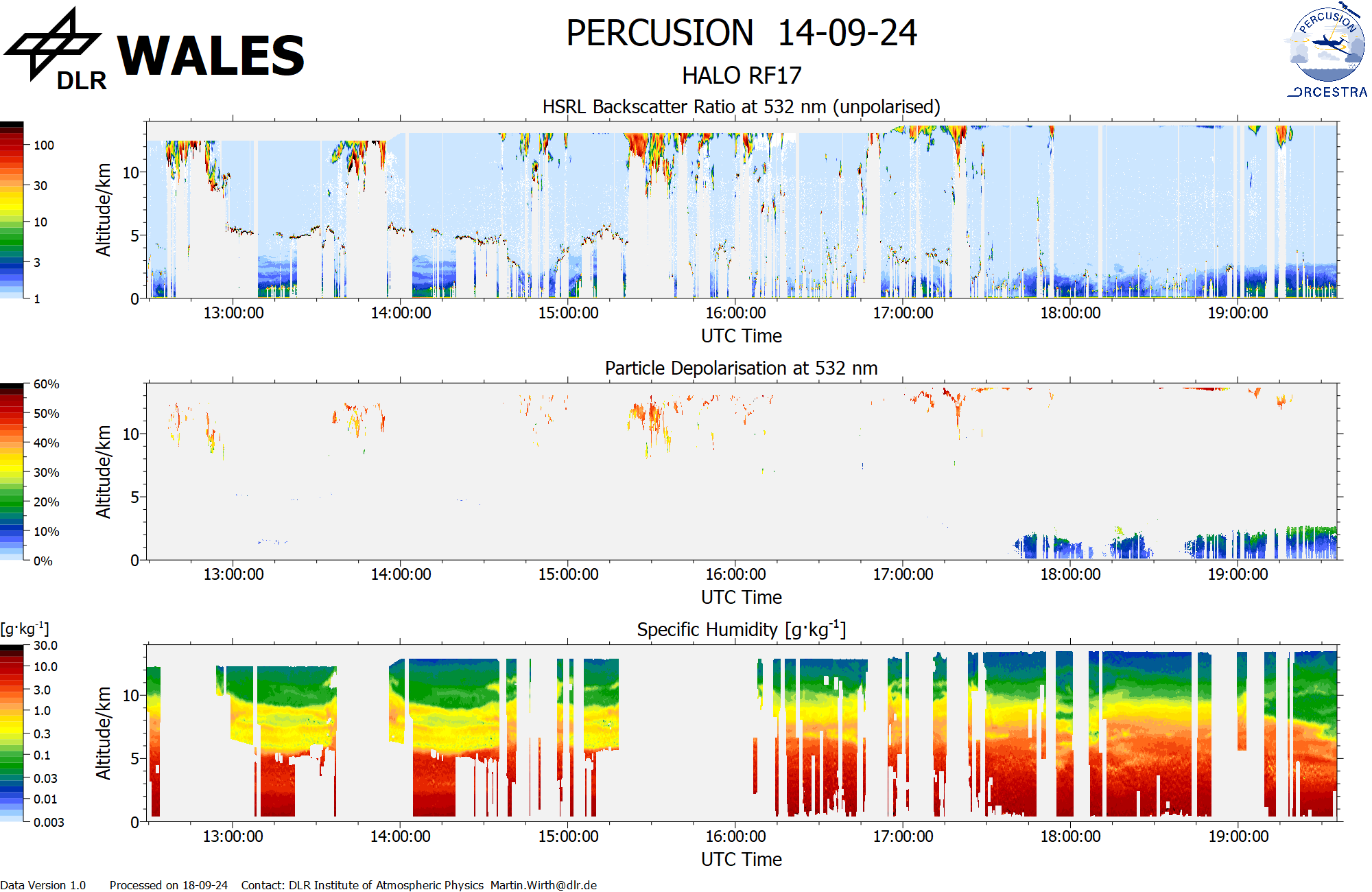
WALES (cross section)