

HALO-20240907a#
ec_under ec_track c_north c_mid c_southCrew#
Bjorn Stevens, Georgios Dekoutsidis, Clara Bayley, Helene Glöckner, Michael Schäfer, Anja Stallmach, Daniel Rowe, Chavez PopeTrack#
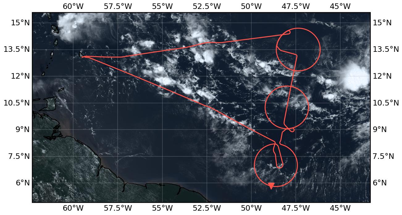
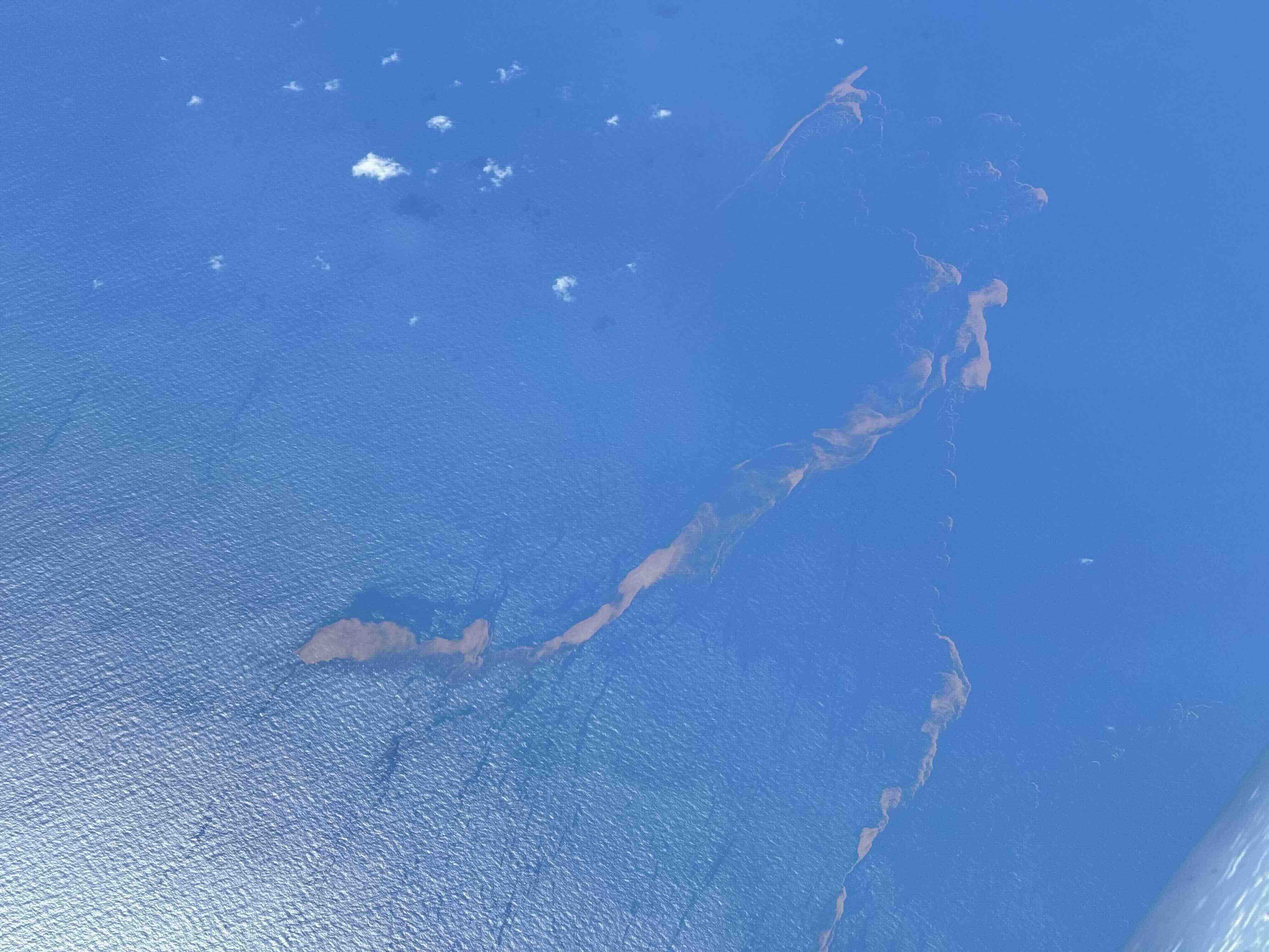
Flight path superimposed on the natural color image from NOAA’s Geostationary Operational Environmental Satellites (GOES) 16 satellite on September 7, 2024 at 15:20 UTC. The location of the aircraft at the time of the satellite image is highlighted.
Conditions#
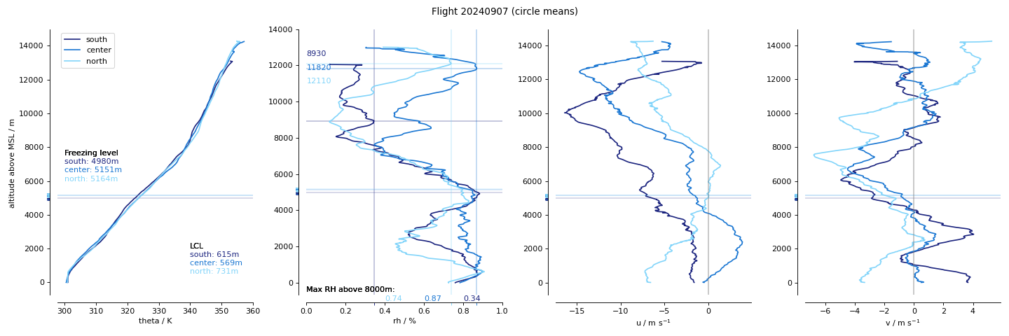
Vertically pointing cumulus at takeoff, thin coverage of cirrus. The ITCZ seemed to be characterized by an easterly wave or northward undulation near Barbados, and another near 45 W, so that it had a slight nortward tilt as it moved westward. From the region of the EarthCARE overpass to the west there were very low winds, and convection seemed to be concentrated in the band between the outer two circles. Convection extended to the west from the band, and there were large cirrus outflows, presumably fed by lines or squalls to the east of the overpass line whose cirrus blew into the north-easter part of the central circle and the south-eastern part of the northern circle.
In the southern circle we had hoped to do a cloud loop at the top of the circle, but the area was remarkably clear, in what seemed like a big cold-pool basin. There were some clouds that looked a bi tmore developed toward the center of the circle so we flew towards these. They were forming at the intersection of different convective lines, and we looped around them to the south, sort of ringing the center of the circle before returning to its perimeter while maintaining the developing convection out our left window.
The center circle encompassed lines of convection extending ESE-WNW through it in what seemed to be a central ITCZ region with low reflection and seemingly very low winds to the south of this circle, south of the main convective activity, and near the top of the southern circle. One could imagine the band of convection in the middle of this circle as the southern edge, in which case a northern edge was intensified more westward, so that convective activity appeared to hop-scotch between the edges of the band..
The northern circle’s southern flank skirted the edge of the deep convection, but never really sampled it. Conditions were supressed on the northern side and an extensive aerosol layer was measured. The conditions were such that we glided along the southern edge, but outside of the main convetive region, on the outbound ferry, and along but outside the northern edge on the inbound ferry, providing nice contrast for the different sides of the ITCZ. We went from being a water vapor flight on the south to an eaorosl flight on the north.
lots of
Impressions from the Flight Documentation Scientist – D. Rowe
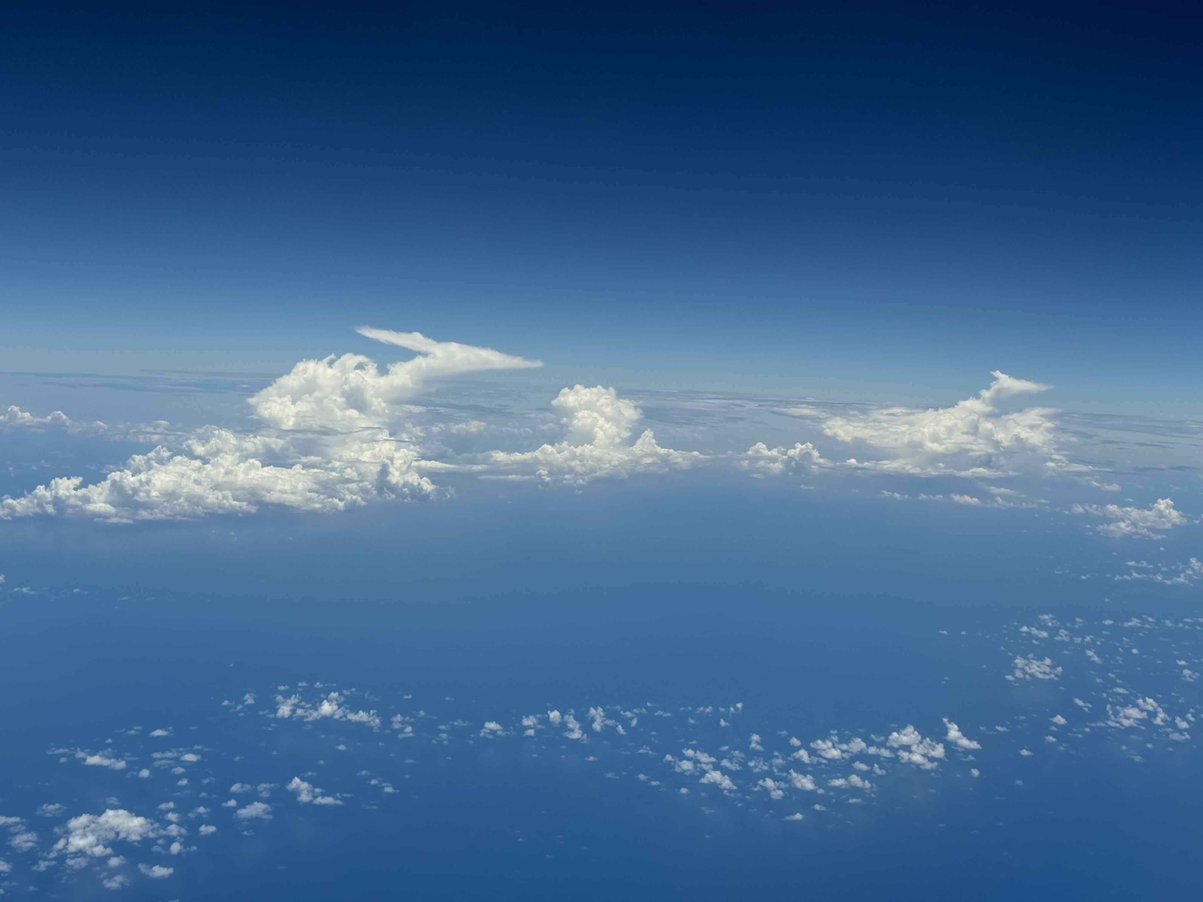
The forecast showed that around the flight axis for HALO, there would be narrow strip of enhanced moisture convergence at the surface. There was sufficient upper level divergence and an area averaged model sounding showed low wind speeds throughout the depth of the troposphere, with some environmental dryness around the middle troposphere. The environment was primed for cumulus convection of all variants, with cumulonimbus clouds not uncommon. The expectation was for these cloud structures to maintain their verticality as they developed, due to a weak wind shear regime. In the low to middle levels, various cumulus variants were observed. Shallow cumulus fractus and humilis occupied vast regions of the flight path. Aggregated structures of towering cumulus, accompanied by stratocumulus sheets were often observed with little to no wind shear. Many cold pools were identified, with shallow to towering cumulus convection forming along the boundaries of these cold pools. At the upper levels, there was significant cirrus cover throughout the entirety of the flight. This cirrus occupied a region of around 400hPa to 175hPa, and was comprised of thicker cirrus clouds with a depth of 2km which were suspected to be the remnants of convective anvils. Additionally, thin cirrus structures formed, most likely due to the saturated upper level environment. These thinner cirrus clouds possessed a “curtain” structure. A few isolated cumulonimbus clouds were observed, which possessed slight easterly shear in the upper level levels. Larger, aggregated cumulonimbus structures were confined to the horizon and were slight obscured by their own cirrus deck.
Execution#
changed direction on approach to small circle because of iceing on the specMACS camera looking out the right window
for the small circle an absence of clouds and flexibility in use of space caused us to detour to the center of the big circle where we flew manually around some developing congestus chosen by PI based on visual inspection out of the cockpit window. Convection appeared to be forming on the interesection of convective lines. This was more to the center of the circle than anticipated rsulting in a detour, but we seemed to have extra tim, so even with the detour we remained on schedule.
had to stop sondings at about 8pm on the circle (after ten sondes), then didn’t get permission to exist circle leading to some overlap
received permission later and continued to fill in with sondes along center line
didn’t have permission to enter circle so we had to fly through it… communication on how to return to circle wasn’t effective.
didn’t get permission to exit circle, so we had to continue on it.
Impressions#
12:50 take-off, cumulus congestus growing on north end and preciptating on decaying (southern flank)
13:10 climgint to 410… some congestus degraining at flight level (FL350).
13:18 flying through cirrus topping out at FL400
13:52 convection rising to flight level
13:55 slight diversion around developing convection
14:04 passing a convective cell that extended above the aircraft along our left wing.
14:19 large cold pool boundary
14:28 turning on to small circle to use left window, right is frozen .
14:40 circling around a developing cloud on a large cold pool boundary
14:45 waiting for permission for soundings
14:46 flew circle around convection developing in the center maybe to FL350
14:51 out of excursion turning on to big circle
15:00 drop didn’t show winds.. dropping again
15:00 convection sampled in middle continues to develop and gro along the boundary. More stratiform clouds at mid levels behind (east) of boundary
15:14 stratiform layer shows up in lidar brightly, hardly in radar, at about 5.7 km.
15:14 clouds condtinue to develop in center of circle.
15:20 sugar to the south (at south point); stratiform laye rmostly interior toward center of circle
15:27 crossing what seems to be another cold pool boundary that intersects with the deeper clouds in circle center
15:43 cumulus in center detraining into stratiform layers at what seems like flight level
15:50 left circle over a big clear patch… central cluster now a cluster
15:58 entering circle rising to FL430
16:15 larger cirrus layuer edge, convection bubbling through to the NW
16:30 thin cirrus just above FL430
16:30 three or four developing convective cells ot the left, with extensive mid-level outflow and sheared toward the north it seems
16:42 more thin cirrus at flight level for the past few minutes… at various levels
16:52 had to stop dropping due to air traffic
16:57 lots of isolated deep convective cells all around us, sometimes directly out the window
17:04 huge sargassam below us
17:08 on track, FL450
17:18 line of convection nicely aligned with overpass, also dropped two sondes to make up for inability to drop
17:22 cirrus cleared again to allow deeper lidar penetration
17:28 passing over a lconvective line with clear to the south and midlayer startiform to the north
17:36 flying longer over circle as we await clearance for circle.
17:37 mostly sugar below us with some slight cirrus still working tis way into flight level from north and east
17:52 on the circle and launching sondes.
17:52 some lines of not particularly developing clouds… still a bit of cirrus
18:06 some slightly deeper clusters but not directly below us… growing cirrus at flight level and higher.
18:15 some wind aligned cloud bands, ragged, but deeper than sugar… cirrus layer above us.
18:25 thin cirrus shows up as -30deg C in IR, but -65deg as we fly through it. Deeper (3 km?) band off to the side.
18:28 beautiful pair of convective towers off the left wing on south of circle
18:59 turning off circle to return home… still sugary with NE to SW alinged cloud rows
19:38 Crossing a convective line along which the convection deepens to the left… flying all along the northern edge
19:49 convective fingers reaching up off the left wing .. also some convection on the radar and now on the right wing
20:13 thin cirrus, and cirrus virga suggestive of supercooled regions, the insitu water vapor measurements could be quite interesting
20:40 landing
Note
Co-location with ATR and EarthCARE over an aerosol layer near SAL. Spectacular line of convection on southern edge toward the west.
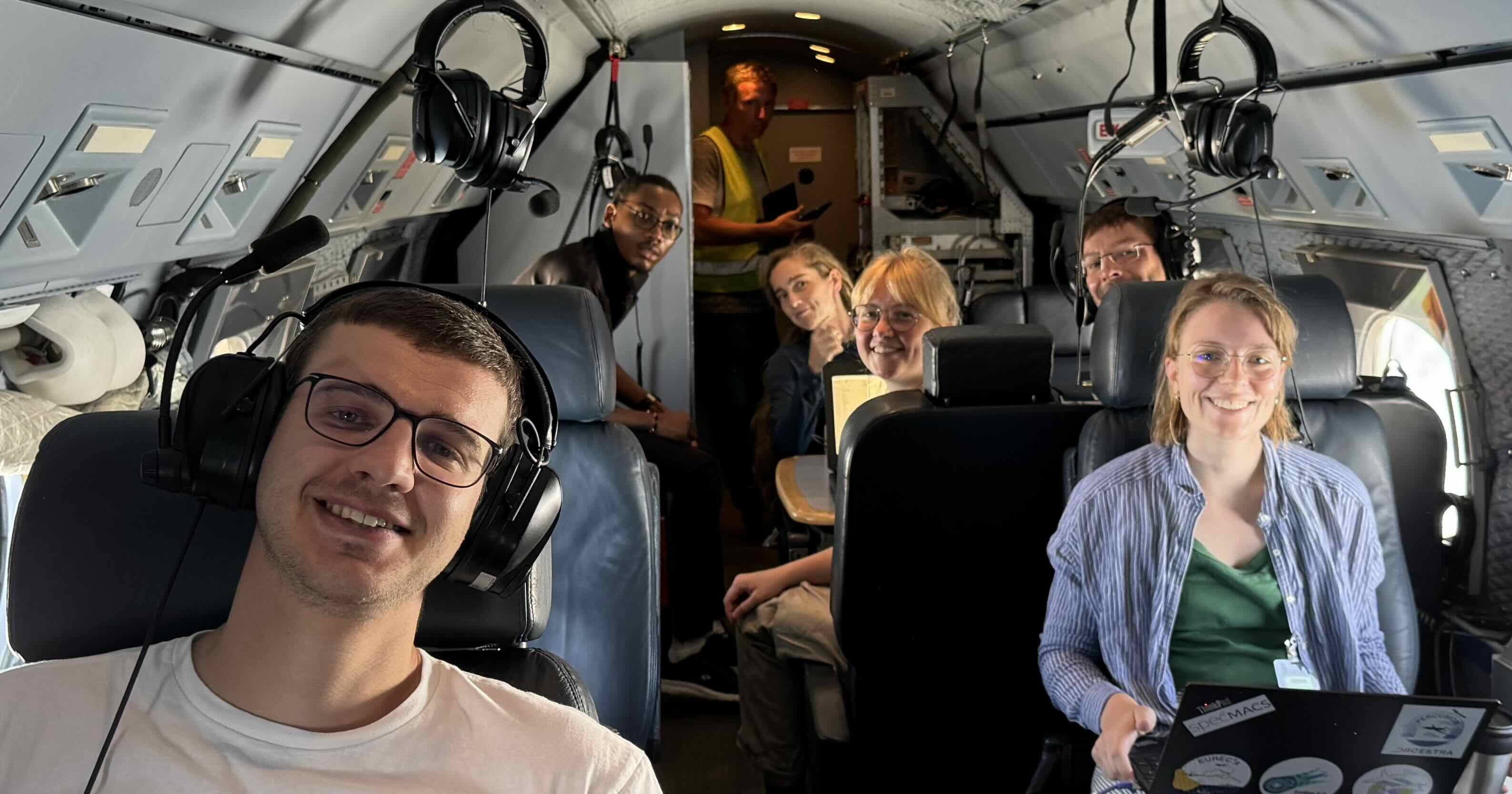
Crew with flight PI behid the camera (B Stevens, 1344 UTC)
Convective complex developing in center of southern circl, also rounded by cloud circle, at full development. (B Stevens, 1545 UTC)

Isolated deep convection forming at instersection of cloud lines with cold-pool-like structure (B Stevens, 1601 UTC)
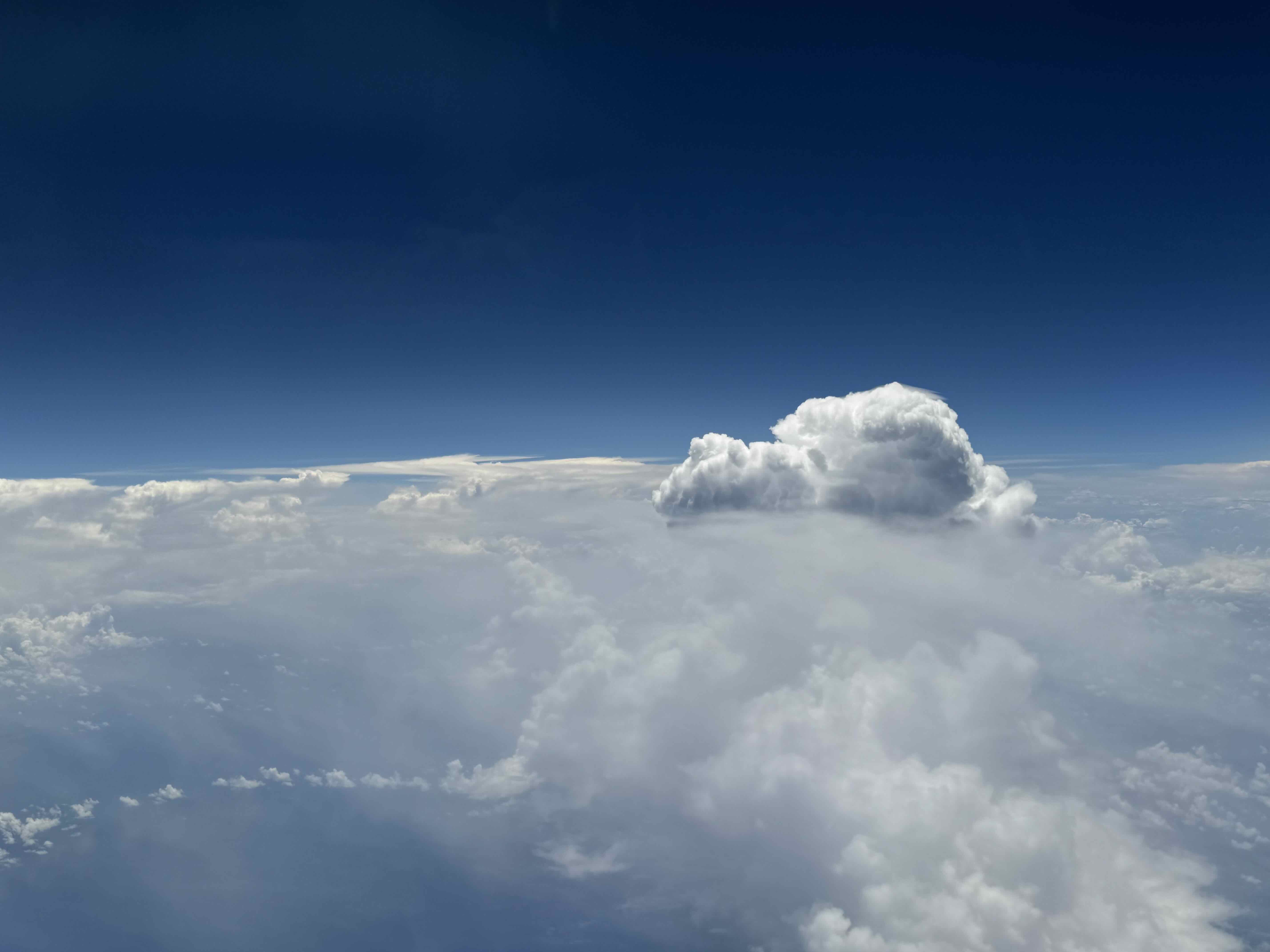
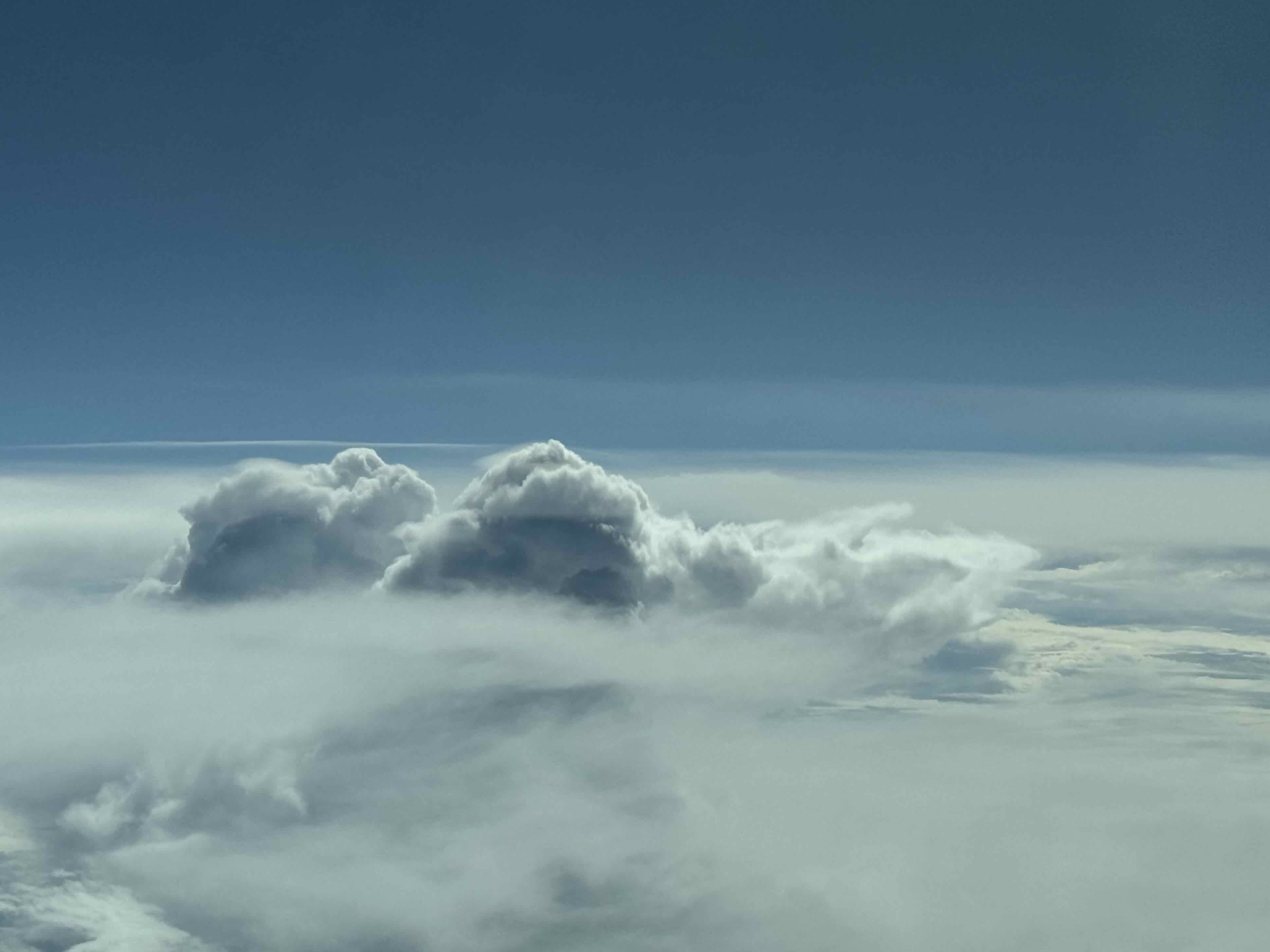
Deeper convection popping out of its own cirrus shield (B. Stevens, 1646 UTC)
Large region of sargassum with it calming influence on ocean waves (B Stevens, 1703 UTC)

Sugar north of the convective regions (B Stevens, 1758 UTC)
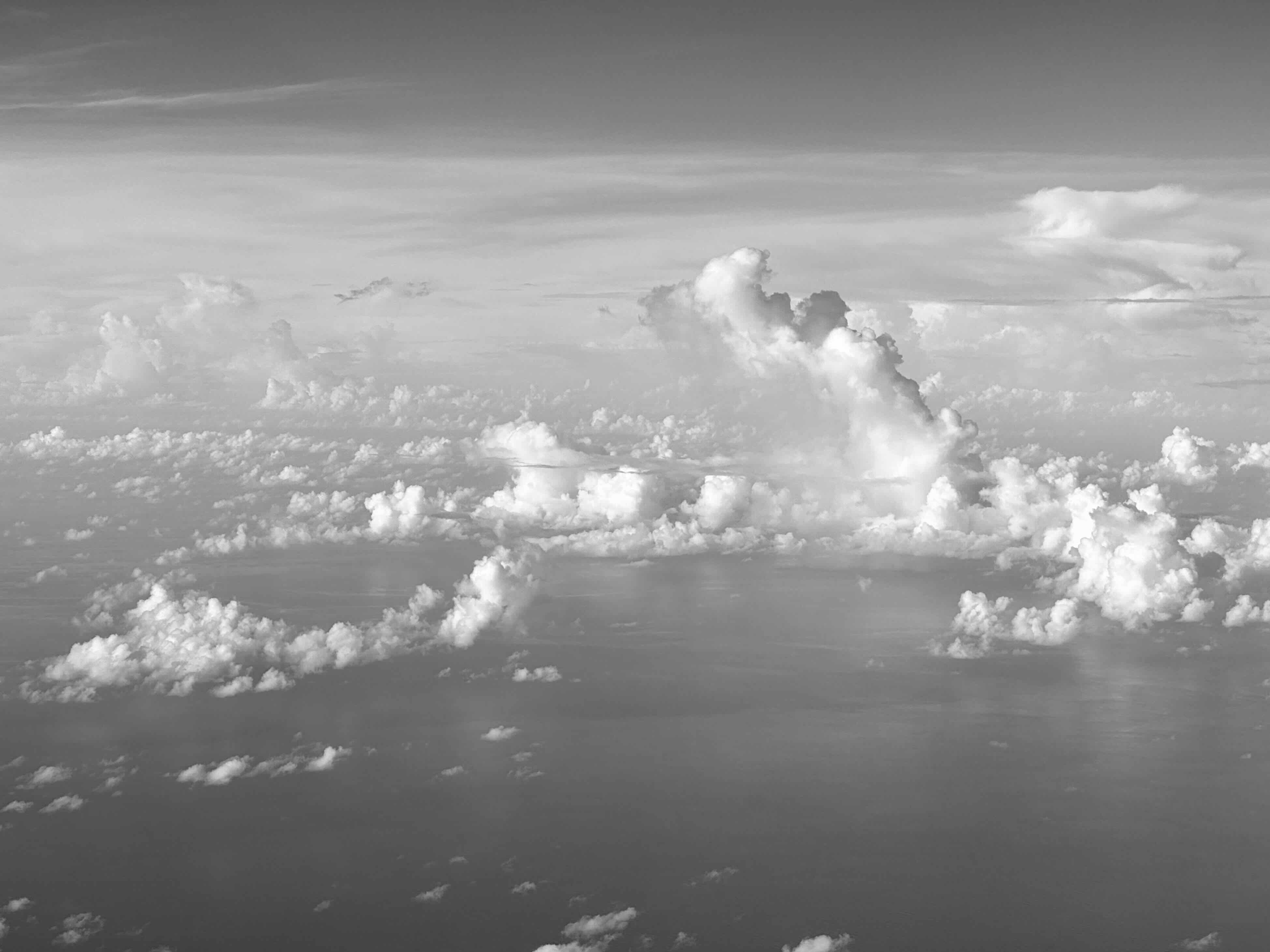
Clouds observing us (B Stevens, 1835 UTC)
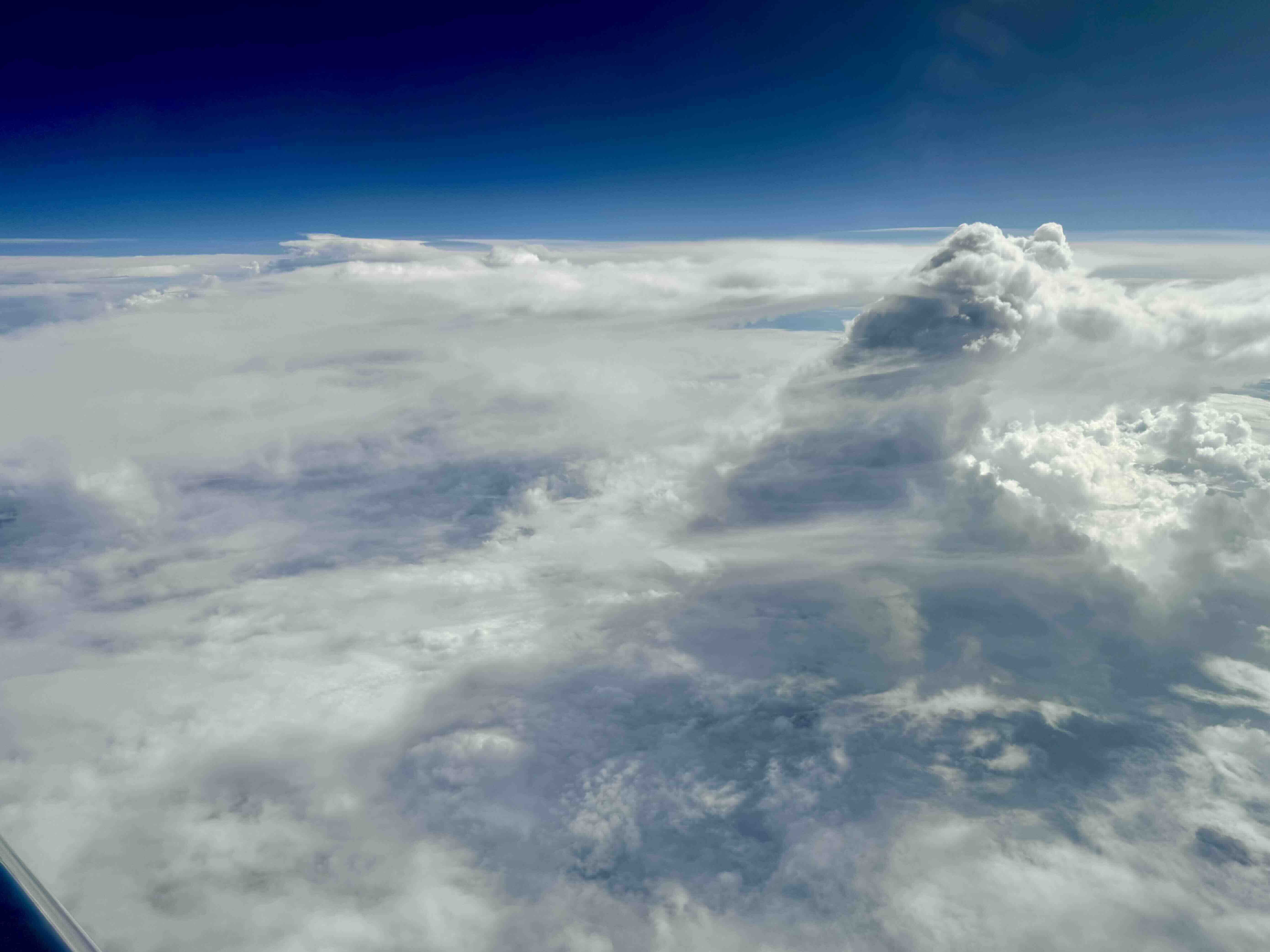
Another view of clouds rising through their own veils (B Stevens, 1837 UTC)
Cold pool edging convection along the edge of the ITCZ (B Stevens, 2024 UTC)
Instrument status & quicklooks#
Instrument |
Operational |
Comment |
|---|---|---|
BACARDI |
✅ |
None |
BAHAMAS |
✅ |
None |
Dropsondes |
✅ |
ATC permission revoked, sondes in c_center fly-through |
HAMP |
✅ |
no entry |
PI-Camera |
✅ |
no entry |
Smart |
✅ |
Fully functional. Upper inlet fixed. |
SpecMACS |
✅ |
Measurements in the boilerroom started about 10 min after takeoff, some icing on side cameras. |
VELOX |
✅ |
Fully functional. KT19 measurements ok. |
WALES |
✅ |
no entry |
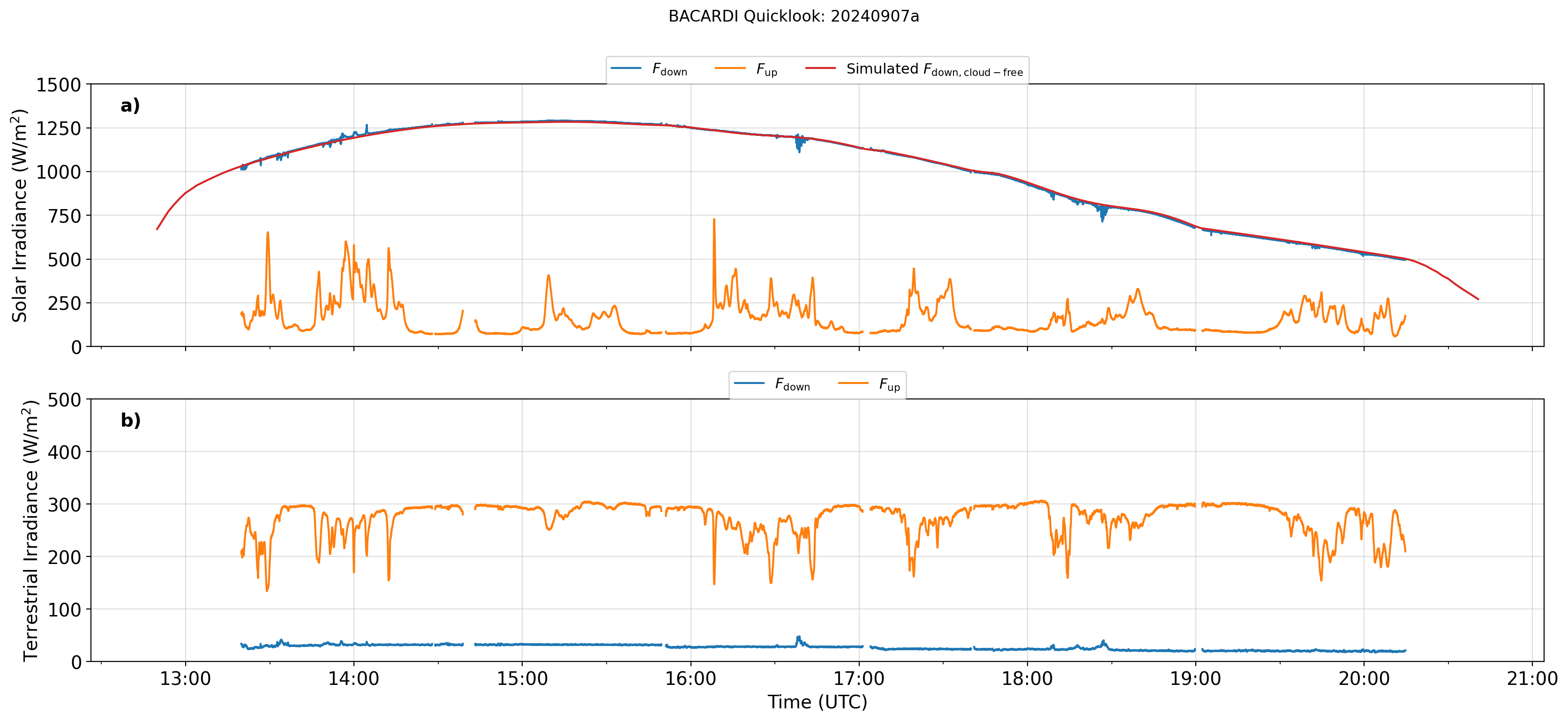
BACARDI
Dropsondes
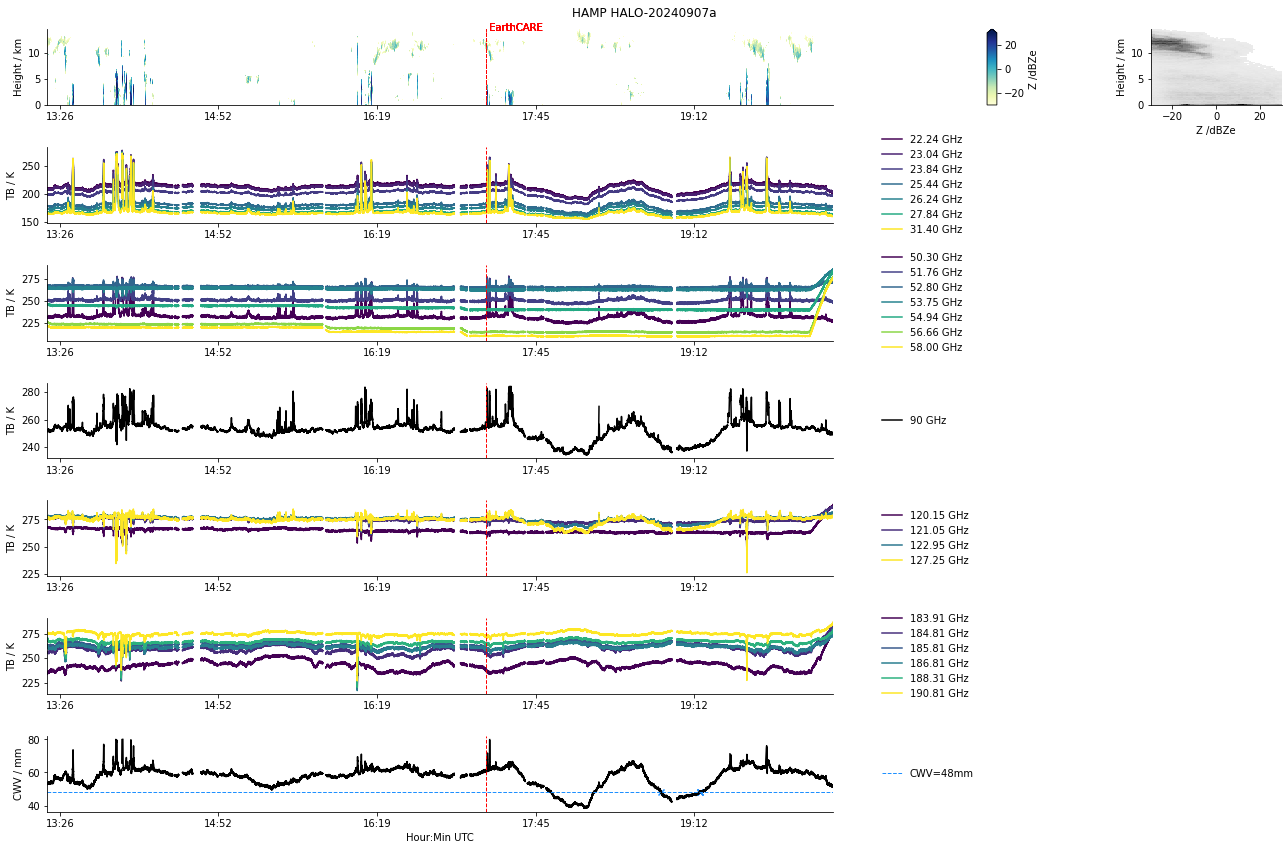
HAMP
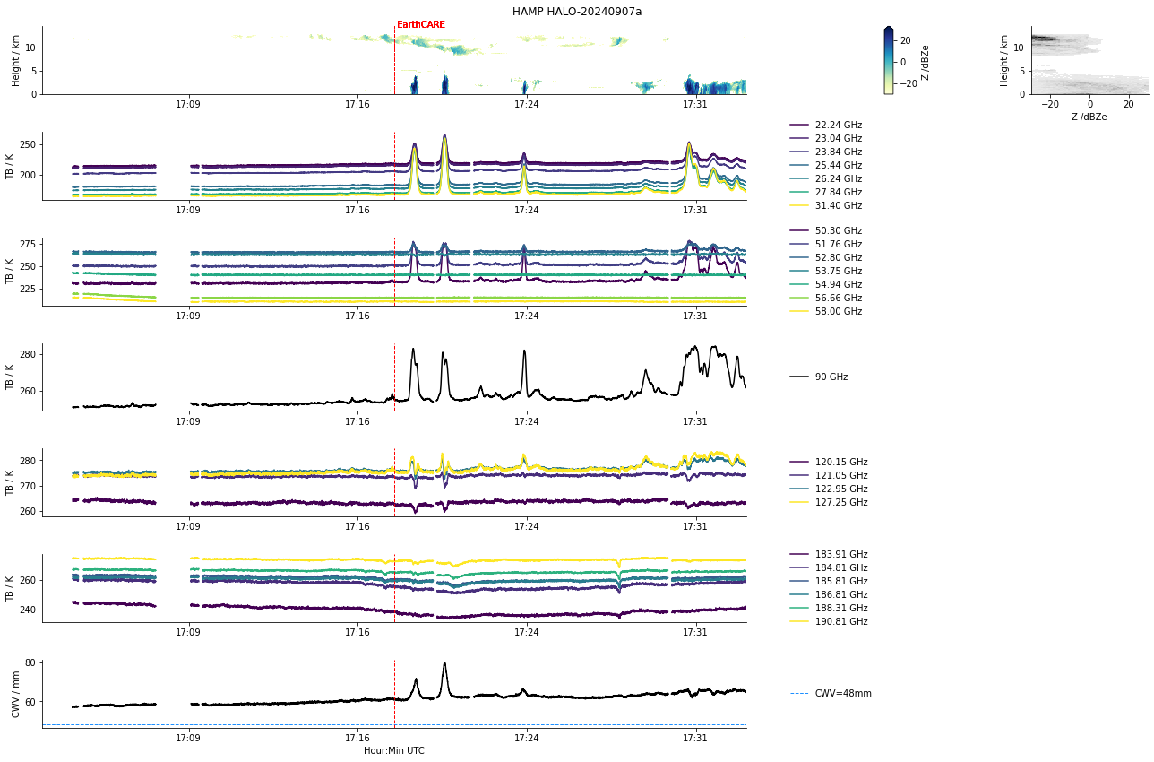
HAMP during EarthCARE underpass
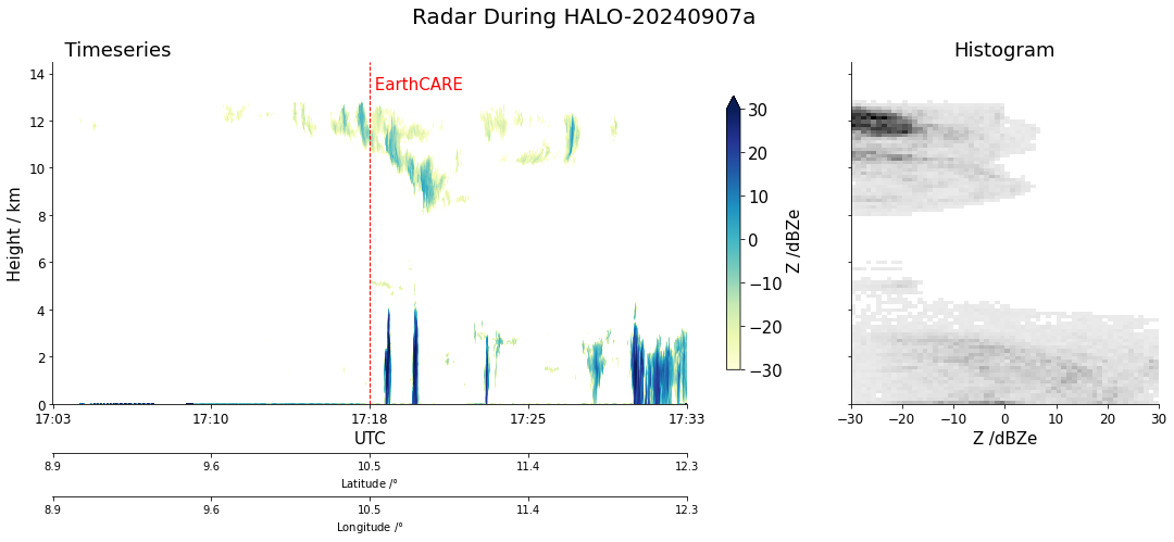
Radar during EarthCARE underpass
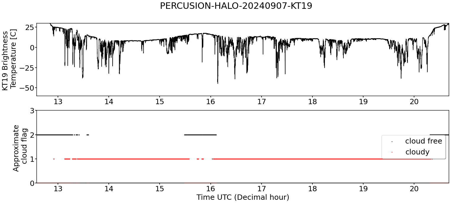
KT19 Timeseries of brigthness temperature. Please use with care. The window infront of the KT19 encountered condensation.
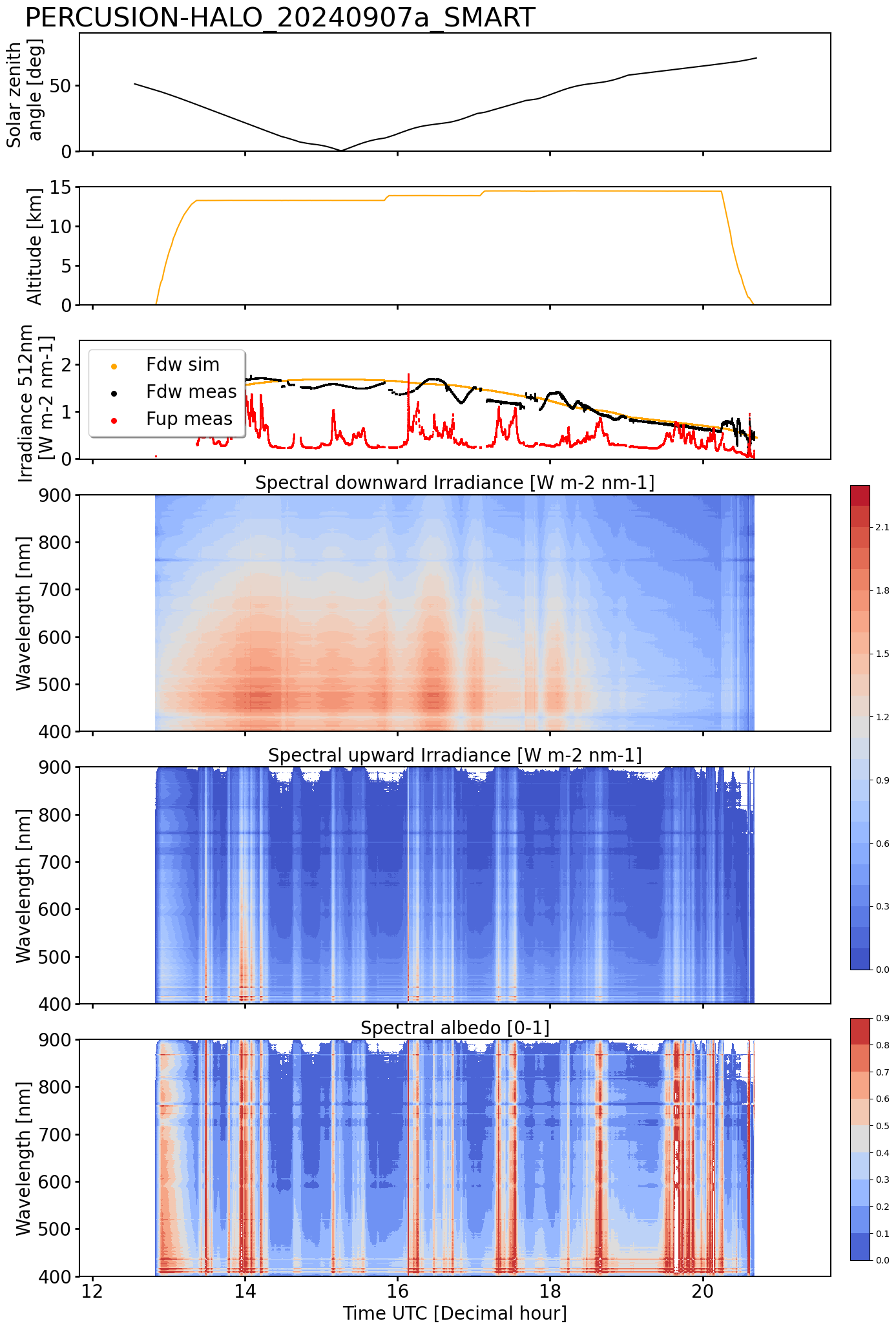
SMART Time series of upward and downward spectral irradiadiance, and albedo.
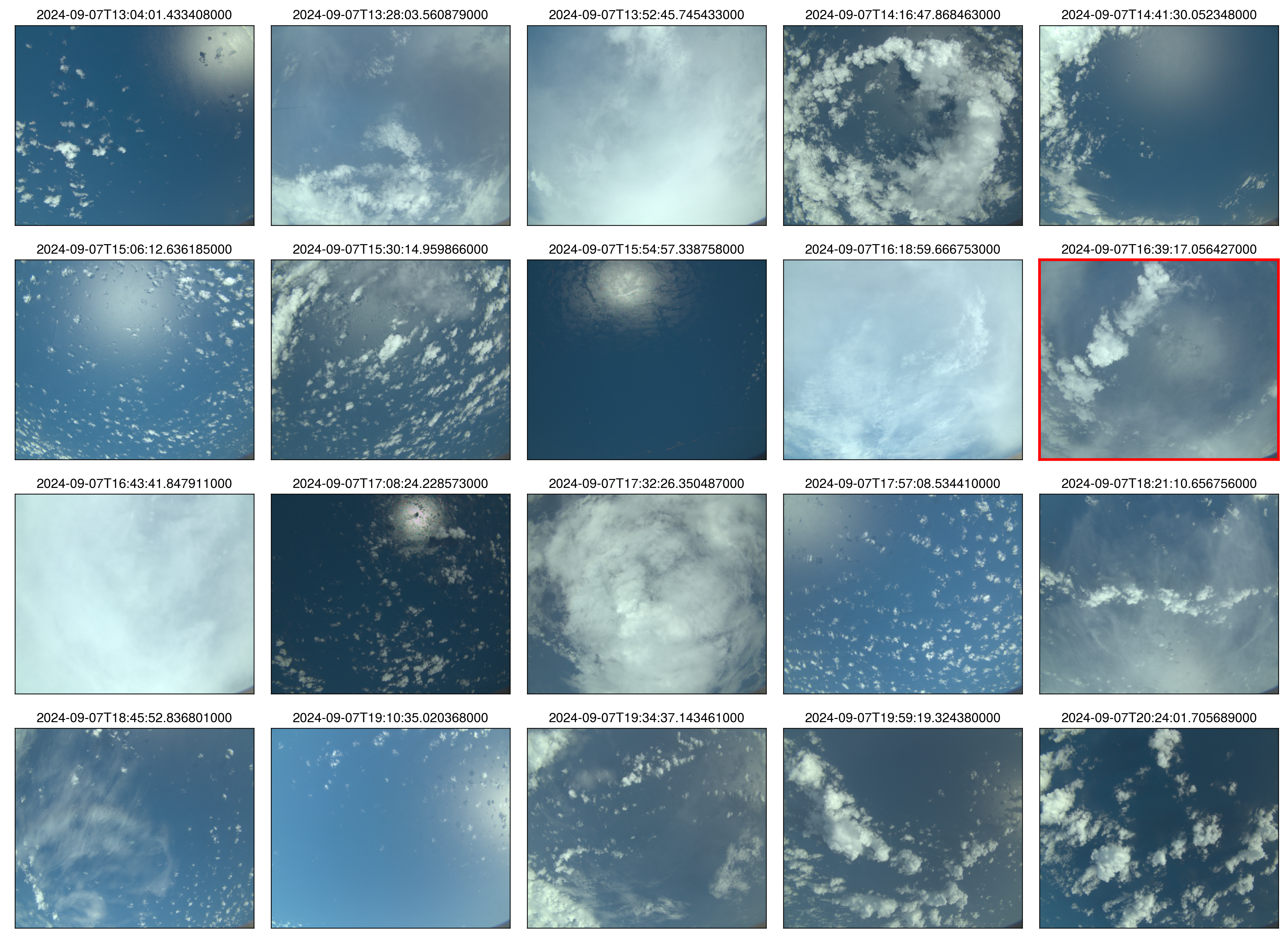 specMACS RGB snapshots from polb (lower right) with EarthCARE underpass marked in red. Find further quicklooks here.
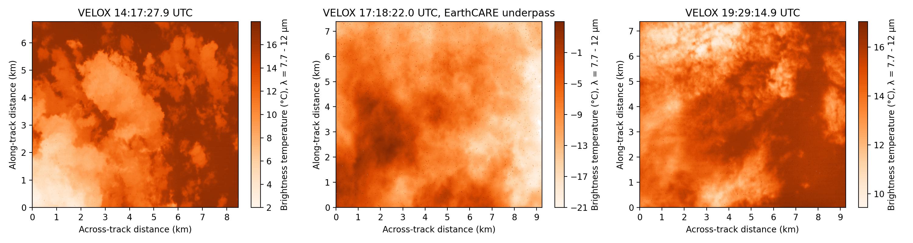
VELOX broadband channel with EC underpass
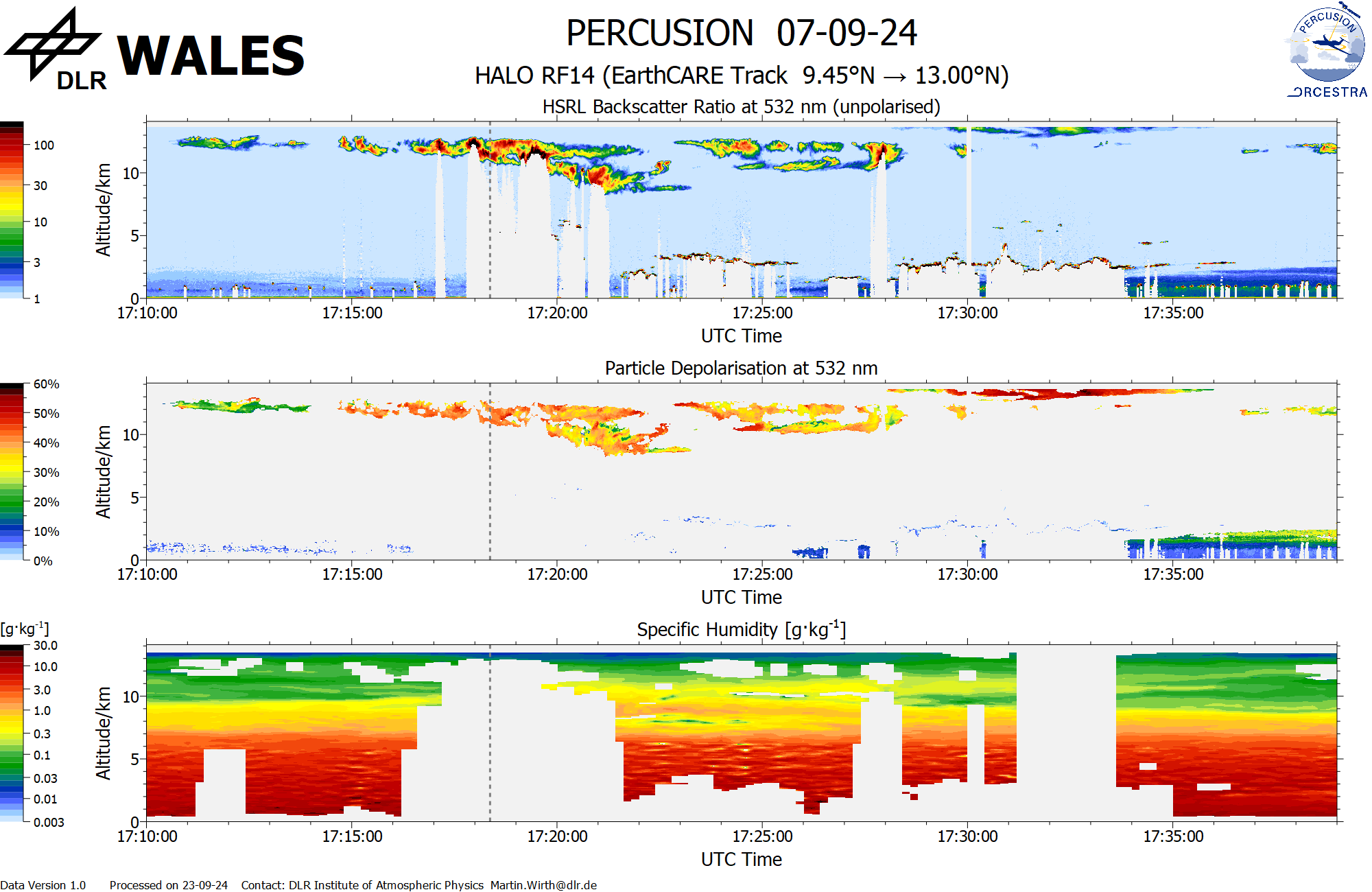
WALES (backscatter, polarization and humidity) at EC overpass
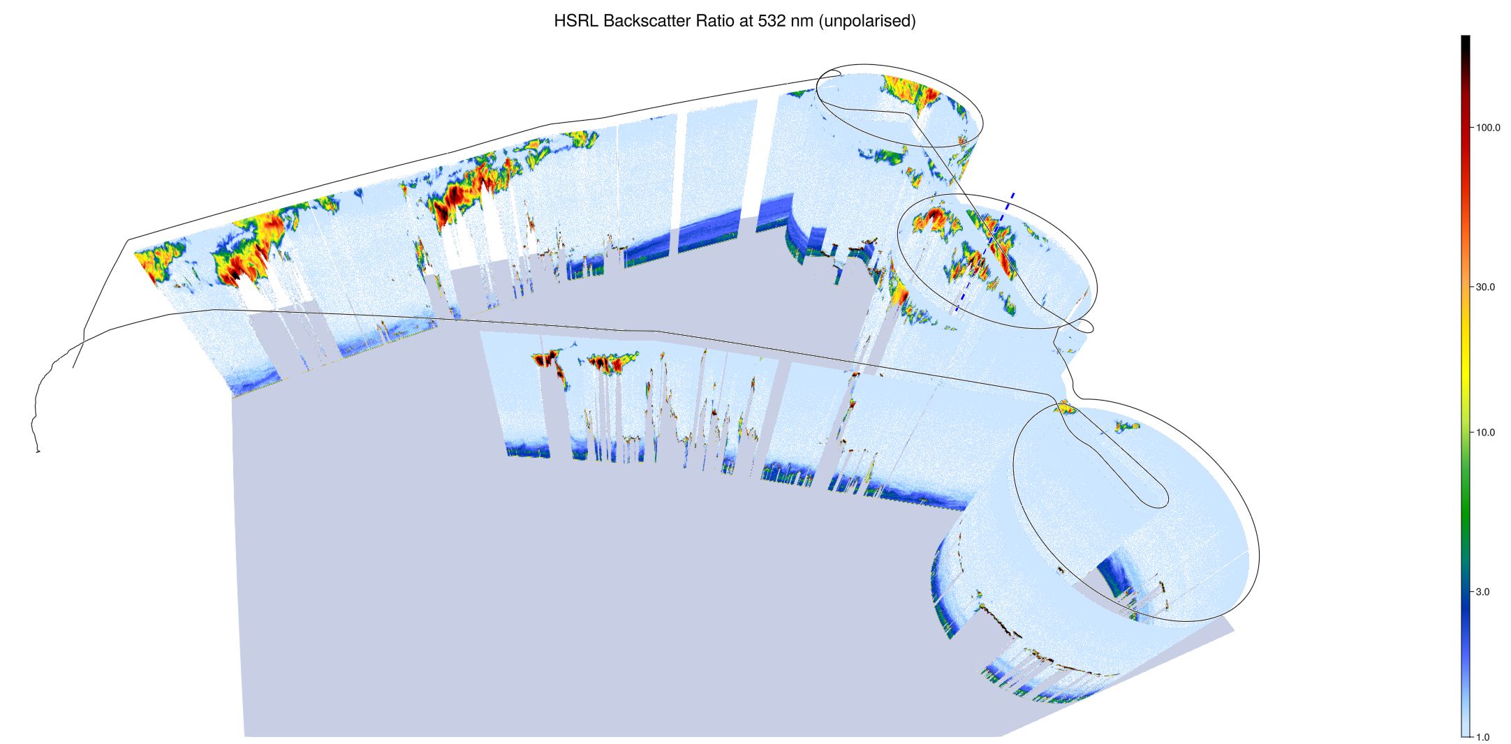
WALES (3D backscatter)
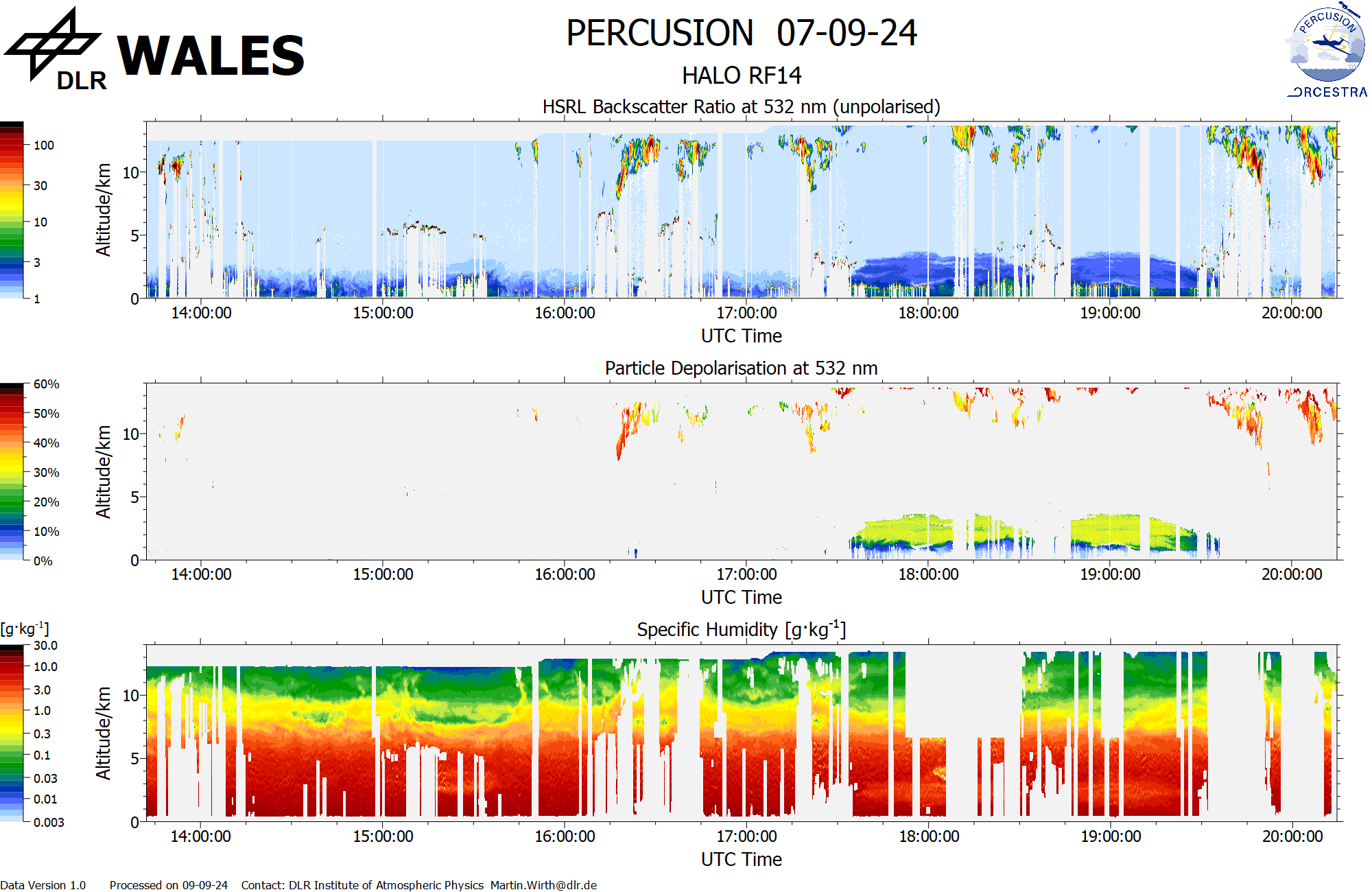
WALES (cross section)