

HALO-20240821a#
c_north c_mid c_south meteorCrew#
Cathy Hohenegger, Georgios Dekoutsidis, Tobias Kölling, Helene Glöckner, Kevin Wolf, Zekican Demiralay, Divya Praturi, Julia WindmillerTrack#
Conditions#
Very clean air conditions over Sal with island-induced shallow clouds at departure.
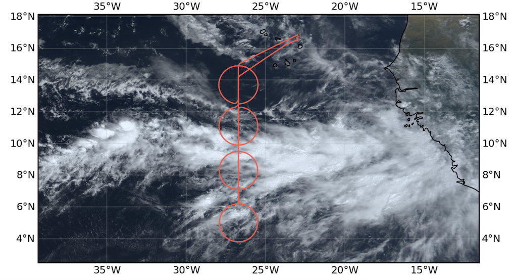
The flight was located on the 26.7W longitude. The ITCZ was narrow with a well defined northern band of deep convection and rain at around 9N. The northern edge in terms of deep convective clouds was in ‘c_north’, on its southern half, whereas there was a band of stratocumulus with an edge at its northern boundary. In terms of precipitable water, there was a second edge with a sharp gradient (from 65 to 30 mm) sampled by ‘c_extra’, whereas precipitable water only dropped to 50 mm in ‘c_mid’. Yet there was no deep convective clouds in ‘c_extra’ but clear sky, and few isolated shallow cumuli. There was a secondary NE-SW oriented band of deep convection striking through the northern half of ‘c_south’. Meteor was under this band while HALO sampled this band while flying around ‘c_south’ in its NW quadrant.
On the leg between Sal and 26.7W we crossed regions/patches of clear sky and stratocumuli. Waves patterning on the clouds visible. On the way back, two layers of clouds with altocumulus/cirrus on top and stratocumuli/cumuli at the bottom.
Execution#
The replacement for the emergency light battery did not arrive in time so that the flight was restricted to daylight hours. With a take-off at 12:20 UTC because of runaway restriction, the original flight plan had to be shorten to ensure a landing in daytime hours. The legs to south_tp (including overpass over Meteor) and to Mindelo were abandonned. Also it turned out that choosing 26.7W as longitude for flying was a mistake as it was below the main route of airliners going to south America. We didn’t get clearance to drop sondes on ‘c_mid’. We circled 1 h around it and then got an estimate that it might be possible to drop sondes in 40 min, which we couldn’t wait anymore. We waved to Meteor from ‘c_south’ while Meteor was in the circle. We did CCW circles where possible as this gave better sight for the SpecMacs camera.
Impressions#
Convection was not as deep as on Sunday, probably top around 12 km. While crossing the ITCZ and circling around ‘c_mid2’, we were in a soup of white.
Circles start time (in UTC, first sonde): 14:17 for ‘c_south’ (from N, CW), 15:20 for ‘c_mid’ (from S, CCW), 16:54 for ‘c_north’ (from N) and 17:55 for ‘c_extra’ (from S, CCW)
HAMP measured 100 mm of precipitable water in ‘c_mid’. This seems unrealistically high.
Note
South circle sampled an active convective line, also experienced by Meteor
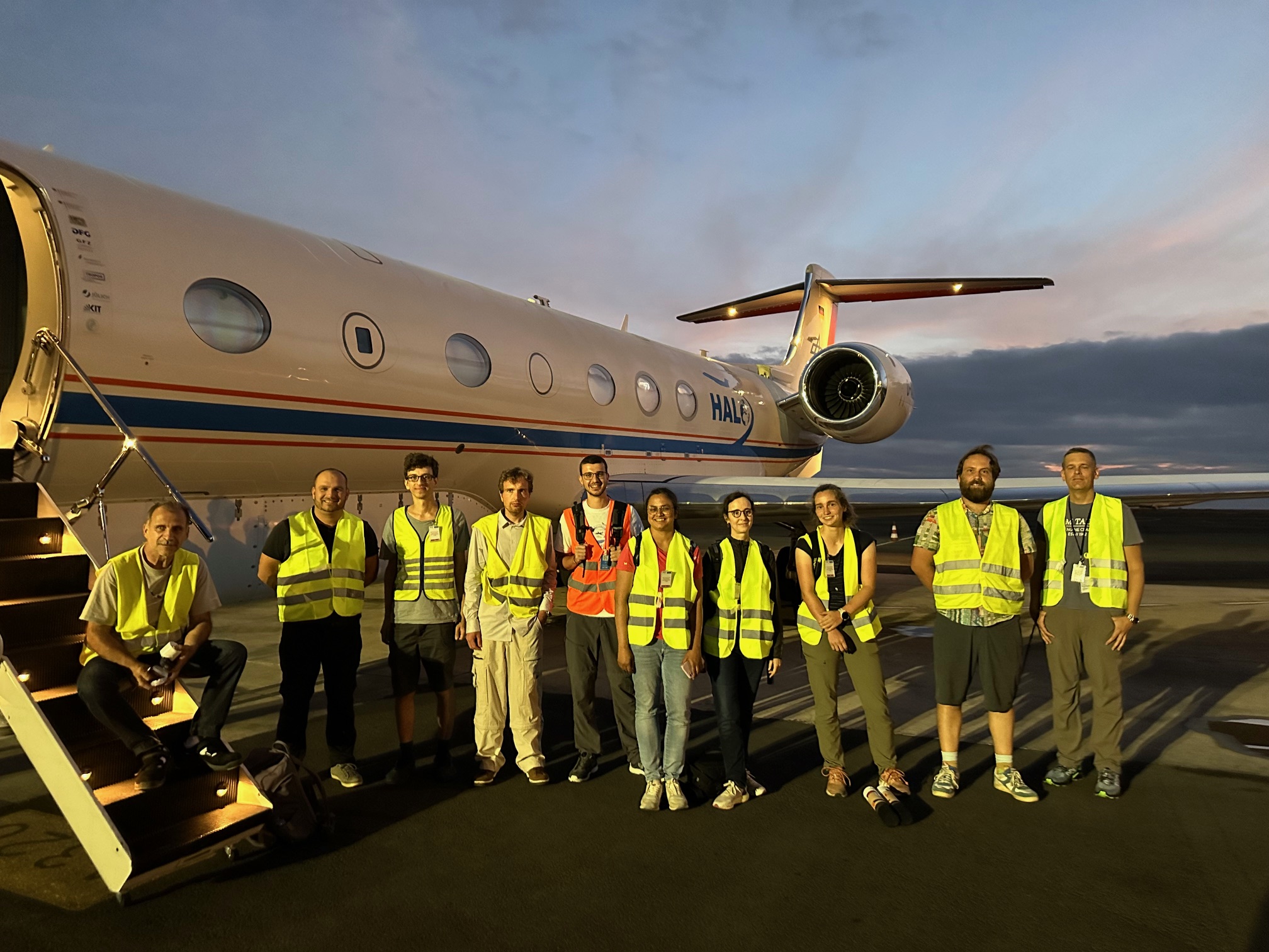
Crew
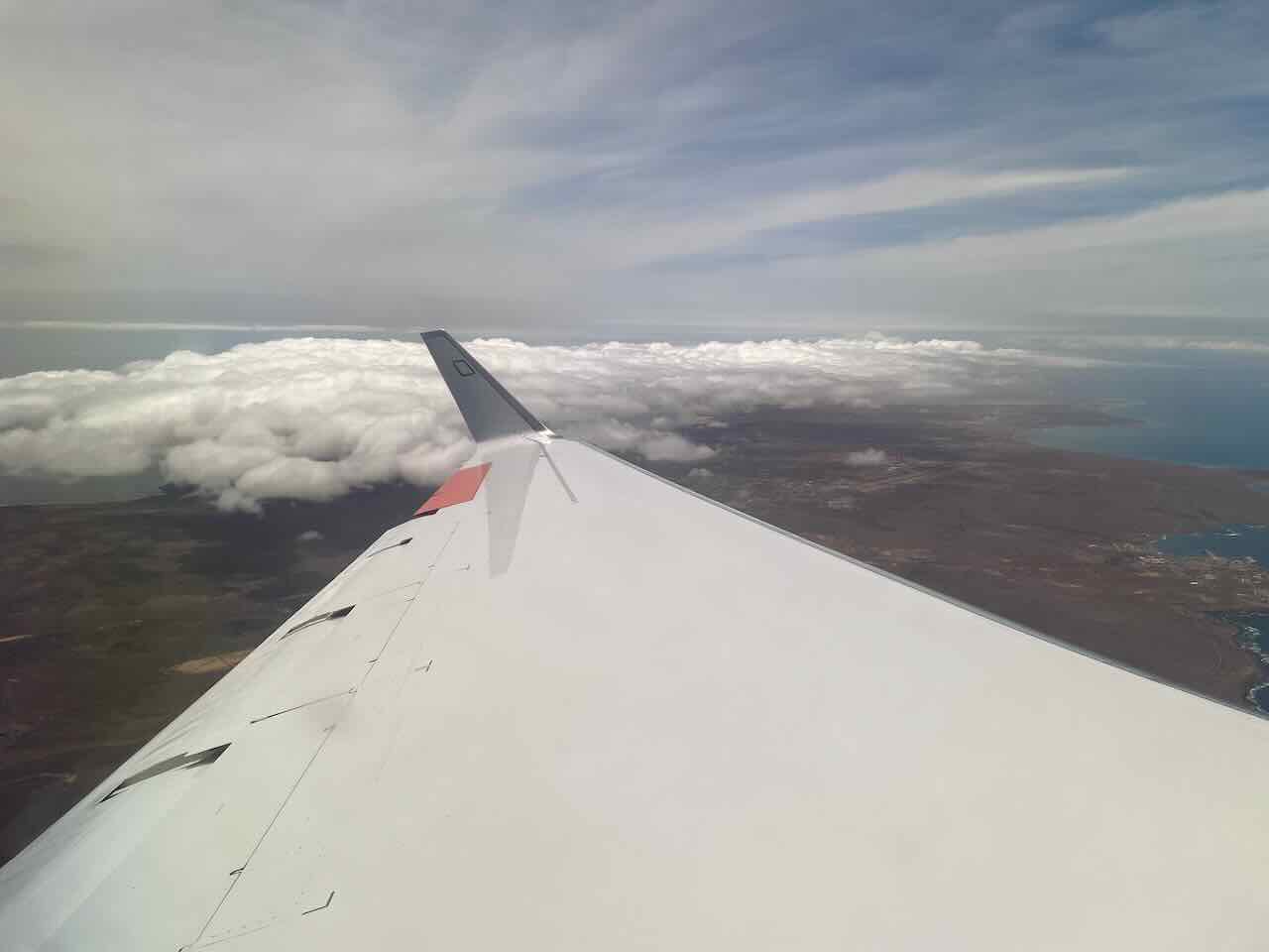
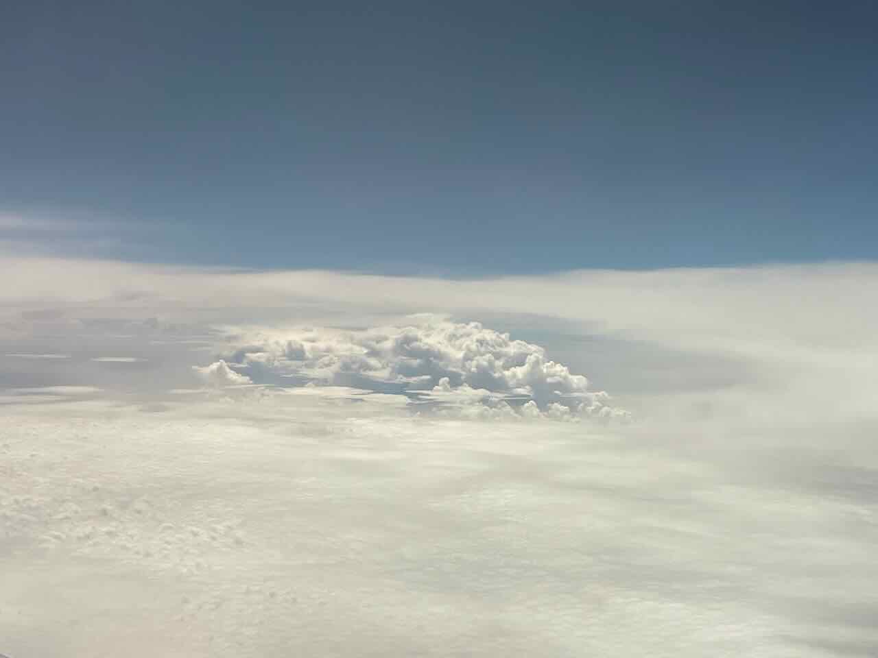
Island-induced clouds by take-off (12:26 UTC)
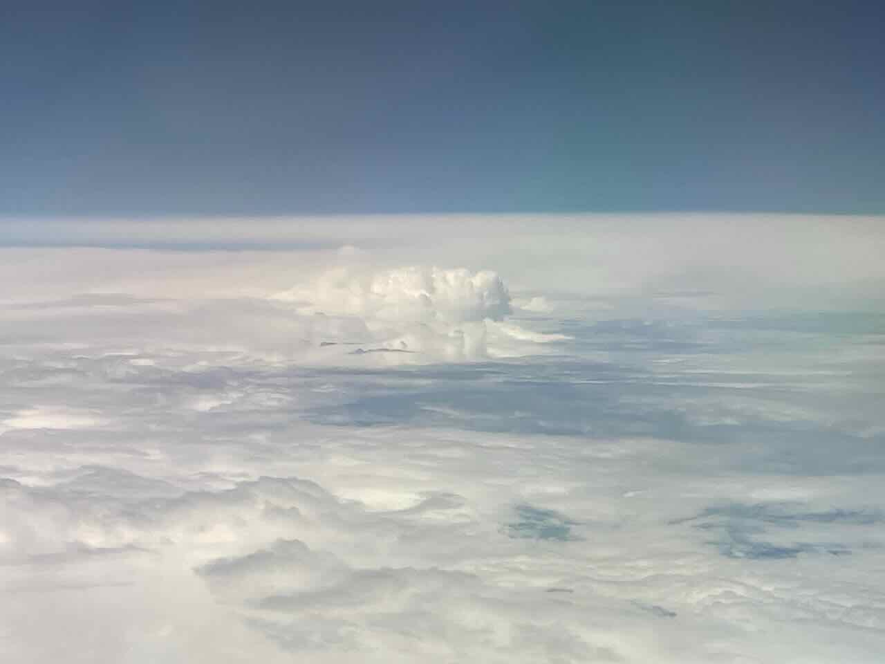
In the ITCZ, entering ‘c_south’ (14:12 UTC)
Hole in the ITCZ (16:44 UTC)
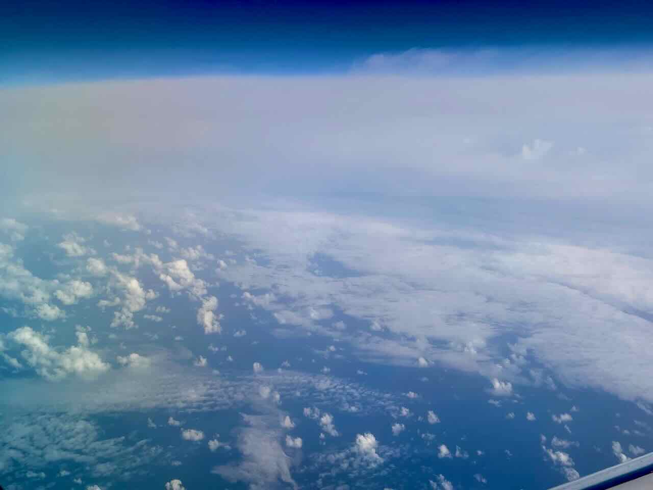
Leaving the ITCZ, southern edge of ‘c_north’ (17:56 UTC)

Stratocumulus edge, southern edge of ‘c_north’ (18:52 UTC)
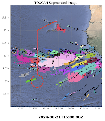
TOOCAN’s segmented MCSs at 1500 UTC.
Instrument status & quicklooks#
Instrument |
Operational |
Comment |
|---|---|---|
BACARDI |
✅ |
None |
BAHAMAS |
✅ |
None |
Dropsondes |
✅ |
Restart needed before first circle. Three no launch detects. No ATC permission to drop sondes on ITCZ center circle |
HAMP-Radar |
✅ |
None |
HAMP-Radiometer |
✅ |
None |
Smart |
✅ |
fully functional |
SpecMACS |
✅ |
Some icing on side windows. |
VELOX |
✅ |
Some icing on KT-19 |
WALES |
✅ |
None |
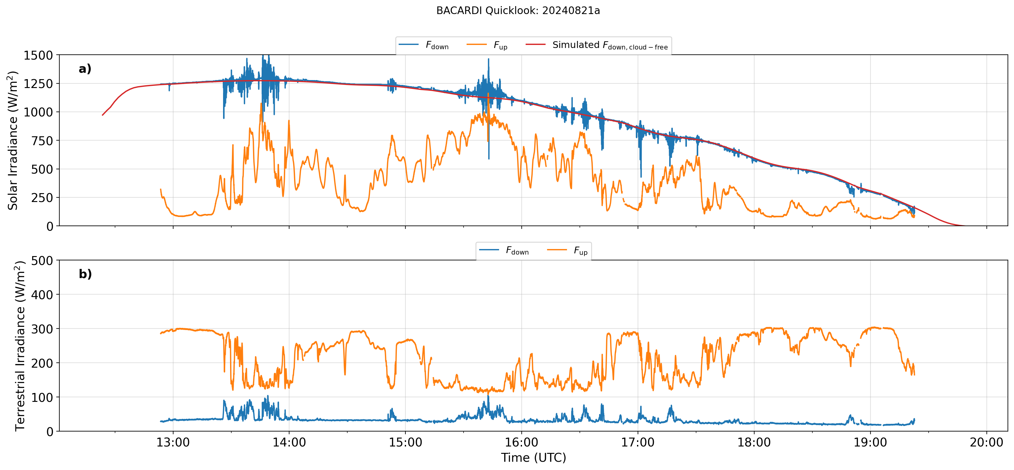
BACARDI.
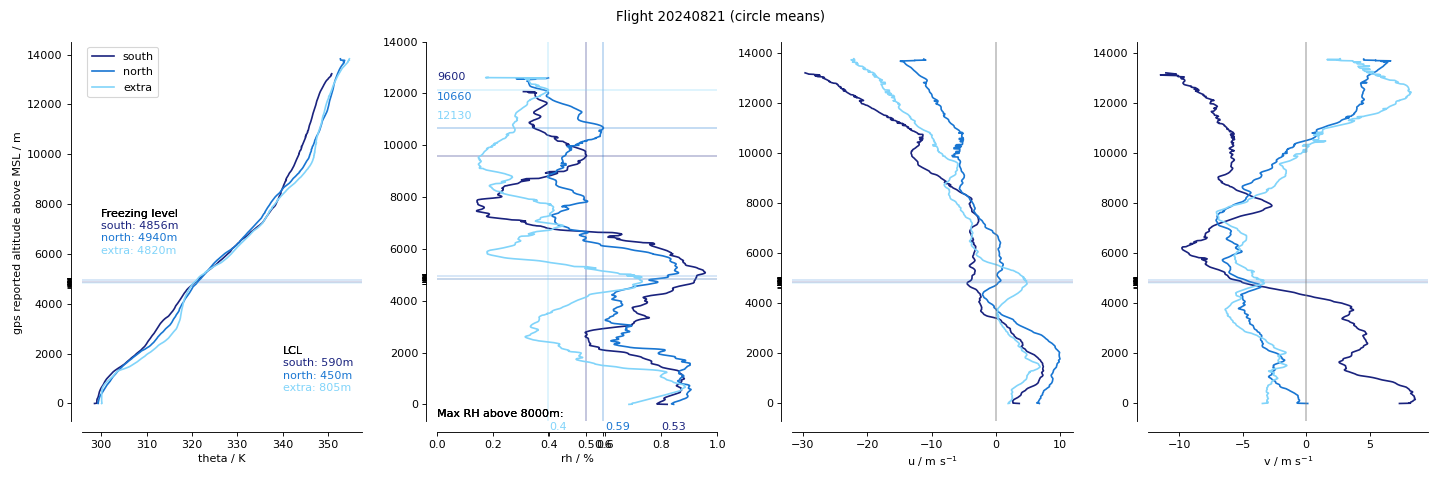
Dropsondes.
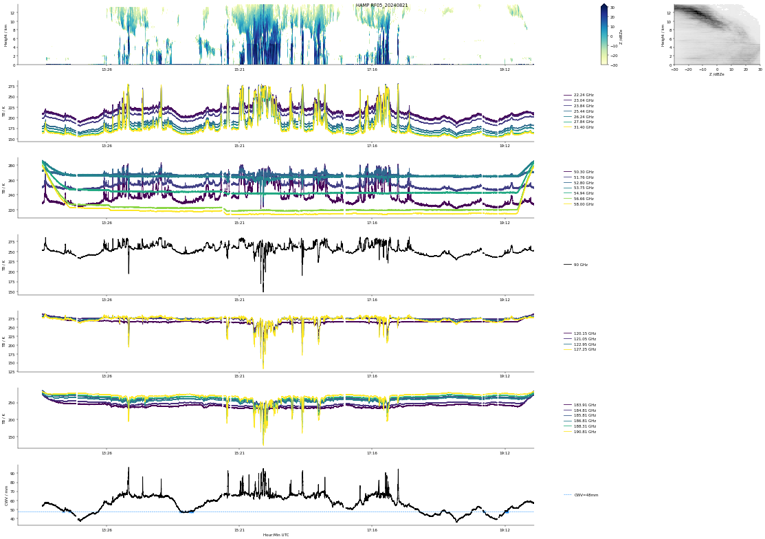
HAMP
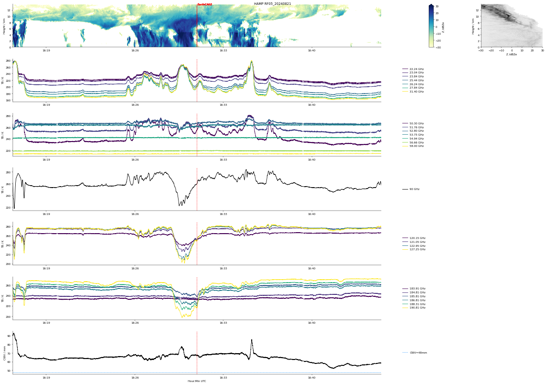
HAMP EC underpass
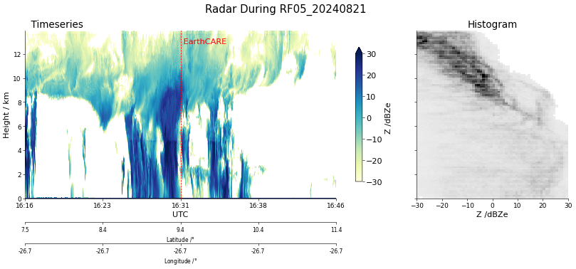
Radar during EarthCARE underpass
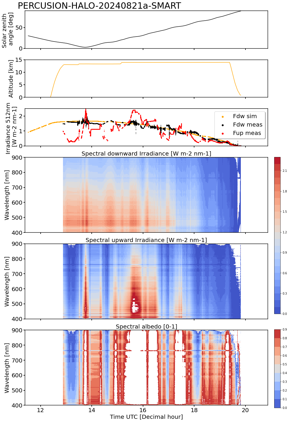
SMART Time series of upward and downward spectral irradiadiance, and albedo.
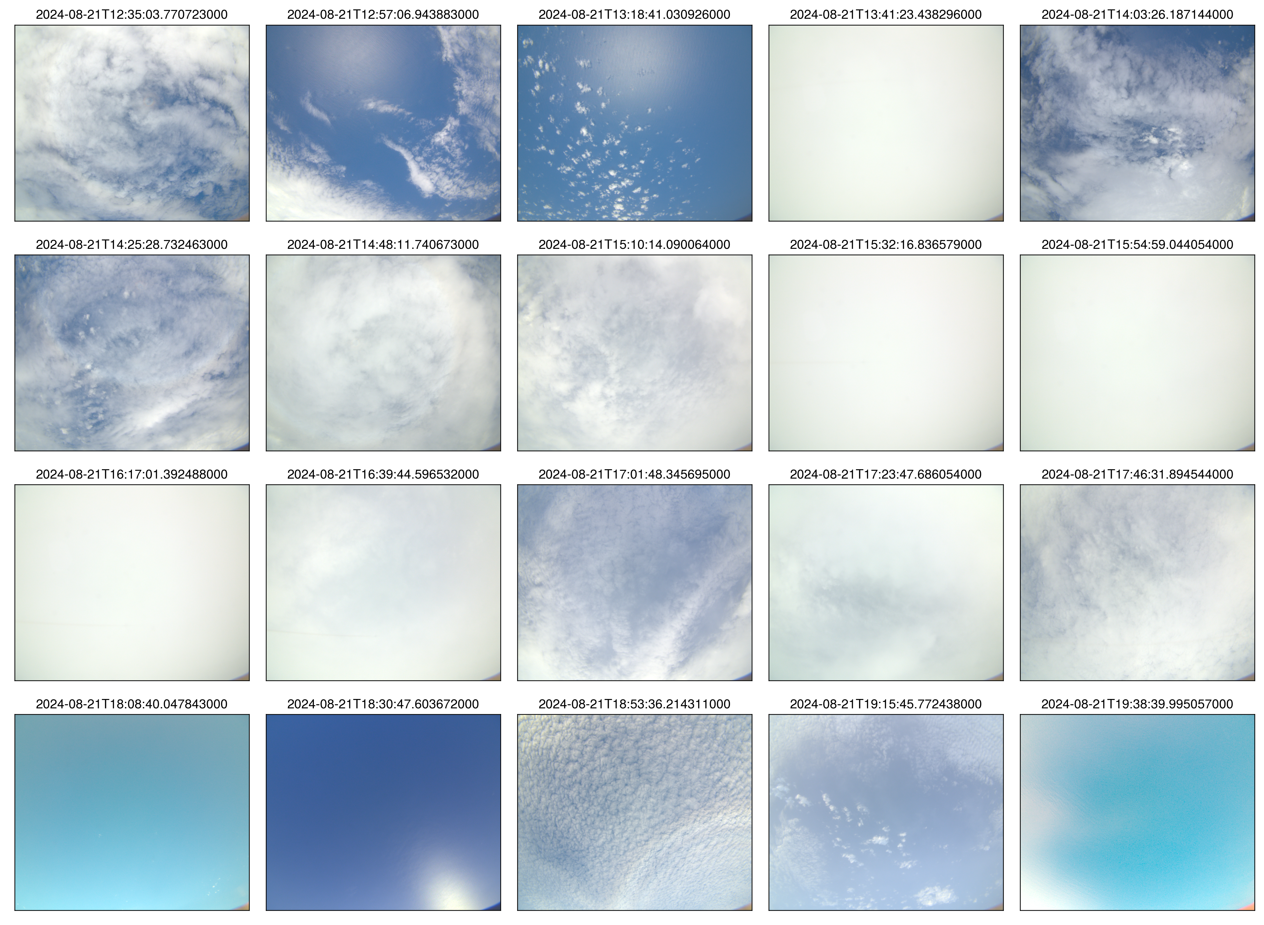 specMACS RGB snapshots from polb (lower right) with EarthCARE underpass marked in red. Find further quicklooks here.
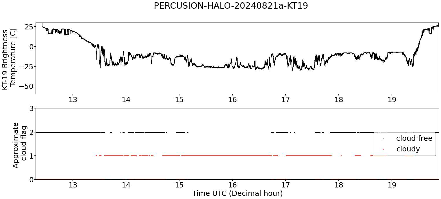
KT19 Timeseries of brigthness temperature.
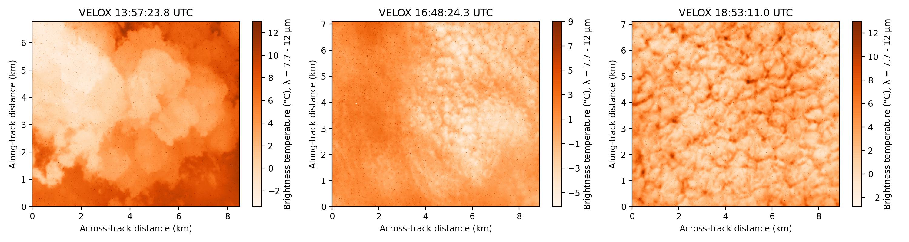
VELOX broadband channel.
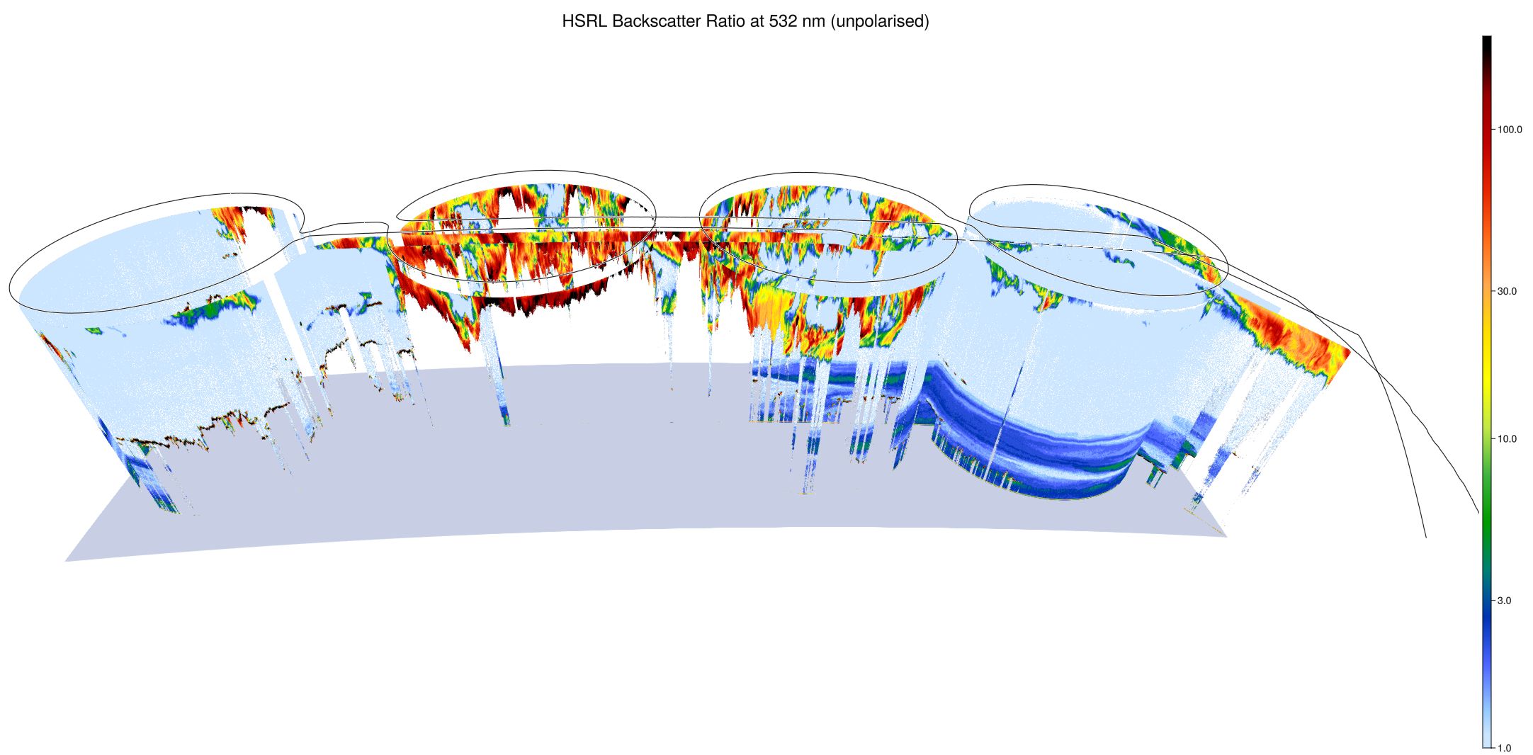
WALES (3D backscatter)
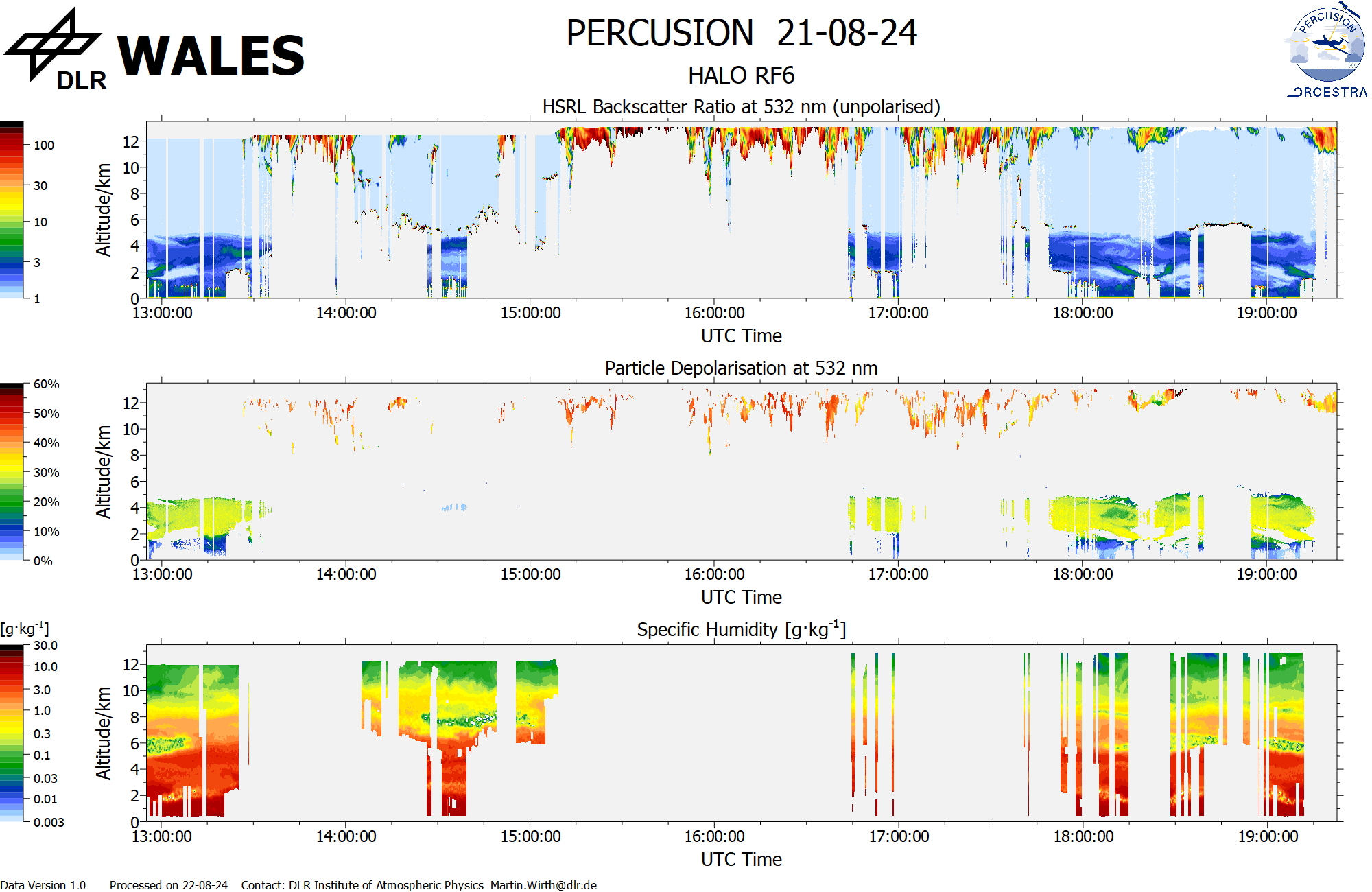
WALES (cross section)