

Flight plan - KA-20240905a#
ec_under ec_track in_cloud insitu_aerosol spiral_mindeloCrew#
The flight is planned to take off at 2024-09-05 14:00:00+00:00.
Job |
Name |
|---|---|
PI |
Robert Oscar David |
Instrument operator |
Sorin Ghemulet |
Instrument operator |
Marius Corbu |
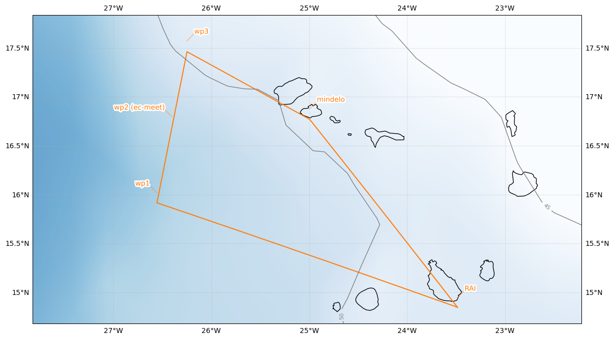
Flight plan#
Leg 1: RAI -> WP1 (arrive @FL180 at 15:30 UTC | 14:30 LT)
Leg 2: Holding pattern at WP1 until 15:40 UTC (assessing cloud situation).
Leg 3 (Start 15:40 UTC): WP1 -> WP3 (via WP2) - around FL180 - 180 kt (~30min) - in-cloud if possible - Note: Be at WP2 at 15:55 UTC | 14:55 LT for satellite overpass
Leg 4: WP3 -> WP4, descend on the way, arrive at WP4 @FL040
Leg 5: Ascent as race track pattern with one straight leg between WP4 and WP5 from FL040 up to FL150 Notes: - if possible with VXE airport Mindelo - WP5: 16.91 N | 25W - 1000 ft/min, right turn - Alternate WP4 (16.99N | 24.83W): in case WP4 not possible
Leg 6: WP4 -> RAI (~1h)
Initalization date of IFS forecast: 2024-09-04
Flight date: 2024-09-05
Flight index: KA-20240905a
| lat | lon | fl | time | note | |
|---|---|---|---|---|---|
| label | |||||
| RAI | 14.945000 | -23.486389 | None | None | None |
| wp1 | 16.019557 | -26.555969 | None | None | None |
| wp2 (ec-meet) | 16.796737 | -26.402921 | None | None | None |
| wp3 | 17.573813 | -26.249023 | None | None | None |
| mindelo | 16.877772 | -24.995374 | None | None | None |
| RAI | 14.945000 | -23.486389 | None | None | None |