

Flight plan - HALO-20240914a#
ec_under ec_track c_north c_mid c_southCrew#
The flight is planned to take off at 2024-09-14 11:50:00+00:00.
Job |
Name |
|---|---|
PI |
Helene Glöckner |
WALES |
Georgios Dekoutsidis |
HAMP |
Clara Bayley |
Dropsondes |
Theresa Mieslinger |
Smart/VELOX |
André Ehrlich |
SpecMACS |
Anna Weber |
Flight Documentation |
Lukas Kluft |
Ground contact |
Wei-Ting Hsiao |
Flight plan#
/home/runner/miniconda3/envs/orcestra_book/lib/python3.12/site-packages/orcestra/sat.py:195: UserWarning: You are using an old forecast (issued on 2024-09-12) for EARTHCARE on 2024-09-14! The newest forecast issued so far was issued on 2024-09-14. It's a PRE forecast.
  warnings.warn(
Flight index: HALO-20240914a
Take-off: 11:49 UTC
Landing:  20:07 UTC

8:17:16.520666
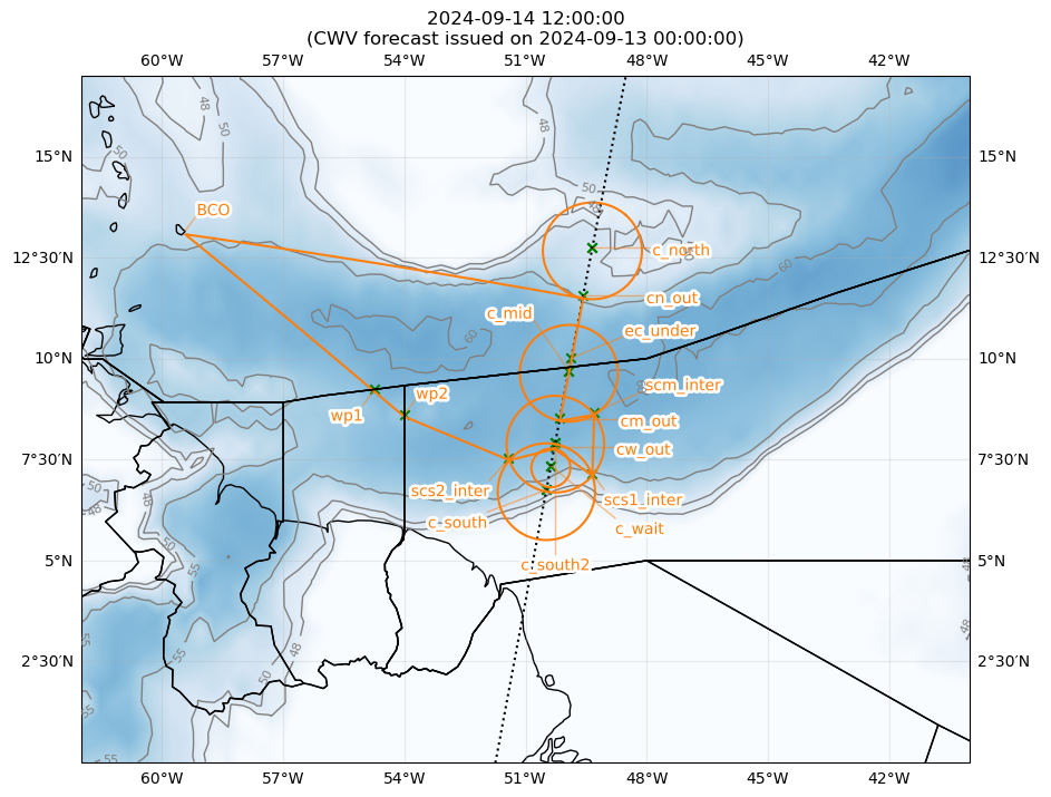
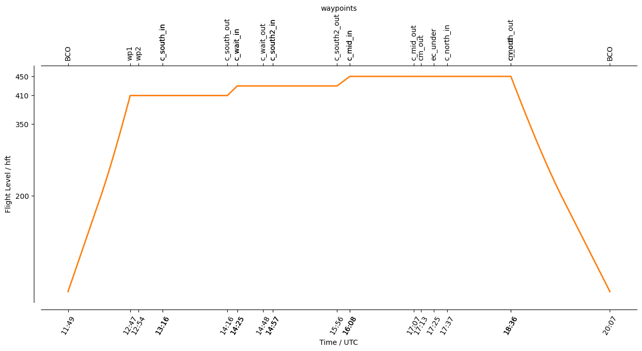
Detailed Overview:
              BCO          N13 09.76, W059 25.72, FL000, 11:49:59 UTC,
to            wp1          N09 14.20, W054 44.20, FL410, 12:47:03 UTC,
to            wp2          N08 37.10, W054 00.00, FL410, 12:54:35 UTC,
to            scs2_inter   N07 32.03, W051 24.07, FL410, 13:16:40 UTC,
circle around c_south      N06 45.00, W050 29.04, FL410, 13:16:40 UTC - 14:16:14 UTC, radius: 72 nm, 360° CCW, enter from north west
to            cw_out       N07 48.99, W050 17.02, FL430, 14:25:14 UTC,
circle around c_wait       N07 20.55, W050 22.37, FL430, 14:25:14 UTC - 14:48:50 UTC, radius: 29 nm, 360° CW, enter from north
to            scs1_inter   N07 08.93, W049 20.71, FL430, 14:57:48 UTC,
circle around c_south2     N07 56.10, W050 15.68, FL430, 14:57:48 UTC - 15:56:49 UTC, radius: 72 nm, 360° CW, enter from south east
to            scm_inter    N08 40.07, W049 18.00, FL450, 16:08:37 UTC,
circle around c_mid        N09 42.00, W049 55.63, FL450, 16:08:37 UTC - 17:07:09 UTC, radius: 72 nm, 360° CW, enter from south east
to            cm_out       N08 30.91, W050 09.11, FL450, 17:13:49 UTC,
to            ec_under     N10 00.66, W049 52.08, FL450, 17:25:35 UTC, meet EarthCARE
circle around c_north      N12 45.00, W049 20.66, FL450, 17:37:49 UTC - 18:36:21 UTC, radius: 72 nm, 360° CW, enter from south
to            cn_out       N11 33.94, W049 34.33, FL450, 18:36:22 UTC,
to            BCO          N13 09.76, W059 25.72, FL000, 20:07:15 UTC,