

Flight plan - HALO-20240912a#
ec_under ec_track c_mid c_southCrew#
Job |
Name |
|---|---|
PI |
Georgios Dekoutsidis |
WALES |
Sabrina Zehlau |
HAMP |
Janina Bömeke |
Dropsondes |
Jakob Deutloff |
Smart/VELOX |
Michael Schäfer |
SpecMACS |
Anja Stallmach |
Flight Documentation |
Felix Ament |
Ground contact |
Manfred Wendisch |
Flight plan#
/home/runner/miniconda3/envs/orcestra_book/lib/python3.12/site-packages/orcestra/sat.py:195: UserWarning: You are using an old forecast (issued on 2024-09-11) for EARTHCARE on 2024-09-12! The newest forecast issued so far was issued on 2024-09-12. It's a PRE forecast.
  warnings.warn(
Flight index: HALO-20240912a
Take-off: 11:40 UTC
Landing:  20:06 UTC
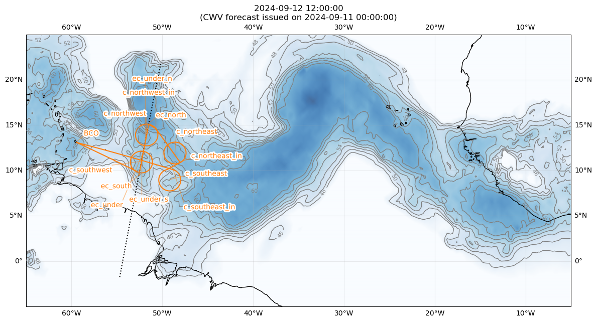
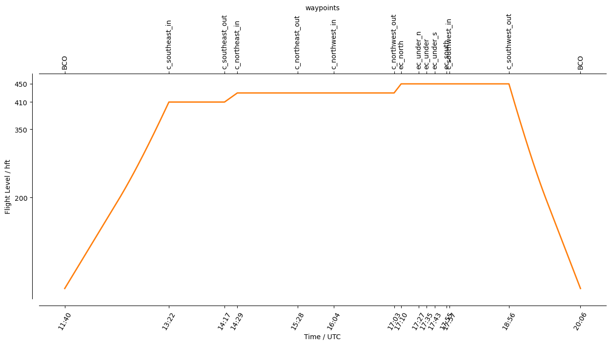
Detailed Overview:
              BCO          N13 09.76, W059 25.72, FL000, 11:40:23 UTC,
to (helper)   c_southeast_in N10 09.15, W048 49.49, FL410, 13:22:36 UTC, upcoming circle will be entered here
circle around c_southeast  N09 00.00, W049 10.88, FL410, 13:22:36 UTC - 14:17:12 UTC, radius: 72 nm, 330° CW, enter from north
to (helper)   c_northeast_in N10 56.37, W048 01.73, FL430, 14:29:46 UTC, upcoming circle will be entered here
circle around c_northeast  N12 00.00, W048 36.60, FL430, 14:29:46 UTC - 15:28:47 UTC, radius: 72 nm, 360° CCW, enter from south east
to (helper)   c_northwest_in N14 41.99, W050 43.08, FL430, 16:04:35 UTC, upcoming circle will be entered here
circle around c_northwest  N14 00.00, W051 43.47, FL430, 16:04:35 UTC - 17:03:36 UTC, radius: 72 nm, 360° CCW, enter from north east
to            ec_north     N15 11.03, W051 29.56, FL450, 17:10:33 UTC,
to            ec_under_n   N13 00.00, W051 55.06, FL450, 17:27:45 UTC, EC align north
to            ec_under     N12 00.00, W052 06.60, FL450, 17:35:37 UTC, meet EarthCARE
to            ec_under_s   N11 00.00, W052 18.08, FL450, 17:43:29 UTC, EC align south
to            ec_south     N09 30.00, W052 35.20, FL450, 17:55:17 UTC,
circle around c_southwest  N11 00.00, W052 18.08, FL450, 17:57:46 UTC - 18:56:19 UTC, radius: 72 nm, 360° CW, enter from south
to            BCO          N13 09.76, W059 25.72, FL000, 20:06:31 UTC,
plan.duration
datetime.timedelta(seconds=30367, microseconds=711189)