

Flight plan - HALO-20240909a#
ec_under ec_track c_north c_mid c_southCrew#
Job |
Name |
|---|---|
PI |
Silke Groß |
WALES |
Konstantin Krüger |
HAMP |
Christian Heske |
Dropsondes |
Theresa Mieslinger |
Smart/VELOX |
André Ehrlich |
SpecMACS |
Lea Volkmer |
Flight Documentation |
Chavez Pope |
Ground contact |
Julia Windmiller |
Flight plan#
/home/runner/miniconda3/envs/orcestra_book/lib/python3.12/site-packages/orcestra/sat.py:195: UserWarning: You are using an old forecast (issued on 2024-09-08) for EARTHCARE on 2024-09-09! The newest forecast issued so far was issued on 2024-09-09. It's a PRE forecast.
  warnings.warn(
Flight index: HALO-20240909a
Take-off: 11:43 UTC
Landing:  20:51 UTC
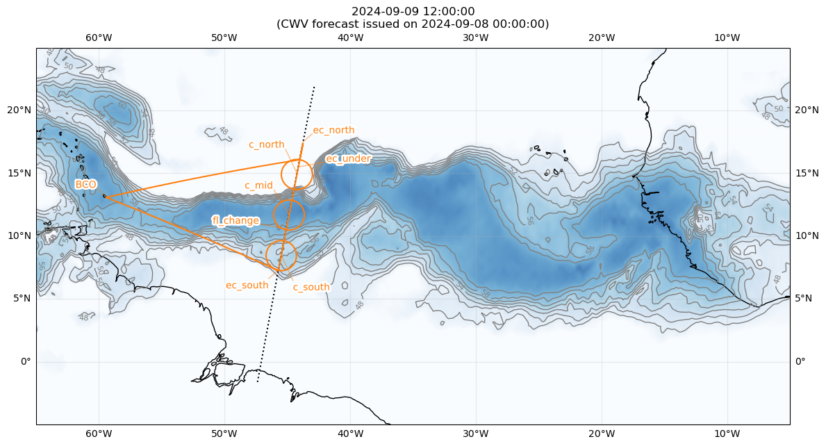
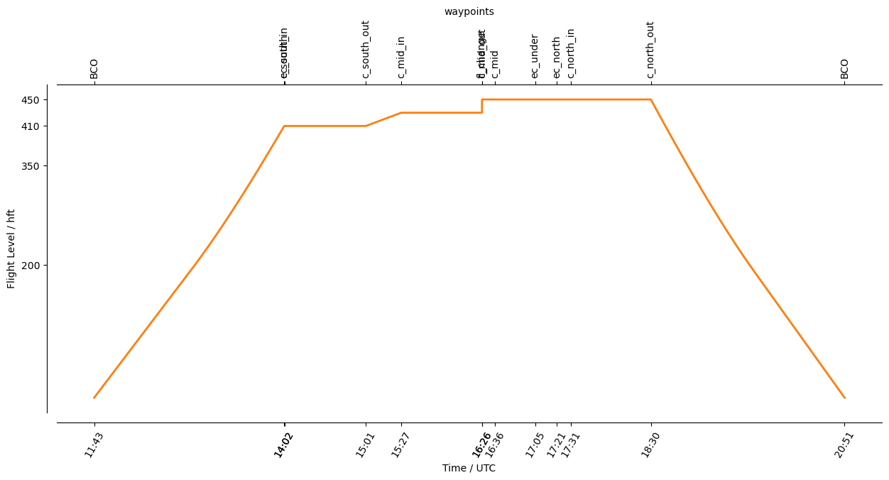
Detailed Overview:
              BCO          N13 09.76, W059 25.72, FL000, 11:43:13 UTC,
to            ec_south     N07 18.00, W045 42.97, FL410, 14:02:11 UTC,
circle around c_south      N08 30.00, W045 29.40, FL410, 14:02:18 UTC - 15:01:52 UTC, radius: 72 nm, 360° CCW, enter from south
circle around c_mid        N11 45.00, W044 52.32, FL430, 15:27:46 UTC - 16:26:47 UTC, radius: 72 nm, 360° CCW, enter from south
to            fl_change    N10 33.93, W045 05.89, FL450, 16:26:47 UTC,
to            c_mid        N11 45.00, W044 52.32, FL450, 16:36:06 UTC,
to            ec_under     N15 30.00, W044 08.77, FL450, 17:05:37 UTC, meet EarthCARE
to            ec_north     N17 30.00, W043 45.13, FL450, 17:21:22 UTC,
circle around c_north      N15 00.00, W044 14.64, FL450, 17:31:44 UTC - 18:30:16 UTC, radius: 72 nm, 360° CCW, enter from north
to            BCO          N13 09.76, W059 25.72, FL000, 20:51:58 UTC,