Flight plan - HALO-20240821a

Contents

Flight plan - HALO-20240821a#

c_north c_mid c_south meteor c_atr

Crew#

The flight is planned to take off at 2024-08-21 12:30:00+00:00.

Job

Name

PI

Cathy Hohenegger

WALES

Silke Gross

HAMP

Tobias Koelling

Dropsondes

Helene Gloeckner

Smart/VELOX

Kevin Wolf

SpecMACS

Zekican Demiralay

Scientist

Divya Praturi

Ground contact

Julia Windmiller

Flight plan#

Hide code cell source
from orcestra.flightplan import sal, bco, LatLon, IntoCircle, path_preview, plot_cwv
from datetime import datetime
import intake
import easygems.healpix as egh

cat = intake.open_catalog("https://tcodata.mpimet.mpg.de/internal.yaml")

# Define dates for forecast initialization and flight

issued_time = datetime(2024, 8, 19, 0, 0, 0)
issued_time_str = issued_time.strftime('%Y-%m-%d')

flight_time = datetime(2024, 8, 21, 12, 0, 0)
flight_time_str = flight_time.strftime('%Y-%m-%d')
flight_index = f"HALO-{flight_time.strftime('%Y%m%d')}a"

print("Initalization date of IFS forecast: " + issued_time_str + "\nFlight date: " + flight_time_str + "\nFlight index: " + flight_index)
radius = 130e3
atr_radius = 70e3

airport=sal

mindelo = LatLon(lat=16.8778, lon=-24.995,label= "mindelo")
north_in = LatLon(lat=15.00, lon=-26.71,label= "north_in")
north_out = LatLon(lat=16.8778, lon=-26.71,label= "north_out")
south_tp = LatLon(lat=3., lon=-26.71,label= "south_tp")

c_extra = LatLon(13.7,-26.71, "c_extra")
c_south = LatLon(5.5, -26.71, "c_south")
c_north=LatLon(11.1,-26.71,"c_north")
c_mid=LatLon(8.3,-26.71,"c_mid")

leg_south = [
    airport, 
    north_in,
    c_extra,
    c_north,
    c_mid,
    c_south,
    south_tp
]

leg_circles = [
     IntoCircle(c_south, radius, 360),
         IntoCircle(c_mid, radius, 360),
    IntoCircle(c_north, radius, 360),
    IntoCircle(c_extra, radius, 360),
]

leg_home = [
     north_out,
     airport
]  

path = leg_south+leg_circles+leg_home

cat = intake.open_catalog("https://tcodata.mpimet.mpg.de/internal.yaml")
ds = cat.HIFS(datetime=issued_time).to_dask().pipe(egh.attach_coords)
cwv_flight_time = ds["tcwv"].sel(time=flight_time, method = "nearest")

ax = path_preview(path)
plot_cwv(cwv_flight_time)
Initalization date of IFS forecast: 2024-08-19
Flight date: 2024-08-21
Flight index: HALO-20240821a
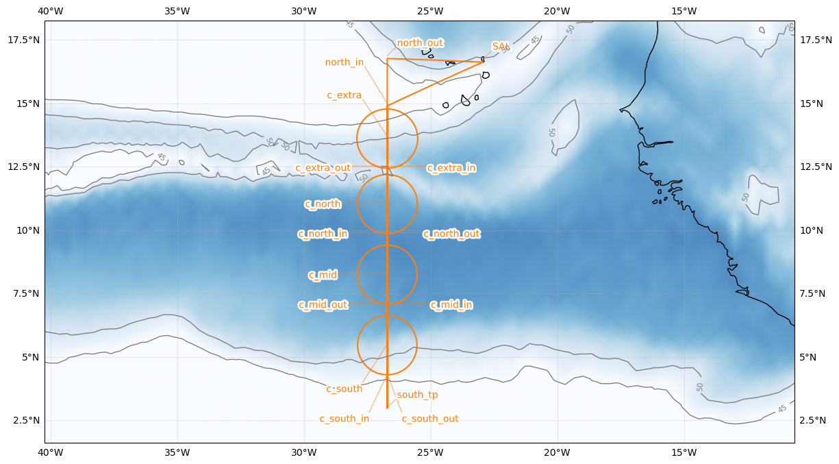
../_images/1d1dbbebba014dcb39c35698687e629d5cf2c782ea9f135f8035c0ca2d19e99e.png
Hide code cell source
import pandas as pd
from dataclasses import asdict

pd.DataFrame.from_records(map(asdict, [sal,north_in,c_extra,c_north,c_mid,c_south,south_tp,north_out])).set_index("label")
lat lon fl time note
label
SAL 16.734488 -22.943974 0.0 None None
north_in 15.000000 -26.710000 NaN None None
c_extra 13.700000 -26.710000 NaN None None
c_north 11.100000 -26.710000 NaN None None
c_mid 8.300000 -26.710000 NaN None None
c_south 5.500000 -26.710000 NaN None None
south_tp 3.000000 -26.710000 NaN None None
north_out 16.877800 -26.710000 NaN None None
Hide code cell source
from orcestra.flightplan import export_flightplan

export_flightplan("HALO-20240821a", path)