

Flight plan - HALO-20240813a#
ec_under ec_track c_north c_mid c_south ec_south curtainCrew#
The flight is planned to take off at 2024-08-13 14:15:00+00:00.
Job |
Name |
|---|---|
PI |
Silke Gross |
WALES |
Tanja Bodenbacher |
HAMP |
Florian Ewald |
Dropsondes |
Björn Stevens |
Smart/VELOX |
tbd |
SpecMACS |
Lea Volkmer |
Scientist |
tbd |
Ground contact |
Martin Singh |
Flight plan#
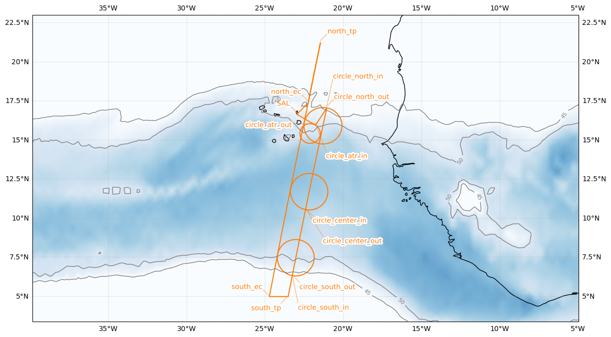
| lat | lon | fl | time | note | |
|---|---|---|---|---|---|
| label | |||||
| north_ec | 17.475000 | -22.222900 | None | None | None |
| north_ec | 17.475000 | -22.222900 | None | None | None |
| north_tp | 21.350000 | -21.440600 | None | None | None |
| south_ec | 5.000000 | -24.702000 | None | None | None |
| south_tp | 5.000000 | -23.502000 | None | None | None |
| circle_south | 7.500000 | -23.016200 | None | None | None |
| circle_center | 11.751952 | -22.160695 | None | None | None |
| circle_north | 16.000000 | -21.278500 | None | None | None |
| circle_atr | 15.500000 | -22.100000 | None | None | None |