

Flight plan - HALO-20240809b#
Crew#
The flight is planned to take off at 2024-08-09 09:30:00+00:00.
Job |
Name |
|---|---|
PI |
Florian Ewald |
WALES |
Martin Wirth |
HAMP |
Clara Bayley |
Dropsondes |
Helene Glöckner |
Smart/VELOX |
Kevin Wolf |
SpecMACS |
Lea Volkmer |
Scientist |
Christian Heske |
Ground contact |
tbd |
Flight plan#
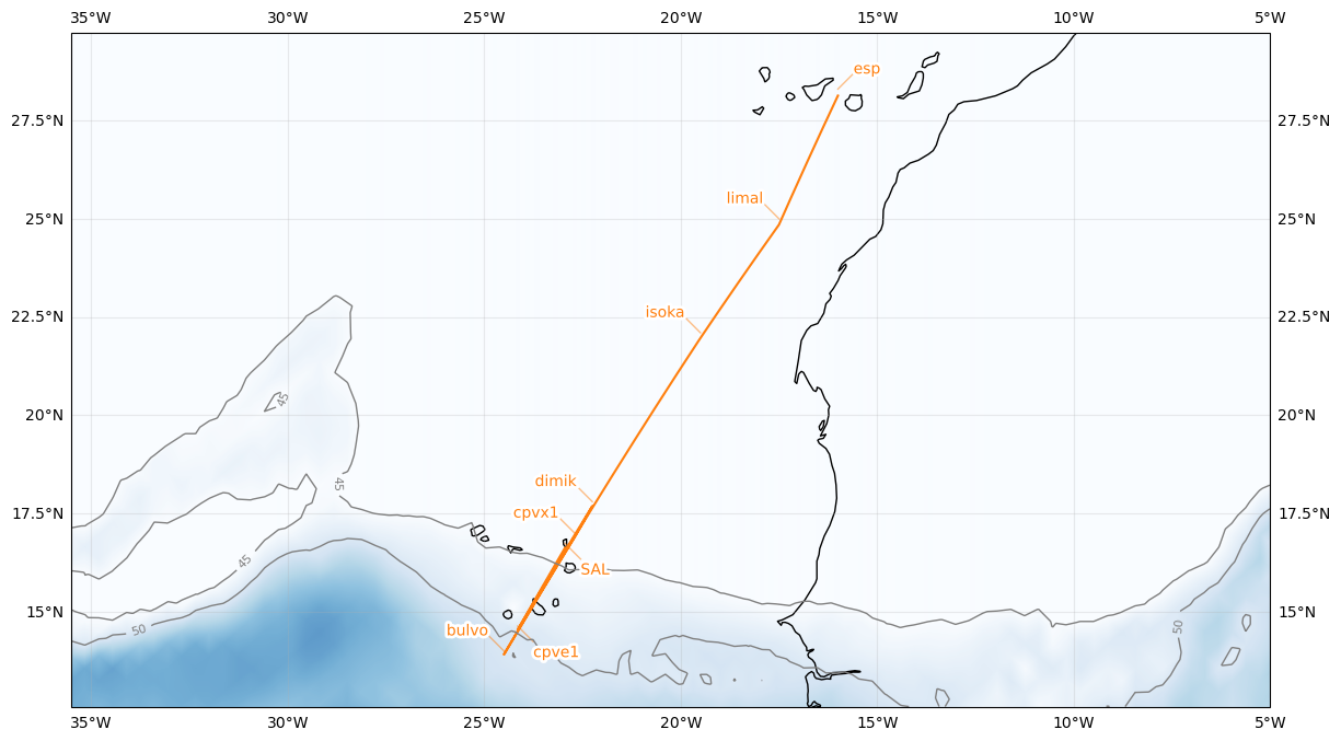
| lat | lon | fl | time | note | |
|---|---|---|---|---|---|
| label | |||||
| limal | 25.000000 | -17.500000 | NaN | None | None |
| bulvo | 14.000000 | -24.500000 | NaN | None | None |
| dimik | 17.800000 | -22.250000 | NaN | None | None |
| SAL | 16.734488 | -22.943974 | 0.0 | None | None |
After takeoff, fly to south of Canary Island (limal)
Fly towards Sal and drop 3 dropsondes along the path
If last dropsonde is still in the air continue south of Sal and return when DS landed (bulvo)
Return to Sal