

Flight plan - ATR-20240826b#
Flight plan#
The flight is planned to take off at 2024-08-26 18:00:00+00:00 UTC and land at 2024-08-26 21:30:00+00:00 UTC.
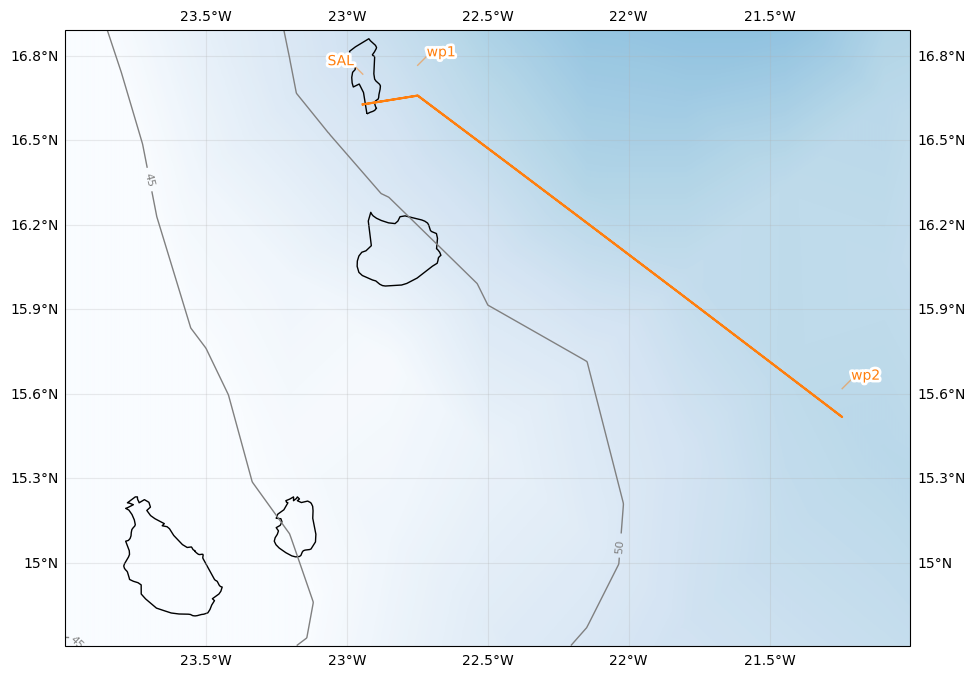
Flight track designed to sample conditions behind the African Easterly Wave Trough
Previous flight followed the same track and sampled conditions ahead of the African Easterly Wave Trough (the trough passed by in-between flights)
NOTE: flight plan was modified in-flight to sample deep convection further to the south of the planned waypoints
| lat | lon | fl | time | note | |
|---|---|---|---|---|---|
| label | |||||
| SAL | 16.734488 | -22.943974 | 0.0 | None | None |
| wp1 | 16.766000 | -22.749000 | NaN | None | None |
| wp2 | 15.618000 | -21.242000 | NaN | None | None |
| wp1 | 16.766000 | -22.749000 | NaN | None | None |
| SAL | 16.734488 | -22.943974 | 0.0 | None | None |
Crew#
Job |
Name |
|---|---|
Pilot |
D Duchanoy |
Pilot |
G Seurat |
Mechanics |
T André |
Expé Principal |
M Cluzeau |
Expé |
B Celou |
PI |
Louis Jaffeux |
LNG |
S Bounissou |
aWALI |
F Lally |
Microphys 1 |
P Coutris |
Microphys 2 |
G Fevre |
RASTA |
J Delanoë |
BASTA |
B McKim |