

Flight plan - HALO-20240919a#
ec_under ec_track c_north c_mid pace_under meteor curtain radarCrew#
Job |
Name |
|---|---|
PI |
Clara Bayley |
WALES |
Sabrina Zechlau |
HAMP |
Raphaela Vogel |
Dropsondes |
Helene Glöckner |
Smart/VELOX |
Patrizia Schoch |
SpecMACS |
Anna Weber |
Flight Documentation |
Chelsea Nam |
Ground contact |
Julia Windmiller and Janina Boemeke |
Flight plan#
SATELITE TRACK FORECAST FROM: 2024-09-19 FOR FLIGHT DAY: 2024-09-19
Flight ID: HALO-20240919a
Take-off: 10:33 UTC
Landing:  19:33 UTC
Duration: 9:00:23.590589
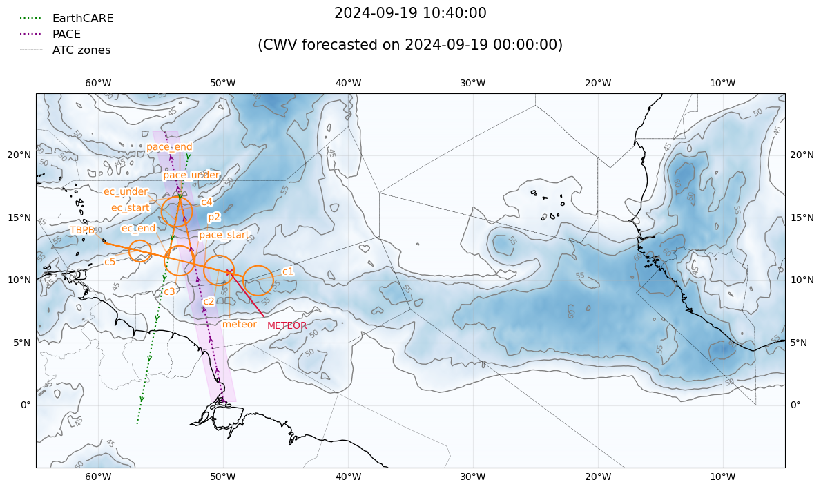
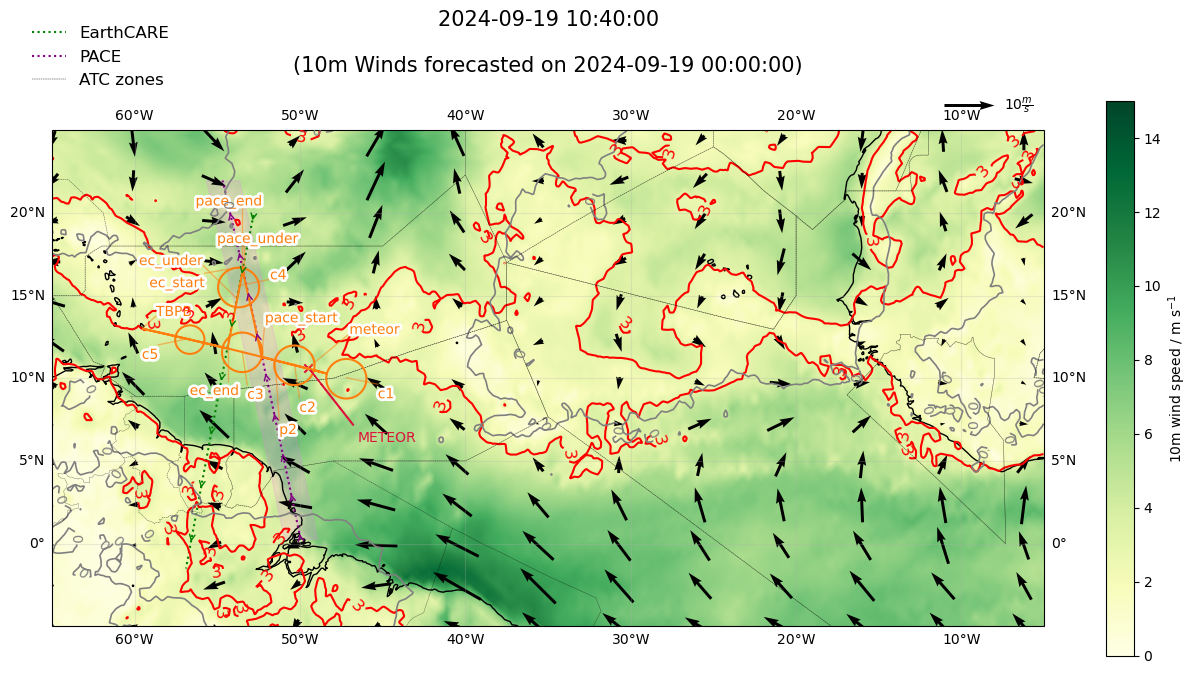

Detailed Overview:
              TBPB         N13 04.48, W059 29.55, FL000, 10:33:13 UTC,
to            meteor       N10 39.00, W049 30.00, FL410, 12:08:29 UTC,
circle around c1           N10 02.31, W047 12.11, FL430, 12:17:29 UTC - 13:16:30 UTC, radius: 72 nm, 360° CCW, enter from west
to            meteor       N10 39.00, W049 30.00, FL430, 13:25:29 UTC,
to            p2           N11 09.51, W051 31.44, FL430, 13:41:34 UTC,
circle around c2           N10 51.54, W050 20.53, FL430, 13:41:34 UTC - 14:40:35 UTC, radius: 72 nm, 360° CCW, enter from west
circle around c3           N11 38.84, W053 29.96, FL450, 14:46:49 UTC - 15:45:22 UTC, radius: 72 nm, 360° CCW, enter from east
to            pace_start   N11 21.00, W052 18.89, FL450, 15:45:24 UTC,
to            pace_under   N16 08.84, W053 21.83, FL450, 16:23:21 UTC, meet PACE
to            pace_end     N16 46.75, W053 30.27, FL450, 16:28:21 UTC,
circle around c4           N15 35.51, W053 43.02, FL450, 16:28:21 UTC - 17:26:53 UTC, radius: 72 nm, 360° CW, enter from north
to            ec_start     N16 45.25, W053 26.31, FL450, 17:27:25 UTC,
to            ec_under     N14 48.86, W053 49.14, FL450, 17:42:41 UTC, meet EarthCARE
to            ec_end       N11 52.80, W054 23.15, FL450, 18:05:47 UTC,
circle around c5           N12 25.24, W056 40.14, FL450, 18:16:55 UTC - 18:59:12 UTC, radius: 52 nm, 360° CCW, enter from east
to            TBPB         N13 04.48, W059 29.55, FL000, 19:33:37 UTC,